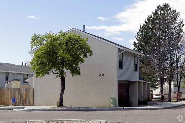
Property Record
2501 King St, Colorado Springs, CO 80904


NEARBY LISTINGS FOR SALE OR LEASE
Property Detail
2501 King St
Colorado Springs, CO
Squaw Valley Sub
74024-04-033
LOT 1, VAC NLY 10.0 FT OF W CACHE LA POUDRE ST ADJ SQUAW VALLEY SUB COLO SPGS
Taxexempt
El Paso
X
Colorado
08041C0726G
1
0
1.63 AC
2025
Pleasant Valley
001302
Colorado Springs
17,764 SF
DEMOGRAPHICS near 2501 King St
1 Mile
3 Mile
5 Mile
2024 Total Population
10,767
62,739
153,313
2029 Population
11,244
65,508
160,128
Pop Growth 2024-2029
+ 4.43%
+ 4.41%
+ 4.45%
Average Age
43
43
42
2024 Total Households
5,141
29,179
69,341
HH Growth 2024-2029
+ 4.71%
+ 4.70%
+ 4.71%
Median Household Inc
$63,325
$65,298
$63,541
Avg Household Size
2.00
2.00
2.10
2024 Avg HH Vehicles
2.00
2.00
2.00
Median Home Value
$410,100
$442,021
$409,289
Median Year Built
1970
1967
1969
Nearby Places
Map Layers
Map Styles
 Street
 Aerial
- Restaurants
- Banks
- Shops
- Fitness
- Groceries
PUBLIC TRANSPORTATION
AIRPORT
City of Colorado Springs Municipal
DRIVE
WALK
Distance
City of Colorado Springs Municipal
26 min
12.0 mi
Freight Ports
Tulsa Port Of Catoosa
DRIVE
WALK
Distance
Tulsa Port Of Catoosa
748 min
697.6 mi
Nearby Properties
Address
Land Use
TOTAL SIZE
Lot Size
Zoning
Address
Land Use
TOTAL SIZE
Lot Size
Zoning
586,419 SF
17.77 AC
R-5 CU
Address
Land Use
TOTAL SIZE
Lot Size
Zoning
107,247 SF
56.98 AC
R-E PF
Address
Land Use
TOTAL SIZE
Lot Size
Zoning
662,208 SF
14.96 AC
BP
Address
Land Use
TOTAL SIZE
Lot Size
Zoning
604,992 SF
28.95 AC
MX-T CU
Address
Land Use
TOTAL SIZE
Lot Size
Zoning
123,725 SF
1.57 AC
FBZ-CEN
Address
Land Use
TOTAL SIZE
Lot Size
Zoning
271,048 SF
3.67 AC
FBZ-T2A
Address
Land Use
TOTAL SIZE
Lot Size
Zoning
151,674 SF
1.21 AC
FBZ-CEN
Address
Land Use
TOTAL SIZE
Lot Size
Zoning
217,459 SF
3.67 AC
FBZ-CEN UV
Address
Land Use
TOTAL SIZE
Lot Size
Zoning
226,707 SF
3.25 AC
PF UV
Address
Land Use
TOTAL SIZE
Lot Size
Zoning
51,766 SF
4.53 AC
FBZ-CEN
Address
Land Use
TOTAL SIZE
Lot Size
Zoning
130,451 SF
0.66 AC
FBZ-CEN
Address
Land Use
TOTAL SIZE
Lot Size
Zoning
420,063 SF
2.31 AC
FBZ-CEN
Address
Land Use
TOTAL SIZE
Lot Size
Zoning
50,519 SF
1.66 AC
FBZ-CEN
Address
Land Use
TOTAL SIZE
Lot Size
Zoning
1,294,065 SF
3.78 AC
FBZ-CEN
Address
Land Use
TOTAL SIZE
Lot Size
Zoning
80,802 SF
14.45 AC
PF NNA
Address
Land Use
TOTAL SIZE
Lot Size
Zoning
70,985 SF
0.65 AC
FBZ-CEN
Address
Land Use
TOTAL SIZE
Lot Size
Zoning
184,595 SF
3.67 AC
R-1 6
Address
Land Use
TOTAL SIZE
Lot Size
Zoning
198,916 SF
31.69 AC
PF/CR SS
Address
Land Use
TOTAL SIZE
Lot Size
Zoning
98,647 SF
9.50 AC
PDZ MX-N/C
Address
Land Use
TOTAL SIZE
Lot Size
Zoning
99,750 SF
0.92 AC
FBZ-CEN UV
Address
Land Use
TOTAL SIZE
Lot Size
Zoning
139,621 SF
403.34 AC
A R-E HS
Address
Land Use
TOTAL SIZE
Lot Size
Zoning
53,652 SF
0.52 AC
FBZ-T2A
Address
Land Use
TOTAL SIZE
Lot Size
Zoning
244,545 SF
1.14 AC
FBZ-CEN
Address
Land Use
TOTAL SIZE
Lot Size
Zoning
74,258 SF
4.60 AC
MX-T CU
Address
Land Use
TOTAL SIZE
Lot Size
Zoning
33,830 SF
1.09 AC
FBZ-T2A
Address
Land Use
TOTAL SIZE
Lot Size
Zoning
125,685 SF
1.28 AC
FBZ-T1
Address
Land Use
TOTAL SIZE
Lot Size
Zoning
75,958 SF
0.96 AC
PK R-5 HR
Address
Land Use
TOTAL SIZE
Lot Size
Zoning
58,105 SF
3.67 AC
PK
Address
Land Use
TOTAL SIZE
Lot Size
Zoning
56,526 SF
1.62 AC
FBZ-CEN
Address
Land Use
TOTAL SIZE
Lot Size
Zoning
64,870 SF
0.92 AC
PDZ UV
The World's #1 Commercial Real Estate Marketplace
Connect with us
© 2025 CoStar Group
The information above has been obtained from sources believed reliable. While we do not doubt its accuracy we have not verified it and make no guarantee, warranty or representation about it. It is your responsibility to independently confirm its accuracy and completeness. Any projections, opinions, assumptions, or estimates used are for example only and do not represent the current or future performance of the property. The value of this transaction to you depends on tax and other factors which should be evaluated by your tax, financial, and legal advisors. You and your advisors should conduct a careful, independent investigation of the property to determine to your satisfaction the suitability of the property for your needs.