Property Record
2501 Londin Ln E, Saint Paul, MN 55119


NEARBY LISTINGS FOR SALE OR LEASE
Property Detail
2501 Londin Ln E
12-28-22-12-0001
Section 12 Town 28 Range 22
Apartment
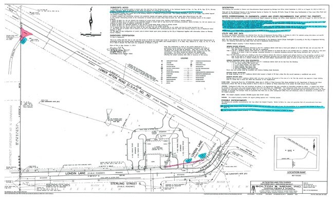
SECTION 12 TOWN 28 RANGE 22 PART LYING SWLY OF NEW LOWER AFTON RD & ...OF NE 1/4 OF SEC 12 TN 28 RN 22
X
Ramsey
27123C0140G
Minnesota
2024
5.92 AC
2025
Suburban St Paul
042504
Minneapolis/St Paul
6,154 SF
Minneapolis-St. Paul-Bloomington, MN-WI
DEMOGRAPHICS near 2501 Londin Ln E
1 Mile
3 Mile
5 Mile
2024 Total Population
10,374
68,696
240,317
2029 Population
10,344
70,004
244,390
Pop Growth 2024-2029
(0.29%)
+ 1.90%
+ 1.69%
Average Age
38
38
38
2024 Total Households
3,929
25,893
90,066
HH Growth 2024-2029
+ 0.03%
+ 2.27%
+ 1.97%
Median Household Inc
$73,425
$73,708
$74,514
Avg Household Size
2.60
2.50
2.60
2024 Avg HH Vehicles
2.00
2.00
2.00
Median Home Value
$289,438
$275,546
$275,365
Median Year Built
1976
1976
1975
Nearby Places
Map Layers
Map Styles
 Street
 Aerial
- Restaurants
- Banks
- Shops
- Fitness
- Groceries
PUBLIC TRANSPORTATION
COMMUTER RAIL
St. Paul-Minneapolis (Empire Builder - Amtrak)
DRIVE
WALK
Distance
St. Paul-Minneapolis (Empire Builder - Amtrak)
9 min
6.2 mi
AIRPORT
Minneapolis-St Paul International/Wold-Chamberlain
DRIVE
WALK
Distance
Minneapolis-St Paul International/Wold-Chamberlain
22 min
15.0 mi
Freight Ports
Port Milwaukee
DRIVE
WALK
Distance
Port Milwaukee
358 min
325.2 mi
SALE & LEASE HISTORY
LISTING DATE
SALE/LEASE

Sep 24, 2016
For Sale
Nearby Properties
Address
Land Use
TOTAL SIZE
Lot Size
Zoning
Address
Land Use
TOTAL SIZE
Lot Size
Zoning
267,948 SF
372.92 AC
Address
Land Use
TOTAL SIZE
Lot Size
Zoning
114,777 SF
22.45 AC
Address
Land Use
TOTAL SIZE
Lot Size
Zoning
270,348 SF
35.96 AC
Address
Land Use
TOTAL SIZE
Lot Size
Zoning
127,888 SF
141.04 AC
Address
Land Use
TOTAL SIZE
Lot Size
Zoning
460,439 SF
25.26 AC
Address
Land Use
TOTAL SIZE
Lot Size
Zoning
29.55 AC
Address
Land Use
TOTAL SIZE
Lot Size
Zoning
296,529 SF
31.80 AC
Address
Land Use
TOTAL SIZE
Lot Size
Zoning
81,006 SF
12.05 AC
Address
Land Use
TOTAL SIZE
Lot Size
Zoning
147,199 SF
32.47 AC
Address
Land Use
TOTAL SIZE
Lot Size
Zoning
311,332 SF
36.34 AC
Address
Land Use
TOTAL SIZE
Lot Size
Zoning
181.88 AC
Address
Land Use
TOTAL SIZE
Lot Size
Zoning
551,440 SF
25.40 AC
Address
Land Use
TOTAL SIZE
Lot Size
Zoning
9.90 AC
Address
Land Use
TOTAL SIZE
Lot Size
Zoning
230,892 SF
43.62 AC
Address
Land Use
TOTAL SIZE
Lot Size
Zoning
41,868 SF
6.69 AC
Address
Land Use
TOTAL SIZE
Lot Size
Zoning
262,872 SF
14.22 AC
Address
Land Use
TOTAL SIZE
Lot Size
Zoning
13.43 AC
Address
Land Use
TOTAL SIZE
Lot Size
Zoning
41,201 SF
9.55 AC
Address
Land Use
TOTAL SIZE
Lot Size
Zoning
371,200 SF
8.99 AC
Address
Land Use
TOTAL SIZE
Lot Size
Zoning
Address
Land Use
TOTAL SIZE
Lot Size
Zoning
Address
Land Use
TOTAL SIZE
Lot Size
Zoning
163,561 SF
41.09 AC
Address
Land Use
TOTAL SIZE
Lot Size
Zoning
78,278 SF
4.08 AC
Address
Land Use
TOTAL SIZE
Lot Size
Zoning
188,160 SF
7.53 AC
Address
Land Use
TOTAL SIZE
Lot Size
Zoning
190,062 SF
6.99 AC
Address
Land Use
TOTAL SIZE
Lot Size
Zoning
301,658 SF
21.92 AC
Address
Land Use
TOTAL SIZE
Lot Size
Zoning
192,600 SF
11 AC
Address
Land Use
TOTAL SIZE
Lot Size
Zoning
6,058 SF
80.81 AC
Address
Land Use
TOTAL SIZE
Lot Size
Zoning
52,294 SF
6.47 AC
The World's #1 Commercial Real Estate Marketplace
Connect with us
© 2025 CoStar Group
The information above has been obtained from sources believed reliable. While we do not doubt its accuracy we have not verified it and make no guarantee, warranty or representation about it. It is your responsibility to independently confirm its accuracy and completeness. Any projections, opinions, assumptions, or estimates used are for example only and do not represent the current or future performance of the property. The value of this transaction to you depends on tax and other factors which should be evaluated by your tax, financial, and legal advisors. You and your advisors should conduct a careful, independent investigation of the property to determine to your satisfaction the suitability of the property for your needs.