Property Record
2501 Mcrae St, Leesville, LA 71446

NEARBY LISTINGS FOR SALE OR LEASE
Property Detail
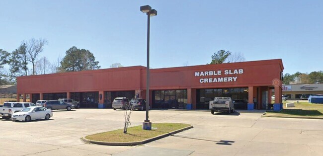
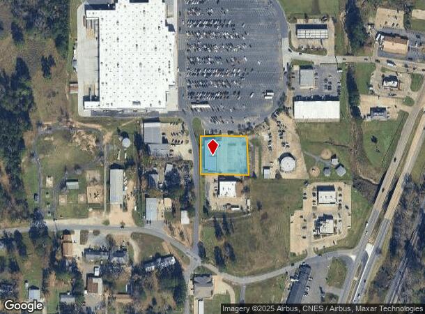
2501 Mcrae St
011-153-9139B
Commencing At A 1/2 Inch Iron Rod Markin
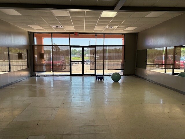
Storebuilding
T2NR9W- SEC 27, COMMENCING AT THE SW/C OF THE SESE; THEN N 00 DEG 08 MIN 55 SEC W, A DISTANCE OF 85.00 FT; THE S 89 DEG 45 MI
X
Vernon
22115C0425E
Louisiana
2025
1 AC
2025
Louisiana North Area
950600
Other Market Areas
DEMOGRAPHICS near 2501 Mcrae St
1 mile
3 mile
5 mile
2024 Total Population
2,671
8,929
18,406
2029 Population
2,529
8,735
17,850
Pop Growth 2024-2029
(5.32%)
(2.17%)
(3.02%)
Average Age
38
38
35
2024 Total Households
1,116
3,818
7,686
HH Growth 2024-2029
(5.11%)
(1.89%)
(2.94%)
Median Household Inc
$50,108
$42,350
$50,249
Avg Household Size
2.30
2.30
2.30
2024 Avg HH Vehicles
2.00
1.00
2.00
Median Home Value
$143,032
$121,889
$145,309
Median Year Built
1977
1978
1984
Nearby Places
Map Layers
Map Styles
 Street
 Aerial
Transit
 Traffic
 Biking
Places
Listings with unknown addresses are not visible on the map
- Restaurants
- Banks
- Shops
- Fitness
- Groceries
SALE & LEASE HISTORY
LISTING DATE
SALE/LEASE

Apr 09, 2025
For Sale
Nearby Properties
Address
Land Use
TOTAL SIZE
Lot Size
Zoning
Address
Land Use
TOTAL SIZE
Lot Size
Zoning
Address
Land Use
TOTAL SIZE
Lot Size
Zoning
Address
Land Use
TOTAL SIZE
Lot Size
Zoning
Address
Land Use
TOTAL SIZE
Lot Size
Zoning
Address
Land Use
TOTAL SIZE
Lot Size
Zoning
Address
Land Use
TOTAL SIZE
Lot Size
Zoning
Address
Land Use
TOTAL SIZE
Lot Size
Zoning
Address
Land Use
TOTAL SIZE
Lot Size
Zoning
Address
Land Use
TOTAL SIZE
Lot Size
Zoning
Address
Land Use
TOTAL SIZE
Lot Size
Zoning
Address
Land Use
TOTAL SIZE
Lot Size
Zoning
2.70 AC
Address
Land Use
TOTAL SIZE
Lot Size
Zoning
0.22 AC
Address
Land Use
TOTAL SIZE
Lot Size
Zoning
Address
Land Use
TOTAL SIZE
Lot Size
Zoning
2.56 AC
Address
Land Use
TOTAL SIZE
Lot Size
Zoning
Address
Land Use
TOTAL SIZE
Lot Size
Zoning
1.84 AC
Address
Land Use
TOTAL SIZE
Lot Size
Zoning
Address
Land Use
TOTAL SIZE
Lot Size
Zoning
Address
Land Use
TOTAL SIZE
Lot Size
Zoning
Address
Land Use
TOTAL SIZE
Lot Size
Zoning
Address
Land Use
TOTAL SIZE
Lot Size
Zoning
Address
Land Use
TOTAL SIZE
Lot Size
Zoning
The World's #1 Commercial Real Estate Marketplace
Connect with us
© 2026 CoStar Group
The information above has been obtained from sources believed reliable. While we do not doubt its accuracy we have not verified it and make no guarantee, warranty or representation about it. It is your responsibility to independently confirm its accuracy and completeness. Any projections, opinions, assumptions, or estimates used are for example only and do not represent the current or future performance of the property. The value of this transaction to you depends on tax and other factors which should be evaluated by your tax, financial, and legal advisors. You and your advisors should conduct a careful, independent investigation of the property to determine to your satisfaction the suitability of the property for your needs.