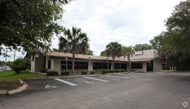
Property Record
2501 N Main St, Gainesville, FL 32609


NEARBY LISTINGS FOR SALE OR LEASE
Property Detail
2501 N Main St
08236-001-000
Haile Lt 65 A Condo
Commercialacreage
COM SW COR SEC E ALG S/L SEC & C/L NE 23RD AVE 911.25 FT N ALG C/L NE 5TH TER 292.82 FT W 25 FT TO WLY R/W N & 5TH TER POB CONT W 252.50 FT N 66.54 FT W 113.33 FT TO ELY R/W N MAIN ST NELY ALG R/W 336.64 FT W 219.73 FT TO WLY R/W NE 5TH TERR S ALG R/
X
Alachua
12001C0312D
Florida
2025
6.85 AC
2025
Northwest Gainesville
000400
Other Market Areas
7,107 SF
Gainesville, FL
DEMOGRAPHICS near 2501 N Main St
1 Mile
3 Mile
5 Mile
2024 Total Population
8,100
66,066
137,511
2029 Population
8,565
69,202
144,229
Pop Growth 2024-2029
+ 5.74%
+ 4.75%
+ 4.89%
Average Age
38
34
35
2024 Total Households
3,706
25,796
55,322
HH Growth 2024-2029
+ 5.80%
+ 5.12%
+ 5.06%
Median Household Inc
$42,695
$37,888
$43,731
Avg Household Size
2.10
2.10
2.10
2024 Avg HH Vehicles
1.00
1.00
2.00
Median Home Value
$149,120
$182,278
$198,575
Median Year Built
1970
1976
1980
Nearby Places
Map Layers
Map Styles
 Street
 Aerial
- Restaurants
- Banks
- Shops
- Fitness
- Groceries
PUBLIC TRANSPORTATION
AIRPORT
Gainesville Regional
DRIVE
WALK
Distance
Gainesville Regional
15 min
6.1 mi
Freight Ports
Jacksonville Port
DRIVE
WALK
Distance
Jacksonville Port
1 min
62.8 mi
SALE & LEASE HISTORY
LISTING DATE
SALE/LEASE

Sep 24, 2016
For Sale
Nov 02, 2020
For Sale
Nearby Properties
Address
Land Use
TOTAL SIZE
Lot Size
Zoning
Address
Land Use
TOTAL SIZE
Lot Size
Zoning
698,640 SF
24.04 AC
U9
Address
Land Use
TOTAL SIZE
Lot Size
Zoning
108,640 SF
20 AC
ED
Address
Land Use
TOTAL SIZE
Lot Size
Zoning
17.87 AC
ED
Address
Land Use
TOTAL SIZE
Lot Size
Zoning
430,590 SF
16.95 AC
ED
Address
Land Use
TOTAL SIZE
Lot Size
Zoning
682,400 SF
20 AC
ED
Address
Land Use
TOTAL SIZE
Lot Size
Zoning
959,910 SF
2.50 AC
PD
Address
Land Use
TOTAL SIZE
Lot Size
Zoning
399,130 SF
18.13 AC
ED
Address
Land Use
TOTAL SIZE
Lot Size
Zoning
416,200 SF
20 AC
ED
Address
Land Use
TOTAL SIZE
Lot Size
Zoning
334,819 SF
1.79 AC
U9
Address
Land Use
TOTAL SIZE
Lot Size
Zoning
325,519 SF
1.25 AC
U8
Address
Land Use
TOTAL SIZE
Lot Size
Zoning
582,311 SF
20 AC
ED
Address
Land Use
TOTAL SIZE
Lot Size
Zoning
348,458 SF
81.44 AC
ED
Address
Land Use
TOTAL SIZE
Lot Size
Zoning
372,990 SF
20 AC
ED
Address
Land Use
TOTAL SIZE
Lot Size
Zoning
357,020 SF
20 AC
ED
Address
Land Use
TOTAL SIZE
Lot Size
Zoning
25.64 AC
PS
Address
Land Use
TOTAL SIZE
Lot Size
Zoning
594,946 SF
4.47 AC
DT
Address
Land Use
TOTAL SIZE
Lot Size
Zoning
271,079 SF
0.94 AC
PD
Address
Land Use
TOTAL SIZE
Lot Size
Zoning
279,647 SF
1.66 AC
PD
Address
Land Use
TOTAL SIZE
Lot Size
Zoning
117,563 SF
1.61 AC
U8
Address
Land Use
TOTAL SIZE
Lot Size
Zoning
362,539 SF
2.11 AC
U8
Address
Land Use
TOTAL SIZE
Lot Size
Zoning
414,780 SF
1.99 AC
PD
Address
Land Use
TOTAL SIZE
Lot Size
Zoning
299,737 SF
1.14 AC
DT
Address
Land Use
TOTAL SIZE
Lot Size
Zoning
94,156 SF
3.65 AC
U9
Address
Land Use
TOTAL SIZE
Lot Size
Zoning
295,990 SF
20 AC
ED
Address
Land Use
TOTAL SIZE
Lot Size
Zoning
385,841 SF
21.74 AC
U6
Address
Land Use
TOTAL SIZE
Lot Size
Zoning
280,840 SF
20 AC
ED
Address
Land Use
TOTAL SIZE
Lot Size
Zoning
404,722 SF
2.82 AC
U6
Address
Land Use
TOTAL SIZE
Lot Size
Zoning
444,350 SF
4.38 AC
DT
Address
Land Use
TOTAL SIZE
Lot Size
Zoning
1,331,605 SF
32.61 AC
ED
Address
Land Use
TOTAL SIZE
Lot Size
Zoning
395,561 SF
19.11 AC
PD
The World's #1 Commercial Real Estate Marketplace
Connect with us
© 2025 CoStar Group
The information above has been obtained from sources believed reliable. While we do not doubt its accuracy we have not verified it and make no guarantee, warranty or representation about it. It is your responsibility to independently confirm its accuracy and completeness. Any projections, opinions, assumptions, or estimates used are for example only and do not represent the current or future performance of the property. The value of this transaction to you depends on tax and other factors which should be evaluated by your tax, financial, and legal advisors. You and your advisors should conduct a careful, independent investigation of the property to determine to your satisfaction the suitability of the property for your needs.