Property Record
2501 N Shiloh Dr, Fayetteville, AR 72704


NEARBY LISTINGS FOR SALE OR LEASE
Property Detail
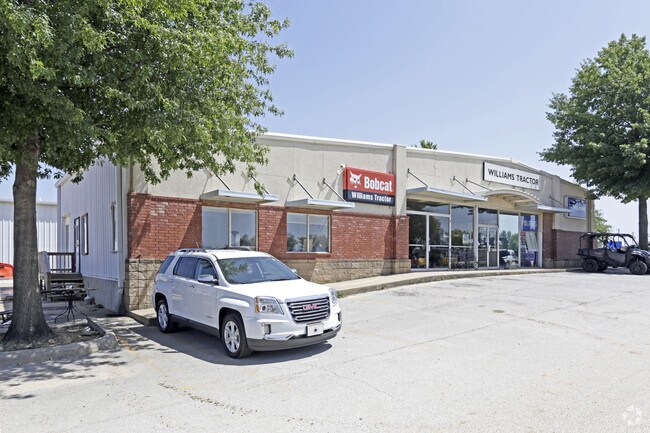
2501 N Shiloh Dr
765-15872-000
Fayetteville Outlots
Vehiclerentalsvehiclesales
PT S/2 SW 13.5 AC FURTHER DESCRIBED FROM 2015-35610 AS: PART OF THE SOUTH HALF OF THE SOUTHWEST QUARTER OF SECTION 33, TOWNSH
X
Washington
05143C0205G
Arkansas
2025
3.62 AC
2025
Greater Fayetteville
010517
Fayetteville/Springdale/Rogers
45,471 SF
Fayetteville-Springdale-Rogers, AR-MO
DEMOGRAPHICS near 2501 N Shiloh Dr
1 Mile
3 Mile
5 Mile
2024 Total Population
4,395
64,407
118,826
2029 Population
4,793
70,147
130,033
Pop Growth 2024-2029
+ 9.06%
+ 8.91%
+ 9.43%
Average Age
34
32
35
2024 Total Households
2,037
26,868
49,112
HH Growth 2024-2029
+ 9.13%
+ 9.78%
+ 10.06%
Median Household Inc
$54,262
$57,579
$61,331
Avg Household Size
2.10
2.10
2.20
2024 Avg HH Vehicles
2.00
2.00
2.00
Median Home Value
$241,580
$265,897
$270,746
Median Year Built
1999
1995
1995
Nearby Places
Map Layers
Map Styles
 Street
 Aerial
- Restaurants
- Banks
- Shops
- Fitness
- Groceries
PUBLIC TRANSPORTATION
AIRPORT
Northwest Arkansas Ntl
DRIVE
WALK
Distance
Northwest Arkansas Ntl
37 min
17.2 mi
Freight Ports
Tulsa Port of Inola
DRIVE
WALK
Distance
Tulsa Port of Inola
106 min
88.6 mi
Nearby Properties
Address
Land Use
TOTAL SIZE
Lot Size
Zoning
Address
Land Use
TOTAL SIZE
Lot Size
Zoning
92,872 SF
15.37 AC
Address
Land Use
TOTAL SIZE
Lot Size
Zoning
316,846 SF
2.31 AC
I1
Address
Land Use
TOTAL SIZE
Lot Size
Zoning
63,080 SF
3.42 AC
Address
Land Use
TOTAL SIZE
Lot Size
Zoning
153,698 SF
14.10 AC
C2
Address
Land Use
TOTAL SIZE
Lot Size
Zoning
226,792 SF
26.66 AC
Address
Land Use
TOTAL SIZE
Lot Size
Zoning
145,586 SF
2.18 AC
R3
Address
Land Use
TOTAL SIZE
Lot Size
Zoning
238,168 SF
Address
Land Use
TOTAL SIZE
Lot Size
Zoning
176,747 SF
4.98 AC
Address
Land Use
TOTAL SIZE
Lot Size
Zoning
50,708 SF
1.69 AC
C2
Address
Land Use
TOTAL SIZE
Lot Size
Zoning
36,104 SF
8.36 AC
I1
Address
Land Use
TOTAL SIZE
Lot Size
Zoning
191,928 SF
0.81 AC
C4
Address
Land Use
TOTAL SIZE
Lot Size
Zoning
62,644 SF
0.49 AC
R3
Address
Land Use
TOTAL SIZE
Lot Size
Zoning
40,964 SF
10.59 AC
F
Address
Land Use
TOTAL SIZE
Lot Size
Zoning
305,272 SF
9.66 AC
R2
Address
Land Use
TOTAL SIZE
Lot Size
Zoning
121,758 SF
20.54 AC
Address
Land Use
TOTAL SIZE
Lot Size
Zoning
48,120 SF
0.53 AC
R3
Address
Land Use
TOTAL SIZE
Lot Size
Zoning
91,380 SF
9.53 AC
Address
Land Use
TOTAL SIZE
Lot Size
Zoning
13,012 SF
10.36 AC
I2
Address
Land Use
TOTAL SIZE
Lot Size
Zoning
122,309 SF
9.64 AC
Address
Land Use
TOTAL SIZE
Lot Size
Zoning
86,794 SF
0.33 AC
Address
Land Use
TOTAL SIZE
Lot Size
Zoning
19,805 SF
0.35 AC
R0
Address
Land Use
TOTAL SIZE
Lot Size
Zoning
78,284 SF
0.43 AC
Address
Land Use
TOTAL SIZE
Lot Size
Zoning
171,828 SF
9.95 AC
R2
Address
Land Use
TOTAL SIZE
Lot Size
Zoning
22,208 SF
5.22 AC
Address
Land Use
TOTAL SIZE
Lot Size
Zoning
106,961 SF
8.56 AC
Address
Land Use
TOTAL SIZE
Lot Size
Zoning
259,706 SF
5.31 AC
C2
Address
Land Use
TOTAL SIZE
Lot Size
Zoning
86,260 SF
4.15 AC
Address
Land Use
TOTAL SIZE
Lot Size
Zoning
217,873 SF
24.10 AC
C2
Address
Land Use
TOTAL SIZE
Lot Size
Zoning
39,936 SF
1.68 AC
Address
Land Use
TOTAL SIZE
Lot Size
Zoning
12,580 SF
14.16 AC
The World's #1 Commercial Real Estate Marketplace
Connect with us
© 2025 CoStar Group
The information above has been obtained from sources believed reliable. While we do not doubt its accuracy we have not verified it and make no guarantee, warranty or representation about it. It is your responsibility to independently confirm its accuracy and completeness. Any projections, opinions, assumptions, or estimates used are for example only and do not represent the current or future performance of the property. The value of this transaction to you depends on tax and other factors which should be evaluated by your tax, financial, and legal advisors. You and your advisors should conduct a careful, independent investigation of the property to determine to your satisfaction the suitability of the property for your needs.