Property Record
2501 Ne 138Th Ave, Vancouver, WA 98684


NEARBY LISTINGS FOR SALE OR LEASE
Property Detail
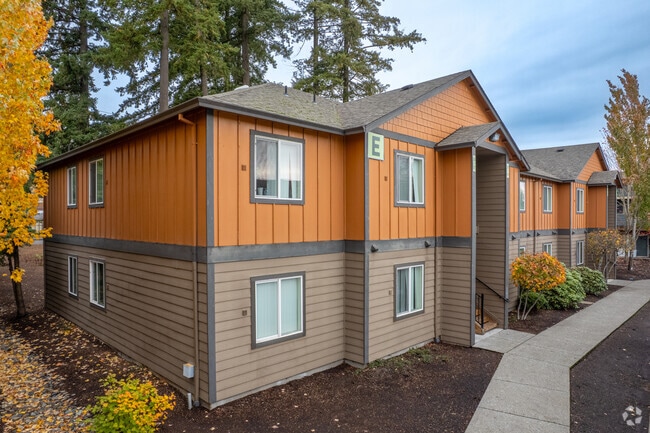
2501 Ne 138Th Ave
163958-000
#10 #155 #226 #151 #172 #62 SEC 23-2-2EWM 5.70A FOR ASSESSOR USE ONLY NH OF TT PTN EH OF WH OF NEQ OF SWQ SEC 23-2-2E DAF: BAAP THT IS N0-03-44E 666.60 FT FRM SE COR OF WH OF NEQ OF SWQ OF SD SEC SD PT BG NE COR OF TT CVYD TO M SAMPLE ETUX PER G18257
Multifamilydwelling
Clark
X
Washington
53011C0394D
5.70 AC
2025
Landover-Sharmel
2025
Portland
041319
Portland-Vancouver-Hillsboro, OR-WA
241,832 SF
DEMOGRAPHICS near 2501 Ne 138Th Ave
1 Mile
3 Mile
5 Mile
2024 Total Population
17,797
131,129
248,765
2029 Population
19,192
141,556
268,927
Pop Growth 2024-2029
+ 7.84%
+ 7.95%
+ 8.10%
Average Age
39
39
39
2024 Total Households
6,467
49,654
93,428
HH Growth 2024-2029
+ 8.04%
+ 8.10%
+ 8.22%
Median Household Inc
$83,910
$75,896
$80,265
Avg Household Size
2.70
2.50
2.60
2024 Avg HH Vehicles
2.00
2.00
2.00
Median Home Value
$382,783
$383,841
$412,175
Median Year Built
1992
1992
1993
Nearby Places
Map Layers
Map Styles
 Street
 Aerial
- Restaurants
- Banks
- Shops
- Fitness
- Groceries
PUBLIC TRANSPORTATION
AIRPORT
Portland International
DRIVE
WALK
Distance
Portland International
17 min
9.1 mi
Freight Ports
Port of Vancouver
DRIVE
WALK
Distance
Port of Vancouver
21 min
11.0 mi
Nearby Properties
Address
Land Use
TOTAL SIZE
Lot Size
Zoning
Address
Land Use
TOTAL SIZE
Lot Size
Zoning
2,279,068 SF
137.78 AC
IL
Address
Land Use
TOTAL SIZE
Lot Size
Zoning
780,691 SF
17.66 AC
OCI
Address
Land Use
TOTAL SIZE
Lot Size
Zoning
681,799 SF
36.22 AC
IL
Address
Land Use
TOTAL SIZE
Lot Size
Zoning
399,563 SF
12.98 AC
CC
Address
Land Use
TOTAL SIZE
Lot Size
Zoning
613,468 SF
45.44 AC
R1-6
Address
Land Use
TOTAL SIZE
Lot Size
Zoning
304,876 SF
11.34 AC
R-18
Address
Land Use
TOTAL SIZE
Lot Size
Zoning
340,500 SF
19.01 AC
R-22
Address
Land Use
TOTAL SIZE
Lot Size
Zoning
699,292 SF
30.16 AC
CG
Address
Land Use
TOTAL SIZE
Lot Size
Zoning
264,044 SF
11.16 AC
CC
Address
Land Use
TOTAL SIZE
Lot Size
Zoning
237,558 SF
15.48 AC
R-22
Address
Land Use
TOTAL SIZE
Lot Size
Zoning
341,504 SF
19.49 AC
R-22
Address
Land Use
TOTAL SIZE
Lot Size
Zoning
49,124 SF
17.26 AC
R-18
Address
Land Use
TOTAL SIZE
Lot Size
Zoning
104,279 SF
6.09 AC
MX
Address
Land Use
TOTAL SIZE
Lot Size
Zoning
282,460 SF
7.85 AC
R-18
Address
Land Use
TOTAL SIZE
Lot Size
Zoning
204,999 SF
5.71 AC
MX
Address
Land Use
TOTAL SIZE
Lot Size
Zoning
280,065 SF
14.80 AC
R-22
Address
Land Use
TOTAL SIZE
Lot Size
Zoning
253,976 SF
11.46 AC
MX
Address
Land Use
TOTAL SIZE
Lot Size
Zoning
201,471 SF
8.76 AC
CG
Address
Land Use
TOTAL SIZE
Lot Size
Zoning
212,641 SF
8.03 AC
R-22
Address
Land Use
TOTAL SIZE
Lot Size
Zoning
171,584 SF
6.26 AC
MX
Address
Land Use
TOTAL SIZE
Lot Size
Zoning
244,812 SF
16.33 AC
CC
Address
Land Use
TOTAL SIZE
Lot Size
Zoning
203,193 SF
4.90 AC
R-30
Address
Land Use
TOTAL SIZE
Lot Size
Zoning
177,297 SF
11.10 AC
R-18
Address
Land Use
TOTAL SIZE
Lot Size
Zoning
275,661 SF
15.23 AC
R-30
Address
Land Use
TOTAL SIZE
Lot Size
Zoning
100,476 SF
5.51 AC
R-18
Address
Land Use
TOTAL SIZE
Lot Size
Zoning
301,864 SF
9.53 AC
R-22
Address
Land Use
TOTAL SIZE
Lot Size
Zoning
144,267 SF
5.83 AC
R-22
Address
Land Use
TOTAL SIZE
Lot Size
Zoning
134,442 SF
6.35 AC
OCI
Address
Land Use
TOTAL SIZE
Lot Size
Zoning
188,974 SF
7.19 AC
R-30
The World's #1 Commercial Real Estate Marketplace
Connect with us
© 2026 CoStar Group
The information above has been obtained from sources believed reliable. While we do not doubt its accuracy we have not verified it and make no guarantee, warranty or representation about it. It is your responsibility to independently confirm its accuracy and completeness. Any projections, opinions, assumptions, or estimates used are for example only and do not represent the current or future performance of the property. The value of this transaction to you depends on tax and other factors which should be evaluated by your tax, financial, and legal advisors. You and your advisors should conduct a careful, independent investigation of the property to determine to your satisfaction the suitability of the property for your needs.