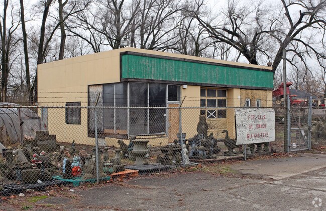
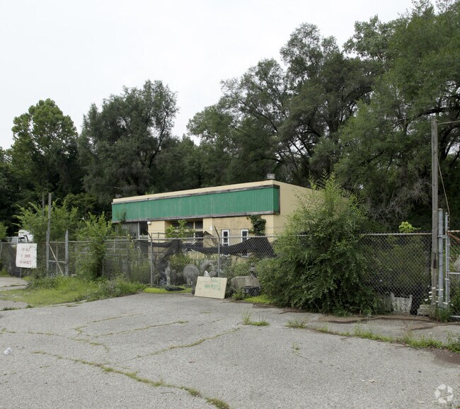
Property Record
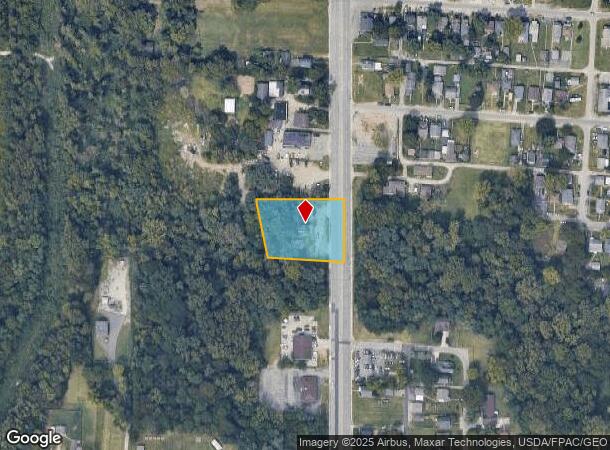
2519 S High St, Columbus, OH 43207
NEARBY LISTINGS FOR SALE OR LEASE
Property Detail
2519 S High St
Columbus, OH
South High Gardens
010-113203
S HIGH ST 1.181 AC
Storebuilding
Franklin
2024
Ohio
2025
0.86 AC
008821
Southeast
1,120 SF
Columbus
DEMOGRAPHICS near 2519 S High St
1 mile
3 mile
5 mile
2024 Total Population
3,760
68,430
229,622
2029 Population
3,772
69,005
232,621
Pop Growth 2024-2029
+ 0.32%
+ 0.84%
+ 1.31%
Average Age
43
38
38
2024 Total Households
1,568
28,189
98,490
HH Growth 2024-2029
+ 0.26%
+ 0.83%
+ 1.37%
Median Household Inc
$44,560
$58,326
$58,162
Avg Household Size
2.30
2.30
2.20
2024 Avg HH Vehicles
2.00
2.00
2.00
Median Home Value
$122,186
$177,964
$194,776
Median Year Built
1958
1958
1964
Nearby Places
Map Layers
Map Styles
 Street
 Aerial
Transit
 Traffic
 Biking
Places
Listings with unknown addresses are not visible on the map
- Restaurants
- Banks
- Shops
- Fitness
- Groceries
PUBLIC TRANSPORTATION
AIRPORT
Rickenbacker International
Drive
Walk
Distance
Rickenbacker International
19 min
10.3 mi
John Glenn Columbus International
Drive
Walk
Distance
John Glenn Columbus International
20 min
12.8 mi
SALE & LEASE HISTORY
LISTING DATE
SALE/LEASE

Sep 23, 2016
For Sale
Jun 06, 2017
For Lease
Nearby Properties
Address
Land Use
TOTAL SIZE
Lot Size
Zoning
Address
Land Use
TOTAL SIZE
Lot Size
Zoning
382.42 AC
Address
Land Use
TOTAL SIZE
Lot Size
Zoning
597,600 SF
68.91 AC
Address
Land Use
TOTAL SIZE
Lot Size
Zoning
496,729 SF
3.47 AC
Address
Land Use
TOTAL SIZE
Lot Size
Zoning
523,793 SF
6.94 AC
Address
Land Use
TOTAL SIZE
Lot Size
Zoning
157,856 SF
0.74 AC
Address
Land Use
TOTAL SIZE
Lot Size
Zoning
705,600 SF
43.41 AC
Address
Land Use
TOTAL SIZE
Lot Size
Zoning
192,038 SF
2.84 AC
Address
Land Use
TOTAL SIZE
Lot Size
Zoning
503,279 SF
1.99 AC
Address
Land Use
TOTAL SIZE
Lot Size
Zoning
455,534 SF
3.01 AC
Address
Land Use
TOTAL SIZE
Lot Size
Zoning
209,884 SF
3.04 AC
Address
Land Use
TOTAL SIZE
Lot Size
Zoning
163,629 SF
26.71 AC
Address
Land Use
TOTAL SIZE
Lot Size
Zoning
406,364 SF
22.03 AC
Address
Land Use
TOTAL SIZE
Lot Size
Zoning
229,640 SF
2.88 AC
Address
Land Use
TOTAL SIZE
Lot Size
Zoning
361,060 SF
1.49 AC
Address
Land Use
TOTAL SIZE
Lot Size
Zoning
169,066 SF
11.72 AC
Address
Land Use
TOTAL SIZE
Lot Size
Zoning
150,289 SF
25.19 AC
Address
Land Use
TOTAL SIZE
Lot Size
Zoning
761,098 SF
35.07 AC
Address
Land Use
TOTAL SIZE
Lot Size
Zoning
146,172 SF
26.42 AC
Address
Land Use
TOTAL SIZE
Lot Size
Zoning
398,594 SF
25.50 AC
Address
Land Use
TOTAL SIZE
Lot Size
Zoning
75,164 SF
16.26 AC
Address
Land Use
TOTAL SIZE
Lot Size
Zoning
204,782 SF
20.82 AC
Address
Land Use
TOTAL SIZE
Lot Size
Zoning
73,908 SF
9 AC
Address
Land Use
TOTAL SIZE
Lot Size
Zoning
139,123 SF
24.67 AC
Address
Land Use
TOTAL SIZE
Lot Size
Zoning
736,660 SF
34.40 AC
Address
Land Use
TOTAL SIZE
Lot Size
Zoning
277,746 SF
24.13 AC
Address
Land Use
TOTAL SIZE
Lot Size
Zoning
54,209 SF
13.64 AC
Address
Land Use
TOTAL SIZE
Lot Size
Zoning
231,838 SF
13.17 AC
Address
Land Use
TOTAL SIZE
Lot Size
Zoning
236,000 SF
10.66 AC
Address
Land Use
TOTAL SIZE
Lot Size
Zoning
309,306 SF
0.93 AC
Address
Land Use
TOTAL SIZE
Lot Size
Zoning
86,485 SF
0.37 AC
The World's #1 Commercial Real Estate Marketplace
Connect with us
© 2026 CoStar Group
The information above has been obtained from sources believed reliable. While we do not doubt its accuracy we have not verified it and make no guarantee, warranty or representation about it. It is your responsibility to independently confirm its accuracy and completeness. Any projections, opinions, assumptions, or estimates used are for example only and do not represent the current or future performance of the property. The value of this transaction to you depends on tax and other factors which should be evaluated by your tax, financial, and legal advisors. You and your advisors should conduct a careful, independent investigation of the property to determine to your satisfaction the suitability of the property for your needs.