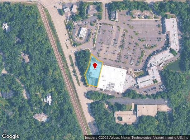
Property Record
2501 Waukegan Rd, Bannockburn, IL 60015


NEARBY LISTINGS FOR SALE OR LEASE
Property Detail
2501 Waukegan Rd
Chicago-Naperville-Elgin, IL-IN-WI
Bannockburn Green Subdivision
16-17-310-006
BANNOCKBURN GREEN SUBDIVISION;LOT 2
Commercialbuilding
Lake
X
Illinois
17097C0278K
2
2023
0.72 AC
2024
Central North
864801
Chicago
15,089 SF
DEMOGRAPHICS near 2501 Waukegan Rd
1 Mile
3 Mile
5 Mile
2024 Total Population
2,119
51,375
123,702
2029 Population
2,068
50,655
122,186
Pop Growth 2024-2029
(2.41%)
(1.40%)
(1.23%)
Average Age
39
42
43
2024 Total Households
582
18,262
46,259
HH Growth 2024-2029
(3.09%)
(1.51%)
(1.31%)
Median Household Inc
$173,369
$162,900
$141,835
Avg Household Size
2.70
2.70
2.60
2024 Avg HH Vehicles
2.00
2.00
2.00
Median Home Value
$876,651
$658,357
$604,721
Median Year Built
1982
1971
1976
Nearby Places
Map Layers
Map Styles
 Street
 Aerial
- Restaurants
- Banks
- Shops
- Fitness
- Groceries
PUBLIC TRANSPORTATION
COMMUTER RAIL
Lake Forest Station (Md-North) (Milwaukee District North Line - Northeast Illinois Regional Commuter Railroad (Metra))
DRIVE
WALK
Distance
Lake Forest Station (Md-North) (Milwaukee District North Line - Northeast Illinois Regional Commuter Railroad (Metra))
3 min
2.1 mi
Deerfield Station (Milwaukee District North Line - Northeast Illinois Regional Commuter Railroad (Metra))
DRIVE
WALK
Distance
Deerfield Station (Milwaukee District North Line - Northeast Illinois Regional Commuter Railroad (Metra))
5 min
2.6 mi
AIRPORT
Chicago O'Hare International
DRIVE
WALK
Distance
Chicago O'Hare International
28 min
19.7 mi
Chicago Midway International
DRIVE
WALK
Distance
Chicago Midway International
50 min
33.7 mi
Freight Ports
Port Milwaukee
DRIVE
WALK
Distance
Port Milwaukee
71 min
60.4 mi
Nearby Properties
Address
Land Use
TOTAL SIZE
Lot Size
Zoning
Address
Land Use
TOTAL SIZE
Lot Size
Zoning
301,050 SF
11.22 AC
Address
Land Use
TOTAL SIZE
Lot Size
Zoning
864,590 SF
2.64 AC
Address
Land Use
TOTAL SIZE
Lot Size
Zoning
806,580 SF
7.64 AC
Address
Land Use
TOTAL SIZE
Lot Size
Zoning
315,160 SF
15.50 AC
Address
Land Use
TOTAL SIZE
Lot Size
Zoning
653,040 SF
7.96 AC
Address
Land Use
TOTAL SIZE
Lot Size
Zoning
8,586,994 SF
10.41 AC
Address
Land Use
TOTAL SIZE
Lot Size
Zoning
188,987 SF
6.65 AC
Address
Land Use
TOTAL SIZE
Lot Size
Zoning
698,127 SF
7.94 AC
Address
Land Use
TOTAL SIZE
Lot Size
Zoning
191,025 SF
15.66 AC
Address
Land Use
TOTAL SIZE
Lot Size
Zoning
13.88 AC
Address
Land Use
TOTAL SIZE
Lot Size
Zoning
74,599 SF
9.16 AC
Address
Land Use
TOTAL SIZE
Lot Size
Zoning
79,073 SF
8.70 AC
Address
Land Use
TOTAL SIZE
Lot Size
Zoning
105,033 SF
5.21 AC
Address
Land Use
TOTAL SIZE
Lot Size
Zoning
738,489 SF
20.24 AC
Address
Land Use
TOTAL SIZE
Lot Size
Zoning
14.82 AC
Address
Land Use
TOTAL SIZE
Lot Size
Zoning
3,896 SF
4.36 AC
Address
Land Use
TOTAL SIZE
Lot Size
Zoning
158,046 SF
5.26 AC
Address
Land Use
TOTAL SIZE
Lot Size
Zoning
0.46 AC
Address
Land Use
TOTAL SIZE
Lot Size
Zoning
231,969 SF
1.86 AC
Address
Land Use
TOTAL SIZE
Lot Size
Zoning
392,643 SF
7.48 AC
Address
Land Use
TOTAL SIZE
Lot Size
Zoning
250,096 SF
2.16 AC
Address
Land Use
TOTAL SIZE
Lot Size
Zoning
45,091 SF
1.81 AC
Address
Land Use
TOTAL SIZE
Lot Size
Zoning
Address
Land Use
TOTAL SIZE
Lot Size
Zoning
313,794 SF
6.91 AC
Address
Land Use
TOTAL SIZE
Lot Size
Zoning
74,190 SF
1.79 AC
Address
Land Use
TOTAL SIZE
Lot Size
Zoning
40,820 SF
5.79 AC
Address
Land Use
TOTAL SIZE
Lot Size
Zoning
123,234 SF
6.13 AC
Address
Land Use
TOTAL SIZE
Lot Size
Zoning
94,920 SF
2.25 AC
Address
Land Use
TOTAL SIZE
Lot Size
Zoning
75,528 SF
7.83 AC
Address
Land Use
TOTAL SIZE
Lot Size
Zoning
96,245 SF
3.98 AC
The World's #1 Commercial Real Estate Marketplace
Connect with us
© 2025 CoStar Group
The information above has been obtained from sources believed reliable. While we do not doubt its accuracy we have not verified it and make no guarantee, warranty or representation about it. It is your responsibility to independently confirm its accuracy and completeness. Any projections, opinions, assumptions, or estimates used are for example only and do not represent the current or future performance of the property. The value of this transaction to you depends on tax and other factors which should be evaluated by your tax, financial, and legal advisors. You and your advisors should conduct a careful, independent investigation of the property to determine to your satisfaction the suitability of the property for your needs.