Property Record
25010 Alliance Dr, Claremore, OK 74019


Save to a Folder
{{folder.Name}}
{{folder.ListingIds.length}} Properties
{{folder.ListingIds.length}} Property
Create a New Folder
Property Detail
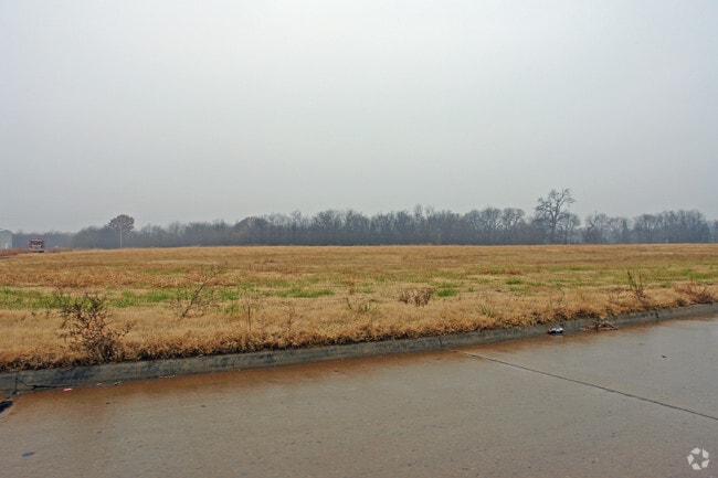
25010 Alliance Dr
Tulsa, OK
LOTS 1,2 & 3 BLOCK 2 RIVERVIEW BUS PARK.
660054784
ROGERS
Manufacturinglight
Oklahoma
B and X Area of moderate flood hazard, usually the area between the limits of the 100-year and 500-year floods.
1-3
2025
4.46 AC
2025
Rogers County
050101
Tulsa
120,400 SF
NEARBY LISTINGS FOR SALE OR LEASE
-
-
View all Claremore listings for sale on LoopNet.com
DEMOGRAPHICS near 25010 Alliance Dr
1 mile
3 mile
5 mile
2025 Total Population
425
7,403
22,211
2030 Population
449
7,840
23,495
Pop Growth 2025-2030
+ 5.65%
+ 5.90%
+ 5.78%
Average Age
42
40
41
2025 Total Households
154
2,549
7,876
HH Growth 2025-2030
+ 5.84%
+ 5.96%
+ 5.83%
Median Household Inc
$90,340
$97,511
$90,805
Avg Household Size
2.80
2.80
2.80
2025 Avg HH Vehicles
3.00
2.00
2.00
Median Home Value
$296,077
$296,214
$295,311
Median Year Built
2001
2002
1997
Nearby Places
Map Layers
Map Styles
 Street
 Aerial
Layers
 Traffic
 Biking
Places
Listings with unknown addresses are not visible on the map
- Restaurants
- Banks
- Shops
- Fitness
- Groceries
PUBLIC TRANSPORTATION
AIRPORT
Tulsa International
Drive
Walk
Distance
Tulsa International
18 min
12.2 mi
Freight Ports
Tulsa Port Of Catoosa
Drive
Walk
Distance
Tulsa Port Of Catoosa
7 min
4.3 mi
Nearby Properties
Address
Land Use
TOTAL SIZE
Lot Size
Zoning
Address
Land Use
TOTAL SIZE
Lot Size
Zoning
60,000 SF
Address
Land Use
TOTAL SIZE
Lot Size
Zoning
1,640 SF
47.88 AC
Address
Land Use
TOTAL SIZE
Lot Size
Zoning
3,800 SF
5.71 AC
Address
Land Use
TOTAL SIZE
Lot Size
Zoning
3,000 SF
Address
Land Use
TOTAL SIZE
Lot Size
Zoning
109,800 SF
Address
Land Use
TOTAL SIZE
Lot Size
Zoning
80,000 SF
Address
Land Use
TOTAL SIZE
Lot Size
Zoning
51,427 SF
Address
Land Use
TOTAL SIZE
Lot Size
Zoning
Address
Land Use
TOTAL SIZE
Lot Size
Zoning
8,100 SF
Address
Land Use
TOTAL SIZE
Lot Size
Zoning
2,400 SF
Address
Land Use
TOTAL SIZE
Lot Size
Zoning
10,680 SF
6.18 AC
Address
Land Use
TOTAL SIZE
Lot Size
Zoning
3,400 SF
Address
Land Use
TOTAL SIZE
Lot Size
Zoning
49,185 SF
5 AC
Address
Land Use
TOTAL SIZE
Lot Size
Zoning
6,340 SF
278.23 AC
Address
Land Use
TOTAL SIZE
Lot Size
Zoning
52,800 SF
Address
Land Use
TOTAL SIZE
Lot Size
Zoning
22,590 SF
50.76 AC
Address
Land Use
TOTAL SIZE
Lot Size
Zoning
19,120 SF
3.65 AC
Address
Land Use
TOTAL SIZE
Lot Size
Zoning
150,443 SF
Address
Land Use
TOTAL SIZE
Lot Size
Zoning
200,000 SF
5.34 AC
Address
Land Use
TOTAL SIZE
Lot Size
Zoning
20,900 SF
4.37 AC
Address
Land Use
TOTAL SIZE
Lot Size
Zoning
65,750 SF
Address
Land Use
TOTAL SIZE
Lot Size
Zoning
Address
Land Use
TOTAL SIZE
Lot Size
Zoning
9,740 SF
Address
Land Use
TOTAL SIZE
Lot Size
Zoning
4,632 SF
1.46 AC
Address
Land Use
TOTAL SIZE
Lot Size
Zoning
57,600 SF
17.98 AC
Address
Land Use
TOTAL SIZE
Lot Size
Zoning
4,560 SF
2.10 AC
Address
Land Use
TOTAL SIZE
Lot Size
Zoning
23,878 SF
5.78 AC
Address
Land Use
TOTAL SIZE
Lot Size
Zoning
Address
Land Use
TOTAL SIZE
Lot Size
Zoning
4,500 SF
9.38 AC
The World's #1 Commercial Real Estate Marketplace
Connect with us
© 2026 CoStar Group
The information above has been obtained from sources believed reliable. While we do not doubt its accuracy we have not verified it and make no guarantee, warranty or representation about it. It is your responsibility to independently confirm its accuracy and completeness. Any projections, opinions, assumptions, or estimates used are for example only and do not represent the current or future performance of the property. The value of this transaction to you depends on tax and other factors which should be evaluated by your tax, financial, and legal advisors. You and your advisors should conduct a careful, independent investigation of the property to determine to your satisfaction the suitability of the property for your needs.