Property Record
2502 Reliance Ave, Apex, NC 27539


NEARBY LISTINGS FOR SALE OR LEASE
Property Detail
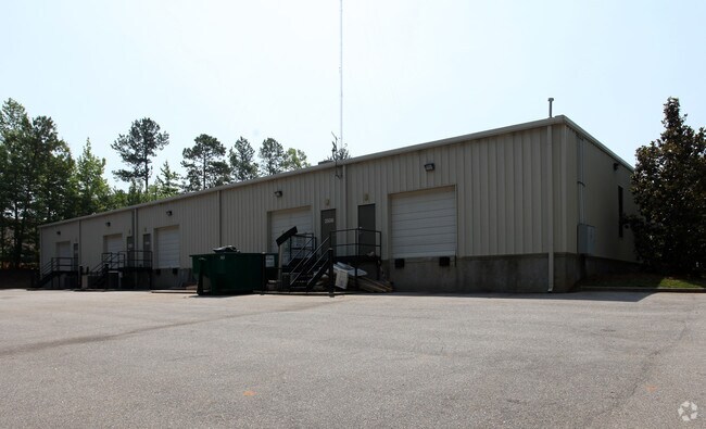
2502 Reliance Ave
Raleigh, NC
Twenty Five Hundred Condo
0751.10-25-5360-002
Wake
Warehouse
North Carolina
X
Southwest Wake County
3720075100K
Raleigh/Durham
3,536 SF
DEMOGRAPHICS near 2502 Reliance Ave
1 Mile
3 Mile
5 Mile
2024 Total Population
3,109
51,871
160,507
2029 Population
3,363
56,079
173,970
Pop Growth 2024-2029
+ 8.17%
+ 8.11%
+ 8.39%
Average Age
42
40
40
2024 Total Households
1,172
19,291
59,357
HH Growth 2024-2029
+ 8.28%
+ 8.17%
+ 8.36%
Median Household Inc
$139,444
$118,030
$119,739
Avg Household Size
2.60
2.70
2.70
2024 Avg HH Vehicles
2.00
2.00
2.00
Median Home Value
$518,308
$435,876
$427,421
Median Year Built
1997
1997
1997
Nearby Places
Map Layers
Map Styles
 Street
 Aerial
- Restaurants
- Banks
- Shops
- Fitness
- Groceries
PUBLIC TRANSPORTATION
COMMUTER RAIL
Cary Station (Piedmont - North Carolina by Train (NC Train))
DRIVE
WALK
Distance
Cary Station (Piedmont - North Carolina by Train (NC Train))
15 min
7.0 mi
AIRPORT
Raleigh-Durham International
DRIVE
WALK
Distance
Raleigh-Durham International
27 min
17.2 mi
Nearby Properties
Address
Land Use
TOTAL SIZE
Lot Size
Zoning
Address
Land Use
TOTAL SIZE
Lot Size
Zoning
633,930 SF
23.01 AC
OI
Address
Land Use
TOTAL SIZE
Lot Size
Zoning
450,107 SF
30.16 AC
HD MF
Address
Land Use
TOTAL SIZE
Lot Size
Zoning
402,468 SF
37.03 AC
HD MF
Address
Land Use
TOTAL SIZE
Lot Size
Zoning
280,706 SF
15.38 AC
PUD-C
Address
Land Use
TOTAL SIZE
Lot Size
Zoning
362,567 SF
17.97 AC
NMX
Address
Land Use
TOTAL SIZE
Lot Size
Zoning
364,727 SF
27.65 AC
RMF-C
Address
Land Use
TOTAL SIZE
Lot Size
Zoning
338,234 SF
18.77 AC
PUD-C
Address
Land Use
TOTAL SIZE
Lot Size
Zoning
260,809 SF
18.80 AC
HD MF
Address
Land Use
TOTAL SIZE
Lot Size
Zoning
260,777 SF
22.54 AC
GCCU
Address
Land Use
TOTAL SIZE
Lot Size
Zoning
291,597 SF
20.58 AC
OIP
Address
Land Use
TOTAL SIZE
Lot Size
Zoning
145,001 SF
20.31 AC
PC-CZ
Address
Land Use
TOTAL SIZE
Lot Size
Zoning
225,296 SF
9.57 AC
PUD-C
Address
Land Use
TOTAL SIZE
Lot Size
Zoning
140,005 SF
16.89 AC
LD
Address
Land Use
TOTAL SIZE
Lot Size
Zoning
210,686 SF
14.57 AC
PUD-C
Address
Land Use
TOTAL SIZE
Lot Size
Zoning
209,191 SF
48.77 AC
LD
Address
Land Use
TOTAL SIZE
Lot Size
Zoning
121,224 SF
11.47 AC
MD
Address
Land Use
TOTAL SIZE
Lot Size
Zoning
174,376 SF
17.47 AC
RMFP
Address
Land Use
TOTAL SIZE
Lot Size
Zoning
183,716 SF
18.22 AC
RMF-C
Address
Land Use
TOTAL SIZE
Lot Size
Zoning
142,976 SF
12.82 AC
GCP
Address
Land Use
TOTAL SIZE
Lot Size
Zoning
361,582 SF
45.01 AC
LI
Address
Land Use
TOTAL SIZE
Lot Size
Zoning
302,498 SF
25.99 AC
LI-CZ
Address
Land Use
TOTAL SIZE
Lot Size
Zoning
132,166 SF
30.32 AC
HD SF
Address
Land Use
TOTAL SIZE
Lot Size
Zoning
134,040 SF
3.36 AC
OIM
Address
Land Use
TOTAL SIZE
Lot Size
Zoning
99,326 SF
12.66 AC
TF-CZ
Address
Land Use
TOTAL SIZE
Lot Size
Zoning
133,002 SF
34.94 AC
ORD
Address
Land Use
TOTAL SIZE
Lot Size
Zoning
148,743 SF
10.13 AC
HD MF
Address
Land Use
TOTAL SIZE
Lot Size
Zoning
160,410 SF
14.11 AC
PUD-C
Address
Land Use
TOTAL SIZE
Lot Size
Zoning
257,154 SF
16 AC
GCP
Address
Land Use
TOTAL SIZE
Lot Size
Zoning
234,000 SF
21.53 AC
LI-CZ
Address
Land Use
TOTAL SIZE
Lot Size
Zoning
161,910 SF
22.83 AC
HD MF
The World's #1 Commercial Real Estate Marketplace
Connect with us
© 2025 CoStar Group
The information above has been obtained from sources believed reliable. While we do not doubt its accuracy we have not verified it and make no guarantee, warranty or representation about it. It is your responsibility to independently confirm its accuracy and completeness. Any projections, opinions, assumptions, or estimates used are for example only and do not represent the current or future performance of the property. The value of this transaction to you depends on tax and other factors which should be evaluated by your tax, financial, and legal advisors. You and your advisors should conduct a careful, independent investigation of the property to determine to your satisfaction the suitability of the property for your needs.