Property Record
2503 Niles St, Bakersfield, CA 93306


This Property Is For Sale
NEARBY LISTINGS FOR SALE OR LEASE
Property Detail
2503 Niles St
Bakersfield, CA
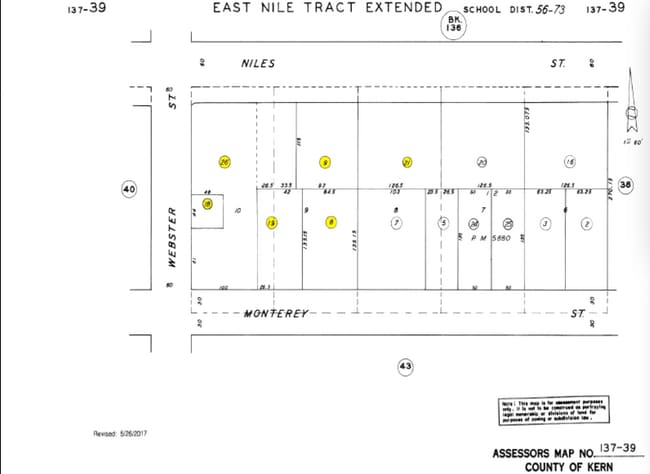
East Nile Tract Extended
137-390-26-00-7
CITY ENILE , BLOCK , LOT P
Religious
Kern
X
California
06029C1840E
p
2024
0.67 AC
2025
Northeast Bakersfield
001107
Bakersfield
DEMOGRAPHICS near 2503 Niles St
1 Mile
3 Mile
5 Mile
2024 Total Population
23,998
138,557
232,598
2029 Population
23,862
138,546
232,654
Pop Growth 2024-2029
(0.57%)
(0.01%)
+ 0.02%
Average Age
32
33
34
2024 Total Households
6,696
40,882
71,661
HH Growth 2024-2029
(0.57%)
(0.01%)
+ 0.03%
Median Household Inc
$40,641
$42,446
$43,177
Avg Household Size
3.40
3.20
3.10
2024 Avg HH Vehicles
2.00
2.00
2.00
Median Home Value
$189,276
$234,728
$233,061
Median Year Built
1960
1969
1968
Nearby Places
Map Layers
Map Styles
 Street
 Aerial
- Restaurants
- Banks
- Shops
- Fitness
- Groceries
PUBLIC TRANSPORTATION
COMMUTER RAIL
Bakersfield (San Joaquins - Amtrak)
DRIVE
WALK
Distance
Bakersfield (San Joaquins - Amtrak)
7 min
3.4 mi
AIRPORT
Meadows Field
DRIVE
WALK
Distance
Meadows Field
19 min
9.0 mi
Freight Ports
The Port of Hueneme
DRIVE
WALK
Distance
The Port of Hueneme
159 min
126.6 mi
Nearby Properties
Address
Land Use
TOTAL SIZE
Lot Size
Zoning
Address
Land Use
TOTAL SIZE
Lot Size
Zoning
18,000 SF
35.01 AC
M-2
Address
Land Use
TOTAL SIZE
Lot Size
Zoning
402,037 SF
17.72 AC
R1
Address
Land Use
TOTAL SIZE
Lot Size
Zoning
1.38 AC
C-2
Address
Land Use
TOTAL SIZE
Lot Size
Zoning
16.64 AC
Address
Land Use
TOTAL SIZE
Lot Size
Zoning
66,139 SF
4.48 AC
CO
Address
Land Use
TOTAL SIZE
Lot Size
Zoning
825 SF
9.60 AC
M-3
Address
Land Use
TOTAL SIZE
Lot Size
Zoning
188,976 SF
4.92 AC
Address
Land Use
TOTAL SIZE
Lot Size
Zoning
87,389 SF
1.76 AC
M1
Address
Land Use
TOTAL SIZE
Lot Size
Zoning
112,052 SF
3.14 AC
R3
Address
Land Use
TOTAL SIZE
Lot Size
Zoning
66,139 SF
4.48 AC
CO
Address
Land Use
TOTAL SIZE
Lot Size
Zoning
127,308 SF
8.25 AC
R-2
Address
Land Use
TOTAL SIZE
Lot Size
Zoning
161,946 SF
17.84 AC
C2 PD
Address
Land Use
TOTAL SIZE
Lot Size
Zoning
78,140 SF
2.52 AC
CC
Address
Land Use
TOTAL SIZE
Lot Size
Zoning
79,987 SF
3.22 AC
SP
Address
Land Use
TOTAL SIZE
Lot Size
Zoning
103,536 SF
6.31 AC
R-3
Address
Land Use
TOTAL SIZE
Lot Size
Zoning
102,262 SF
3.93 AC
Address
Land Use
TOTAL SIZE
Lot Size
Zoning
10.31 AC
Address
Land Use
TOTAL SIZE
Lot Size
Zoning
0.96 AC
Address
Land Use
TOTAL SIZE
Lot Size
Zoning
2.14 AC
C2
Address
Land Use
TOTAL SIZE
Lot Size
Zoning
127,224 SF
7 AC
R-2/PUD
Address
Land Use
TOTAL SIZE
Lot Size
Zoning
17,567 SF
19.39 AC
M2
Address
Land Use
TOTAL SIZE
Lot Size
Zoning
137,900 SF
15.69 AC
C2
Address
Land Use
TOTAL SIZE
Lot Size
Zoning
19,350 SF
2.05 AC
Address
Land Use
TOTAL SIZE
Lot Size
Zoning
115,058 SF
13.02 AC
C2
Address
Land Use
TOTAL SIZE
Lot Size
Zoning
1.50 AC
Address
Land Use
TOTAL SIZE
Lot Size
Zoning
1.06 AC
R-1
Address
Land Use
TOTAL SIZE
Lot Size
Zoning
0.41 AC
R1
Address
Land Use
TOTAL SIZE
Lot Size
Zoning
39,024 SF
2.35 AC
C-O-D
Address
Land Use
TOTAL SIZE
Lot Size
Zoning
74,890 SF
3.61 AC
SP
Address
Land Use
TOTAL SIZE
Lot Size
Zoning
74,890 SF
3.75 AC
SP
The World's #1 Commercial Real Estate Marketplace
Connect with us
© 2025 CoStar Group
The information above has been obtained from sources believed reliable. While we do not doubt its accuracy we have not verified it and make no guarantee, warranty or representation about it. It is your responsibility to independently confirm its accuracy and completeness. Any projections, opinions, assumptions, or estimates used are for example only and do not represent the current or future performance of the property. The value of this transaction to you depends on tax and other factors which should be evaluated by your tax, financial, and legal advisors. You and your advisors should conduct a careful, independent investigation of the property to determine to your satisfaction the suitability of the property for your needs.