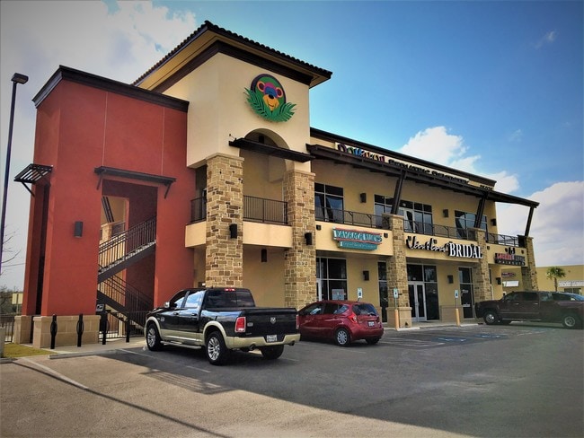
Property Record
25035 W Interstate 10, San Antonio, TX 78257

Save to a Folder
{{folder.Name}}
{{folder.ListingIds.length}} Properties
{{folder.ListingIds.length}} Property
Create a New Folder
Property Detail
25035 W Interstate 10
San Antonio-New Braunfels, TX
NCB 16390 BLK 3 LOT 20 (RIALTO VILLAGE PUD) 2016-RSVY/MAP UPDATE PER PLAT 9691/150-152 FILED 10-30-15. LR/GIS/1-21-16. 2011 NEW ACCT PER PLAT 9612/131-135
16390-003-0200
BEXAR
Regionalshoppingcenterormallwithanchorstore
Texas
AE The base floodplain where base flood elevations are provided. AE Zones are now used on new format FIRMs instead of A1-A30 Zones.
20
2025
1.38 AC
2025
Far Northwest
182102
San Antonio
10,192 SF
NEARBY LISTINGS FOR SALE OR LEASE
DEMOGRAPHICS near 25035 W Interstate 10
1 mile
3 mile
5 mile
2025 Total Population
8,435
34,554
64,613
2030 Population
8,988
36,826
69,285
Pop Growth 2025-2030
+ 6.56%
+ 6.58%
+ 7.23%
Average Age
39
39
39
2025 Total Households
2,942
12,155
24,566
HH Growth 2025-2030
+ 6.70%
+ 6.80%
+ 7.51%
Median Household Inc
$135,111
$138,411
$128,343
Avg Household Size
2.80
2.80
2.60
2025 Avg HH Vehicles
2.00
2.00
2.00
Median Home Value
$486,410
$496,006
$534,295
Median Year Built
2010
2010
2010
Nearby Places
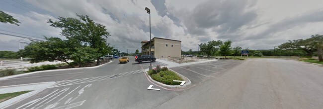
Map Layers
Map Styles
 Street
 Aerial
Layers
 Traffic
 Biking
Places
Listings with unknown addresses are not visible on the map
- Restaurants
- Banks
- Shops
- Fitness
- Groceries
PUBLIC TRANSPORTATION
AIRPORT
San Antonio International
Drive
Walk
Distance
San Antonio International
24 min
18.5 mi
SALE & LEASE HISTORY
LISTING DATE
SALE/LEASE

Mar 23, 2022
For Lease
Jun 22, 2023
For Lease
Jun 22, 2023
For Sale
Nearby Properties
Address
Land Use
TOTAL SIZE
Lot Size
Zoning
Address
Land Use
TOTAL SIZE
Lot Size
Zoning
Address
Land Use
TOTAL SIZE
Lot Size
Zoning
375,702 SF
10 AC
Address
Land Use
TOTAL SIZE
Lot Size
Zoning
361,559 SF
20 AC
Address
Land Use
TOTAL SIZE
Lot Size
Zoning
329,035 SF
21.28 AC
Address
Land Use
TOTAL SIZE
Lot Size
Zoning
260,536 SF
10.71 AC
Address
Land Use
TOTAL SIZE
Lot Size
Zoning
272,094 SF
16.90 AC
Address
Land Use
TOTAL SIZE
Lot Size
Zoning
270,295 SF
14.07 AC
Address
Land Use
TOTAL SIZE
Lot Size
Zoning
269,056 SF
12.13 AC
Address
Land Use
TOTAL SIZE
Lot Size
Zoning
243,485 SF
9.34 AC
Address
Land Use
TOTAL SIZE
Lot Size
Zoning
282,991 SF
26.41 AC
Address
Land Use
TOTAL SIZE
Lot Size
Zoning
265,093 SF
12.55 AC
Address
Land Use
TOTAL SIZE
Lot Size
Zoning
138,046 SF
14.23 AC
Address
Land Use
TOTAL SIZE
Lot Size
Zoning
317,851 SF
16.37 AC
Address
Land Use
TOTAL SIZE
Lot Size
Zoning
82,873 SF
8.87 AC
Address
Land Use
TOTAL SIZE
Lot Size
Zoning
49,164 SF
11.98 AC
Address
Land Use
TOTAL SIZE
Lot Size
Zoning
56,058 SF
8.04 AC
Address
Land Use
TOTAL SIZE
Lot Size
Zoning
68,180 SF
10.22 AC
Address
Land Use
TOTAL SIZE
Lot Size
Zoning
141,203 SF
12.49 AC
Address
Land Use
TOTAL SIZE
Lot Size
Zoning
147,976 SF
16.48 AC
Address
Land Use
TOTAL SIZE
Lot Size
Zoning
43,422 SF
6.38 AC
Address
Land Use
TOTAL SIZE
Lot Size
Zoning
45,441 SF
3.84 AC
Address
Land Use
TOTAL SIZE
Lot Size
Zoning
24,764 SF
4.50 AC
Address
Land Use
TOTAL SIZE
Lot Size
Zoning
142,425 SF
3.08 AC
Address
Land Use
TOTAL SIZE
Lot Size
Zoning
39,291 SF
4 AC
Address
Land Use
TOTAL SIZE
Lot Size
Zoning
129,911 SF
12.25 AC
Address
Land Use
TOTAL SIZE
Lot Size
Zoning
32,952 SF
2.39 AC
Address
Land Use
TOTAL SIZE
Lot Size
Zoning
35,926 SF
3.71 AC
Address
Land Use
TOTAL SIZE
Lot Size
Zoning
27,696 SF
2.97 AC
Address
Land Use
TOTAL SIZE
Lot Size
Zoning
102,935 SF
4.19 AC
Address
Land Use
TOTAL SIZE
Lot Size
Zoning
28,398 SF
5.04 AC
The World's #1 Commercial Real Estate Marketplace
Connect with us
© 2026 CoStar Group
The information above has been obtained from sources believed reliable. While we do not doubt its accuracy we have not verified it and make no guarantee, warranty or representation about it. It is your responsibility to independently confirm its accuracy and completeness. Any projections, opinions, assumptions, or estimates used are for example only and do not represent the current or future performance of the property. The value of this transaction to you depends on tax and other factors which should be evaluated by your tax, financial, and legal advisors. You and your advisors should conduct a careful, independent investigation of the property to determine to your satisfaction the suitability of the property for your needs.