Property Record
2505 Nw 82Nd St, Lawton, OK 73505


NEARBY LISTINGS FOR SALE OR LEASE
-
-
View all Lawton listings for sale on LoopNet.com
Property Detail
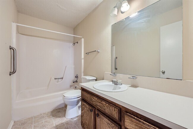
2505 Nw 82Nd St
Lawton, OK
Terrace Hills
0020975
TERRACE HILLS BLK 16 LOT 22 & THE N 30' OF LOT 23
Apartment
Comanche
X
Oklahoma
40031C0263E
22,23
2024
4 AC
2025
Oklahoma West Area
000402
Other Market Areas
3,034 SF
DEMOGRAPHICS near 2505 Nw 82Nd St
1 Mile
3 Mile
5 Mile
2024 Total Population
4,444
29,807
61,948
2029 Population
4,590
30,573
63,994
Pop Growth 2024-2029
+ 3.29%
+ 2.57%
+ 3.30%
Average Age
41
38
37
2024 Total Households
1,836
12,125
24,455
HH Growth 2024-2029
+ 3.21%
+ 2.60%
+ 3.37%
Median Household Inc
$57,272
$52,725
$47,234
Avg Household Size
2.20
2.40
2.40
2024 Avg HH Vehicles
2.00
2.00
2.00
Median Home Value
$171,374
$166,410
$144,006
Median Year Built
1981
1978
1974
Nearby Places
Map Layers
Map Styles
 Street
 Aerial
- Restaurants
- Banks
- Shops
- Fitness
- Groceries
PUBLIC TRANSPORTATION
AIRPORT
Lawton-Fort Sill Regional
DRIVE
WALK
Distance
Lawton-Fort Sill Regional
17 min
8.6 mi
Freight Ports
Tulsa Port Of Catoosa
DRIVE
WALK
Distance
Tulsa Port Of Catoosa
228 min
213.4 mi
Nearby Properties
Address
Land Use
TOTAL SIZE
Lot Size
Zoning
Address
Land Use
TOTAL SIZE
Lot Size
Zoning
44,900 SF
484.43 AC
Address
Land Use
TOTAL SIZE
Lot Size
Zoning
9,000 SF
25.35 AC
Address
Land Use
TOTAL SIZE
Lot Size
Zoning
40,284 SF
7.19 AC
Address
Land Use
TOTAL SIZE
Lot Size
Zoning
25,930 SF
5.47 AC
Address
Land Use
TOTAL SIZE
Lot Size
Zoning
7,752 SF
6.30 AC
Address
Land Use
TOTAL SIZE
Lot Size
Zoning
8,800 SF
30.05 AC
Address
Land Use
TOTAL SIZE
Lot Size
Zoning
9,240 SF
6.43 AC
Address
Land Use
TOTAL SIZE
Lot Size
Zoning
1,488 SF
19.43 AC
Address
Land Use
TOTAL SIZE
Lot Size
Zoning
906 SF
5.51 AC
Address
Land Use
TOTAL SIZE
Lot Size
Zoning
39,546 SF
10.62 AC
Address
Land Use
TOTAL SIZE
Lot Size
Zoning
2,330 SF
19.42 AC
Address
Land Use
TOTAL SIZE
Lot Size
Zoning
16,996 SF
12.16 AC
Address
Land Use
TOTAL SIZE
Lot Size
Zoning
131,736 SF
10.23 AC
Address
Land Use
TOTAL SIZE
Lot Size
Zoning
39,791 SF
20.50 AC
Address
Land Use
TOTAL SIZE
Lot Size
Zoning
83,945 SF
46.95 AC
Address
Land Use
TOTAL SIZE
Lot Size
Zoning
25,800 SF
3.82 AC
Address
Land Use
TOTAL SIZE
Lot Size
Zoning
68,844 SF
10.42 AC
Address
Land Use
TOTAL SIZE
Lot Size
Zoning
2,376 SF
8.64 AC
Address
Land Use
TOTAL SIZE
Lot Size
Zoning
3,470 SF
10.11 AC
Address
Land Use
TOTAL SIZE
Lot Size
Zoning
117,301 SF
13.83 AC
Address
Land Use
TOTAL SIZE
Lot Size
Zoning
36,063 SF
6.35 AC
Address
Land Use
TOTAL SIZE
Lot Size
Zoning
65,320 SF
4.80 AC
Address
Land Use
TOTAL SIZE
Lot Size
Zoning
82,509 SF
6.29 AC
Address
Land Use
TOTAL SIZE
Lot Size
Zoning
50,002 SF
7.66 AC
Address
Land Use
TOTAL SIZE
Lot Size
Zoning
57,096 SF
16.03 AC
Address
Land Use
TOTAL SIZE
Lot Size
Zoning
3,366 SF
5.97 AC
Address
Land Use
TOTAL SIZE
Lot Size
Zoning
4,000 SF
3 AC
Address
Land Use
TOTAL SIZE
Lot Size
Zoning
3,366 SF
4.70 AC
Address
Land Use
TOTAL SIZE
Lot Size
Zoning
55,965 SF
10.72 AC
Address
Land Use
TOTAL SIZE
Lot Size
Zoning
858 SF
5.34 AC
The World's #1 Commercial Real Estate Marketplace
Connect with us
© 2026 CoStar Group
The information above has been obtained from sources believed reliable. While we do not doubt its accuracy we have not verified it and make no guarantee, warranty or representation about it. It is your responsibility to independently confirm its accuracy and completeness. Any projections, opinions, assumptions, or estimates used are for example only and do not represent the current or future performance of the property. The value of this transaction to you depends on tax and other factors which should be evaluated by your tax, financial, and legal advisors. You and your advisors should conduct a careful, independent investigation of the property to determine to your satisfaction the suitability of the property for your needs.