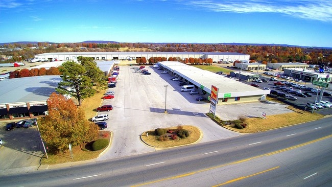
Property Record
2509 S Thompson St, Springdale, AR 72764


NEARBY LISTINGS FOR SALE OR LEASE
Property Detail
2509 S Thompson St
Fayetteville-Springdale-Rogers, AR-MO
Springdale Outlots
815-29158-000
PT SE NE 1.26 A.
Commercialacreage
Washington
X
Arkansas
05143C0070G
1.26 AC
2025
Greater Springdale
2025
Fayetteville/Springdale/Rogers
010304
DEMOGRAPHICS near 2509 S Thompson St
1 Mile
3 Mile
5 Mile
2024 Total Population
7,825
72,762
119,114
2029 Population
8,481
79,623
130,760
Pop Growth 2024-2029
+ 8.38%
+ 9.43%
+ 9.78%
Average Age
34
35
36
2024 Total Households
2,726
24,773
41,821
HH Growth 2024-2029
+ 8.66%
+ 9.62%
+ 9.90%
Median Household Inc
$50,116
$59,475
$67,005
Avg Household Size
2.80
2.80
2.70
2024 Avg HH Vehicles
2.00
2.00
2.00
Median Home Value
$227,947
$201,878
$236,592
Median Year Built
1989
1993
1994
Nearby Places
Map Layers
Map Styles
 Street
 Aerial
- Restaurants
- Banks
- Shops
- Fitness
- Groceries
PUBLIC TRANSPORTATION
AIRPORT
Northwest Arkansas Ntl
DRIVE
WALK
Distance
Northwest Arkansas Ntl
29 min
18.6 mi
Freight Ports
Port of Shreveport
DRIVE
WALK
Distance
Port of Shreveport
1 min
264.4 mi
SALE & LEASE HISTORY
LISTING DATE
SALE/LEASE

May 26, 2017
For Lease
Dec 13, 2016
For Sale
Nearby Properties
Address
Land Use
TOTAL SIZE
Lot Size
Zoning
Address
Land Use
TOTAL SIZE
Lot Size
Zoning
132,060 SF
8 AC
Address
Land Use
TOTAL SIZE
Lot Size
Zoning
167,116 SF
41.39 AC
I1
Address
Land Use
TOTAL SIZE
Lot Size
Zoning
153,698 SF
14.10 AC
C2
Address
Land Use
TOTAL SIZE
Lot Size
Zoning
58,764 SF
1.56 AC
Address
Land Use
TOTAL SIZE
Lot Size
Zoning
403,089 SF
1.93 AC
Address
Land Use
TOTAL SIZE
Lot Size
Zoning
481,800 SF
40 AC
Address
Land Use
TOTAL SIZE
Lot Size
Zoning
23,707 SF
15.45 AC
R2
Address
Land Use
TOTAL SIZE
Lot Size
Zoning
15,347 SF
6.27 AC
Address
Land Use
TOTAL SIZE
Lot Size
Zoning
238,168 SF
Address
Land Use
TOTAL SIZE
Lot Size
Zoning
437,349 SF
40.29 AC
Address
Land Use
TOTAL SIZE
Lot Size
Zoning
106,141 SF
2.82 AC
Address
Land Use
TOTAL SIZE
Lot Size
Zoning
153,718 SF
Address
Land Use
TOTAL SIZE
Lot Size
Zoning
232,212 SF
10.31 AC
Address
Land Use
TOTAL SIZE
Lot Size
Zoning
81,000 SF
7.01 AC
Address
Land Use
TOTAL SIZE
Lot Size
Zoning
341,266 SF
17.61 AC
Address
Land Use
TOTAL SIZE
Lot Size
Zoning
78,374 SF
8.79 AC
Address
Land Use
TOTAL SIZE
Lot Size
Zoning
567,022 SF
88.88 AC
C2
Address
Land Use
TOTAL SIZE
Lot Size
Zoning
6,798 SF
10.56 AC
Address
Land Use
TOTAL SIZE
Lot Size
Zoning
106,961 SF
8.56 AC
Address
Land Use
TOTAL SIZE
Lot Size
Zoning
178,014 SF
6.43 AC
Address
Land Use
TOTAL SIZE
Lot Size
Zoning
117,690 SF
2.38 AC
Address
Land Use
TOTAL SIZE
Lot Size
Zoning
261,670 SF
16.72 AC
R2
Address
Land Use
TOTAL SIZE
Lot Size
Zoning
176,204 SF
7.57 AC
Address
Land Use
TOTAL SIZE
Lot Size
Zoning
217,873 SF
24.10 AC
C2
Address
Land Use
TOTAL SIZE
Lot Size
Zoning
4,941 SF
10.87 AC
Address
Land Use
TOTAL SIZE
Lot Size
Zoning
193,140 SF
21.31 AC
Address
Land Use
TOTAL SIZE
Lot Size
Zoning
134,342 SF
14.95 AC
Address
Land Use
TOTAL SIZE
Lot Size
Zoning
156,072 SF
12.43 AC
Address
Land Use
TOTAL SIZE
Lot Size
Zoning
56,672 SF
0.53 AC
R0
Address
Land Use
TOTAL SIZE
Lot Size
Zoning
140,755 SF
14.15 AC
The World's #1 Commercial Real Estate Marketplace
Connect with us
© 2025 CoStar Group
The information above has been obtained from sources believed reliable. While we do not doubt its accuracy we have not verified it and make no guarantee, warranty or representation about it. It is your responsibility to independently confirm its accuracy and completeness. Any projections, opinions, assumptions, or estimates used are for example only and do not represent the current or future performance of the property. The value of this transaction to you depends on tax and other factors which should be evaluated by your tax, financial, and legal advisors. You and your advisors should conduct a careful, independent investigation of the property to determine to your satisfaction the suitability of the property for your needs.