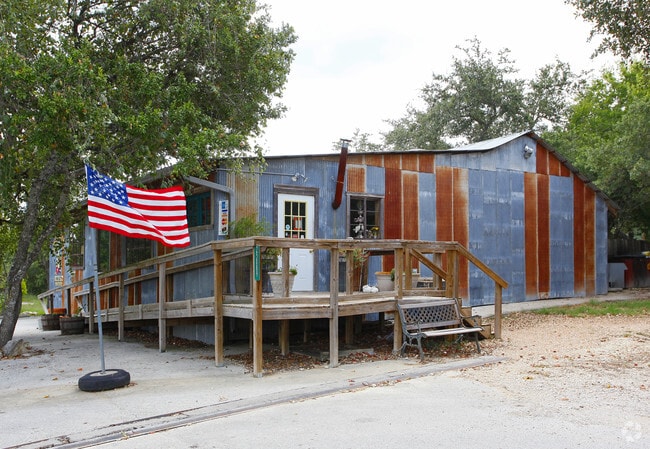
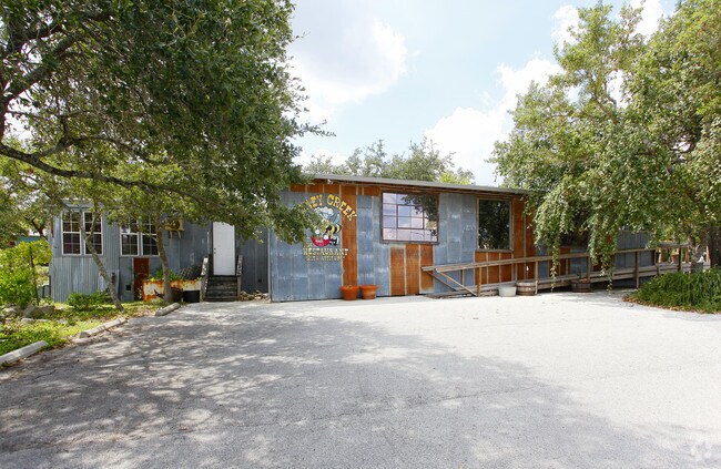
Property Record
25089 State Highway 46 W, Spring Branch, TX 78070

Property Detail
25089 State Highway 46 W
San Antonio-New Braunfels, TX
OAK CLIFF ACRES 1, LOT 5 GR PT
40-0200-0005-02
Comal
Commercialnec
Texas
B and X Area of moderate flood hazard, usually the area between the limits of the 100-year and 500-year floods.
5
2024
0.99 AC
2025
Comal County
310706
San Antonio
4,096 SF
NEARBY LISTINGS FOR SALE OR LEASE
-
-
View all Spring Branch listings for sale on LoopNet.com
DEMOGRAPHICS near 25089 State Highway 46 W
1 mile
3 mile
5 mile
2025 Total Population
269
5,361
17,175
2030 Population
329
6,454
20,300
Pop Growth 2025-2030
+ 22.30%
+ 20.39%
+ 18.20%
Average Age
43
43
43
2025 Total Households
95
1,879
6,124
HH Growth 2025-2030
+ 23.16%
+ 20.54%
+ 18.29%
Median Household Inc
$145,454
$140,976
$134,100
Avg Household Size
2.80
2.80
2.80
2025 Avg HH Vehicles
3.00
3.00
3.00
Median Home Value
$472,222
$512,205
$575,658
Median Year Built
2010
2007
2007
Nearby Places
Map Layers
Map Styles
 Street
 Aerial
Layers
 Traffic
 Biking
Places
Listings with unknown addresses are not visible on the map
- Restaurants
- Banks
- Shops
- Fitness
- Groceries
PUBLIC TRANSPORTATION
AIRPORT
San Antonio International
Drive
Walk
Distance
San Antonio International
31 min
25.1 mi
Freight Ports
Calhoun Port
Drive
Walk
Distance
Calhoun Port
209 min
171.1 mi
Nearby Properties
Address
Land Use
TOTAL SIZE
Lot Size
Zoning
Address
Land Use
TOTAL SIZE
Lot Size
Zoning
5,487 SF
515.01 AC
Address
Land Use
TOTAL SIZE
Lot Size
Zoning
37,551 SF
42.01 AC
Address
Land Use
TOTAL SIZE
Lot Size
Zoning
3,709 SF
37.93 AC
Address
Land Use
TOTAL SIZE
Lot Size
Zoning
13,646 SF
11.32 AC
Address
Land Use
TOTAL SIZE
Lot Size
Zoning
3,838 SF
496.50 AC
Address
Land Use
TOTAL SIZE
Lot Size
Zoning
13,056 SF
5.81 AC
Address
Land Use
TOTAL SIZE
Lot Size
Zoning
6,300 SF
2 AC
Address
Land Use
TOTAL SIZE
Lot Size
Zoning
1,526 SF
7.90 AC
Address
Land Use
TOTAL SIZE
Lot Size
Zoning
16,885 SF
16.01 AC
Address
Land Use
TOTAL SIZE
Lot Size
Zoning
3,900 SF
17.94 AC
Address
Land Use
TOTAL SIZE
Lot Size
Zoning
3,262 SF
29.29 AC
Address
Land Use
TOTAL SIZE
Lot Size
Zoning
Address
Land Use
TOTAL SIZE
Lot Size
Zoning
113.02 AC
Address
Land Use
TOTAL SIZE
Lot Size
Zoning
9,629 SF
38.46 AC
Address
Land Use
TOTAL SIZE
Lot Size
Zoning
Address
Land Use
TOTAL SIZE
Lot Size
Zoning
7,583 SF
21.80 AC
Address
Land Use
TOTAL SIZE
Lot Size
Zoning
6,054 SF
30.90 AC
Address
Land Use
TOTAL SIZE
Lot Size
Zoning
6,848 SF
52.14 AC
Address
Land Use
TOTAL SIZE
Lot Size
Zoning
5,163 SF
1.01 AC
Address
Land Use
TOTAL SIZE
Lot Size
Zoning
Address
Land Use
TOTAL SIZE
Lot Size
Zoning
Address
Land Use
TOTAL SIZE
Lot Size
Zoning
5,205 SF
1.04 AC
Address
Land Use
TOTAL SIZE
Lot Size
Zoning
5,719 SF
7.32 AC
Address
Land Use
TOTAL SIZE
Lot Size
Zoning
5,044 SF
50.91 AC
Address
Land Use
TOTAL SIZE
Lot Size
Zoning
5,143 SF
1.75 AC
Address
Land Use
TOTAL SIZE
Lot Size
Zoning
Address
Land Use
TOTAL SIZE
Lot Size
Zoning
4,767 SF
1.01 AC
Address
Land Use
TOTAL SIZE
Lot Size
Zoning
5,759 SF
1.04 AC
Address
Land Use
TOTAL SIZE
Lot Size
Zoning
4,088 SF
1.01 AC
Address
Land Use
TOTAL SIZE
Lot Size
Zoning
4,466 SF
1.42 AC
The World's #1 Commercial Real Estate Marketplace
Connect with us
© 2026 CoStar Group
The information above has been obtained from sources believed reliable. While we do not doubt its accuracy we have not verified it and make no guarantee, warranty or representation about it. It is your responsibility to independently confirm its accuracy and completeness. Any projections, opinions, assumptions, or estimates used are for example only and do not represent the current or future performance of the property. The value of this transaction to you depends on tax and other factors which should be evaluated by your tax, financial, and legal advisors. You and your advisors should conduct a careful, independent investigation of the property to determine to your satisfaction the suitability of the property for your needs.