Property Record
2509 Highview St, Spring Grove, IL 60081
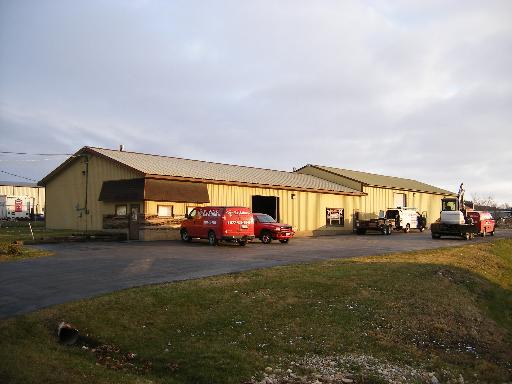

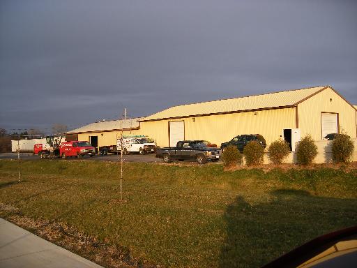
Property Detail
2509 Highview St
Chicago-Naperville-Elgin, IL-IN
DOC 2017R0031336 LT 6 SPRING MEADOWS SUB VILL OF SPRING GROVE
04-25-252-002
McHenry
Commercialnec
Illinois
AE The base floodplain where base flood elevations are provided. AE Zones are now used on new format FIRMs instead of A1-A30 Zones.
6
2024
0.95 AC
2024
McHenry County
870105
Chicago
9,720 SF
NEARBY LISTINGS FOR SALE OR LEASE
DEMOGRAPHICS near 2509 Highview St
1 mile
3 mile
5 mile
2025 Total Population
1,278
13,163
36,412
2030 Population
1,314
13,482
37,514
Pop Growth 2025-2030
+ 2.82%
+ 2.42%
+ 3.03%
Average Age
44
44
44
2025 Total Households
463
5,205
14,811
HH Growth 2025-2030
+ 2.81%
+ 2.54%
+ 3.07%
Median Household Inc
$127,708
$104,076
$92,958
Avg Household Size
2.80
2.50
2.40
2025 Avg HH Vehicles
2.00
2.00
2.00
Median Home Value
$392,592
$342,619
$303,433
Median Year Built
1996
1993
1980
Nearby Places
Map Layers
Map Styles
 Street
 Aerial
Transit
 Traffic
 Biking
Places
Listings with unknown addresses are not visible on the map
- Restaurants
- Banks
- Shops
- Fitness
- Groceries
PUBLIC TRANSPORTATION
COMMUTER RAIL
Fox Lake Station (Milwaukee District North Line - Northeast Illinois Regional Commuter Railroad (Metra))
Drive
Walk
Distance
Fox Lake Station (Milwaukee District North Line - Northeast Illinois Regional Commuter Railroad (Metra))
7 min
4.9 mi
Ingleside Station (Milwaukee District North Line - Northeast Illinois Regional Commuter Railroad (Metra))
Drive
Walk
Distance
Ingleside Station (Milwaukee District North Line - Northeast Illinois Regional Commuter Railroad (Metra))
12 min
6.9 mi
Nearby Properties
Address
Land Use
TOTAL SIZE
Lot Size
Zoning
Address
Land Use
TOTAL SIZE
Lot Size
Zoning
327,323 SF
31.01 AC
Address
Land Use
TOTAL SIZE
Lot Size
Zoning
206,452 SF
29.36 AC
Address
Land Use
TOTAL SIZE
Lot Size
Zoning
63,970 SF
7 AC
Address
Land Use
TOTAL SIZE
Lot Size
Zoning
363,291 SF
43 AC
Address
Land Use
TOTAL SIZE
Lot Size
Zoning
0.90 AC
Address
Land Use
TOTAL SIZE
Lot Size
Zoning
1.48 AC
Address
Land Use
TOTAL SIZE
Lot Size
Zoning
7,600 SF
0.50 AC
Address
Land Use
TOTAL SIZE
Lot Size
Zoning
2.83 AC
Address
Land Use
TOTAL SIZE
Lot Size
Zoning
71,988 SF
4.74 AC
Address
Land Use
TOTAL SIZE
Lot Size
Zoning
46,576 SF
2.68 AC
Address
Land Use
TOTAL SIZE
Lot Size
Zoning
1.23 AC
Address
Land Use
TOTAL SIZE
Lot Size
Zoning
1.12 AC
Address
Land Use
TOTAL SIZE
Lot Size
Zoning
95,760 SF
10.46 AC
Address
Land Use
TOTAL SIZE
Lot Size
Zoning
29,768 SF
2.50 AC
Address
Land Use
TOTAL SIZE
Lot Size
Zoning
47,606 SF
3.34 AC
Address
Land Use
TOTAL SIZE
Lot Size
Zoning
1,513 SF
2.27 AC
Address
Land Use
TOTAL SIZE
Lot Size
Zoning
36,096 SF
2.64 AC
Address
Land Use
TOTAL SIZE
Lot Size
Zoning
47,250 SF
2.70 AC
Address
Land Use
TOTAL SIZE
Lot Size
Zoning
13,765 SF
0.65 AC
Address
Land Use
TOTAL SIZE
Lot Size
Zoning
3,940 SF
0.37 AC
Address
Land Use
TOTAL SIZE
Lot Size
Zoning
10,786 SF
2 AC
Address
Land Use
TOTAL SIZE
Lot Size
Zoning
18,000 SF
2.07 AC
Address
Land Use
TOTAL SIZE
Lot Size
Zoning
33,500 SF
1.84 AC
Address
Land Use
TOTAL SIZE
Lot Size
Zoning
13,061 SF
0.91 AC
Address
Land Use
TOTAL SIZE
Lot Size
Zoning
4,245 SF
9.57 AC
Address
Land Use
TOTAL SIZE
Lot Size
Zoning
32,034 SF
1.84 AC
Address
Land Use
TOTAL SIZE
Lot Size
Zoning
Address
Land Use
TOTAL SIZE
Lot Size
Zoning
27,920 SF
1 AC
Address
Land Use
TOTAL SIZE
Lot Size
Zoning
16,240 SF
2.24 AC
Address
Land Use
TOTAL SIZE
Lot Size
Zoning
28,162 SF
1.84 AC
The World's #1 Commercial Real Estate Marketplace
Connect with us
© 2026 CoStar Group
The information above has been obtained from sources believed reliable. While we do not doubt its accuracy we have not verified it and make no guarantee, warranty or representation about it. It is your responsibility to independently confirm its accuracy and completeness. Any projections, opinions, assumptions, or estimates used are for example only and do not represent the current or future performance of the property. The value of this transaction to you depends on tax and other factors which should be evaluated by your tax, financial, and legal advisors. You and your advisors should conduct a careful, independent investigation of the property to determine to your satisfaction the suitability of the property for your needs.