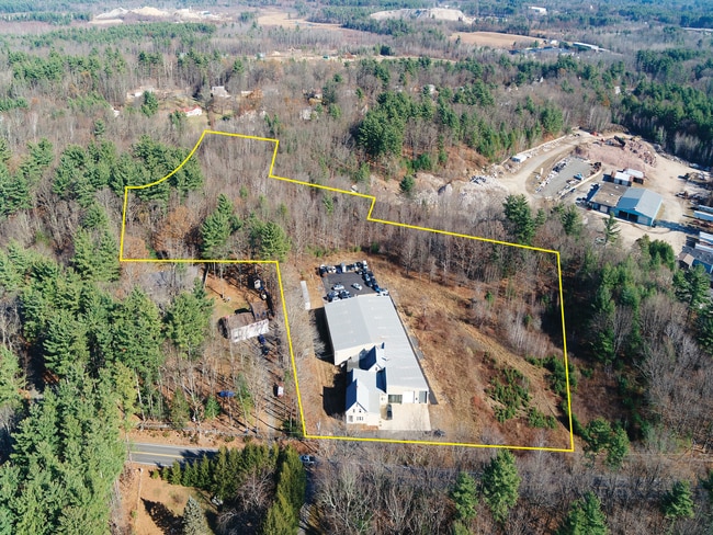
Property Record
253 Main St, Plaistow, NH 03865


NEARBY LISTINGS FOR SALE OR LEASE
Property Detail
253 Main St
PLSW-000019-000019
Rockingham
Commercialofficeresidentialmixeduse
New Hampshire
X
000
25009C0080F
1.43 AC
2024
Rockingham
2024
Boston
101102
Boston-Cambridge-Newton, MA-NH
18,110 SF
DEMOGRAPHICS near 253 Main St
1 Mile
3 Mile
5 Mile
2024 Total Population
1,763
16,889
46,982
2029 Population
1,824
17,377
47,917
Pop Growth 2024-2029
+ 3.46%
+ 2.89%
+ 1.99%
Average Age
41
44
44
2024 Total Households
706
6,737
18,231
HH Growth 2024-2029
+ 3.40%
+ 2.76%
+ 1.86%
Median Household Inc
$86,417
$108,193
$111,460
Avg Household Size
2.50
2.50
2.50
2024 Avg HH Vehicles
2.00
2.00
2.00
Median Home Value
$375,647
$398,263
$406,482
Median Year Built
1978
1979
1980
Nearby Places
Map Layers
Map Styles
 Street
 Aerial
- Restaurants
- Banks
- Shops
- Fitness
- Groceries
PUBLIC TRANSPORTATION
COMMUTER RAIL
Haverhill (Haverhill Line - Massachusetts Bay Transportation Authority Commuter Rail (Purple Line))
DRIVE
WALK
Distance
Haverhill (Haverhill Line - Massachusetts Bay Transportation Authority Commuter Rail (Purple Line))
13 min
7.1 mi
Bradford (Haverhill Line - Massachusetts Bay Transportation Authority Commuter Rail (Purple Line))
DRIVE
WALK
Distance
Bradford (Haverhill Line - Massachusetts Bay Transportation Authority Commuter Rail (Purple Line))
14 min
7.5 mi
AIRPORT
Manchester Boston Regional
DRIVE
WALK
Distance
Manchester Boston Regional
48 min
28.3 mi
Portsmouth International at Pease
DRIVE
WALK
Distance
Portsmouth International at Pease
48 min
34.4 mi
Freight Ports
Port of Boston
DRIVE
WALK
Distance
Port of Boston
60 min
42.5 mi
SALE & LEASE HISTORY
LISTING DATE
SALE/LEASE

Sep 25, 2016
For Lease
Sep 23, 2016
For Sale
Nov 14, 2019
For Sale
Nearby Properties
Address
Land Use
TOTAL SIZE
Lot Size
Zoning
Address
Land Use
TOTAL SIZE
Lot Size
Zoning
8.79 AC
RRAQ R
Address
Land Use
TOTAL SIZE
Lot Size
Zoning
257,286 SF
90 AC
LDR
Address
Land Use
TOTAL SIZE
Lot Size
Zoning
125,627 SF
46.02 AC
C-1
Address
Land Use
TOTAL SIZE
Lot Size
Zoning
35,633 SF
19.15 AC
C-1
Address
Land Use
TOTAL SIZE
Lot Size
Zoning
2,400 SF
4 AC
MDR
Address
Land Use
TOTAL SIZE
Lot Size
Zoning
102,352 SF
19.50 AC
Address
Land Use
TOTAL SIZE
Lot Size
Zoning
5,553 SF
44.71 AC
A-RES
Address
Land Use
TOTAL SIZE
Lot Size
Zoning
89,227 SF
89.88 AC
A-RES
Address
Land Use
TOTAL SIZE
Lot Size
Zoning
115,088 SF
27.42 AC
Address
Land Use
TOTAL SIZE
Lot Size
Zoning
127,248 SF
18.69 AC
C-1
Address
Land Use
TOTAL SIZE
Lot Size
Zoning
39,670 SF
26.55 AC
RES-A
Address
Land Use
TOTAL SIZE
Lot Size
Zoning
55,960 SF
12.42 AC
I
Address
Land Use
TOTAL SIZE
Lot Size
Zoning
184,193 SF
24.80 AC
I
Address
Land Use
TOTAL SIZE
Lot Size
Zoning
32,074 SF
6.69 AC
C-1
Address
Land Use
TOTAL SIZE
Lot Size
Zoning
67,705 SF
10.93 AC
TC- TO
Address
Land Use
TOTAL SIZE
Lot Size
Zoning
12,187 SF
18.51 AC
A-RES
Address
Land Use
TOTAL SIZE
Lot Size
Zoning
18,019 SF
10 AC
C2 C
Address
Land Use
TOTAL SIZE
Lot Size
Zoning
50,210 SF
10.93 AC
C1 C
Address
Land Use
TOTAL SIZE
Lot Size
Zoning
70,433 SF
30.77 AC
VC
Address
Land Use
TOTAL SIZE
Lot Size
Zoning
1,358 SF
74.43 AC
D-MHPM
Address
Land Use
TOTAL SIZE
Lot Size
Zoning
25,614 SF
15.39 AC
C1 C
Address
Land Use
TOTAL SIZE
Lot Size
Zoning
115,964 SF
8.17 AC
C2 C
Address
Land Use
TOTAL SIZE
Lot Size
Zoning
79,184 SF
9.96 AC
C-3
Address
Land Use
TOTAL SIZE
Lot Size
Zoning
5,508 SF
1.80 AC
C2 C
Address
Land Use
TOTAL SIZE
Lot Size
Zoning
16,020 SF
6.68 AC
VC
Address
Land Use
TOTAL SIZE
Lot Size
Zoning
15,396 SF
1.80 AC
C2 C
Address
Land Use
TOTAL SIZE
Lot Size
Zoning
33,519 SF
6.70 AC
C2 C
Address
Land Use
TOTAL SIZE
Lot Size
Zoning
28,698 SF
6.29 AC
C1 C
Address
Land Use
TOTAL SIZE
Lot Size
Zoning
19,823 SF
2.60 AC
C-1
Address
Land Use
TOTAL SIZE
Lot Size
Zoning
4,003 SF
7.97 AC
A-RES
The World's #1 Commercial Real Estate Marketplace
Connect with us
© 2025 CoStar Group
The information above has been obtained from sources believed reliable. While we do not doubt its accuracy we have not verified it and make no guarantee, warranty or representation about it. It is your responsibility to independently confirm its accuracy and completeness. Any projections, opinions, assumptions, or estimates used are for example only and do not represent the current or future performance of the property. The value of this transaction to you depends on tax and other factors which should be evaluated by your tax, financial, and legal advisors. You and your advisors should conduct a careful, independent investigation of the property to determine to your satisfaction the suitability of the property for your needs.