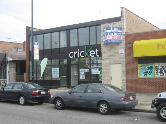
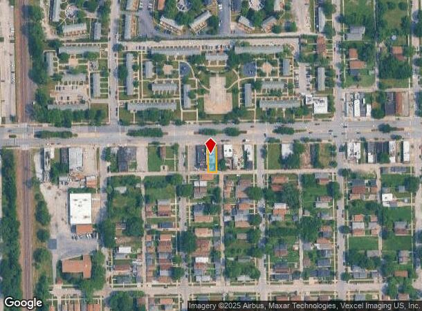
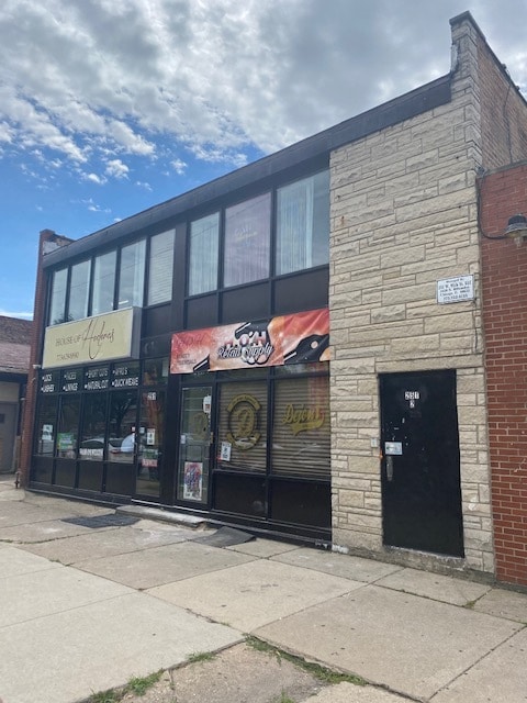
Property Record
251 W 95Th St, Chicago, IL 60628
Current Lease Availabilities
NEARBY LISTINGS FOR SALE OR LEASE
Property Detail
251 W 95Th St
Chicago-Naperville-Elgin, IL-IN-WI
John H Gays
25-09-202-049-0000
LOT 7 E2 OF LOT 8 OF SEC09 T37N R14 E 3P
Miscresidentialimprovement
Cook
X
Illinois
17031C0635J
7
2023
0.09 AC
2024
South Chicago
490600
Chicago
4,901 SF
DEMOGRAPHICS near 251 W 95Th St
1 Mile
3 Mile
5 Mile
2024 Total Population
24,440
213,909
566,007
2029 Population
23,657
206,718
547,409
Pop Growth 2024-2029
(3.20%)
(3.36%)
(3.29%)
Average Age
42
42
40
2024 Total Households
9,006
86,112
221,886
HH Growth 2024-2029
(3.61%)
(3.80%)
(3.60%)
Median Household Inc
$54,607
$46,588
$44,027
Avg Household Size
2.60
2.40
2.40
2024 Avg HH Vehicles
1.00
1.00
1.00
Median Home Value
$153,246
$174,020
$181,194
Median Year Built
1952
1948
1949
Nearby Places
- Restaurants
- Banks
- Shops
- Fitness
- Groceries
PUBLIC TRANSPORTATION
TRANSIT/SUBWAY
95th/Dan Ryan Terminal (Red Line - Chicago Transit Authority "L" Trains (The "L"))
DRIVE
WALK
Distance
95th/Dan Ryan Terminal (Red Line - Chicago Transit Authority "L" Trains (The "L"))
6 min
7 min
0.3 mi
COMMUTER RAIL
Longwood Station (Rock Island District Line - Northeast Illinois Regional Commuter Railroad (Metra))
DRIVE
WALK
Distance
Longwood Station (Rock Island District Line - Northeast Illinois Regional Commuter Railroad (Metra))
6 min
20 min
1.0 mi
Gresham Station (Rock Island District Line - Northeast Illinois Regional Commuter Railroad (Metra))
DRIVE
WALK
Distance
Gresham Station (Rock Island District Line - Northeast Illinois Regional Commuter Railroad (Metra))
7 min
2.0 mi
AIRPORT
Chicago Midway International
DRIVE
WALK
Distance
Chicago Midway International
27 min
17.5 mi
Chicago O'Hare International
DRIVE
WALK
Distance
Chicago O'Hare International
38 min
29.0 mi
Nearby Properties
Address
Land Use
TOTAL SIZE
Lot Size
Zoning
Address
Land Use
TOTAL SIZE
Lot Size
Zoning
41,400 SF
13.35 AC
PD 1254
Address
Land Use
TOTAL SIZE
Lot Size
Zoning
10.73 AC
PD 1243
Address
Land Use
TOTAL SIZE
Lot Size
Zoning
11 AC
PD 1168
Address
Land Use
TOTAL SIZE
Lot Size
Zoning
159,300 SF
13.36 AC
PD 425
Address
Land Use
TOTAL SIZE
Lot Size
Zoning
157,787 SF
12.23 AC
Address
Land Use
TOTAL SIZE
Lot Size
Zoning
162,000 SF
20.94 AC
PD 1167
Address
Land Use
TOTAL SIZE
Lot Size
Zoning
148,700 SF
Address
Land Use
TOTAL SIZE
Lot Size
Zoning
400,737 SF
PD 1167
Address
Land Use
TOTAL SIZE
Lot Size
Zoning
223,310 SF
15.67 AC
Address
Land Use
TOTAL SIZE
Lot Size
Zoning
622,934 SF
34.41 AC
M2-3
Address
Land Use
TOTAL SIZE
Lot Size
Zoning
224,089 SF
Address
Land Use
TOTAL SIZE
Lot Size
Zoning
82,000 SF
Address
Land Use
TOTAL SIZE
Lot Size
Zoning
141,165 SF
7.82 AC
PD 966
Address
Land Use
TOTAL SIZE
Lot Size
Zoning
1 AC
RS-3
Address
Land Use
TOTAL SIZE
Lot Size
Zoning
15,052 SF
1.03 AC
PQ
Address
Land Use
TOTAL SIZE
Lot Size
Zoning
73,947 SF
17.40 AC
PD 1167
Address
Land Use
TOTAL SIZE
Lot Size
Zoning
285,672 SF
13.14 AC
Address
Land Use
TOTAL SIZE
Lot Size
Zoning
101,294 SF
8.10 AC
B3-1
Address
Land Use
TOTAL SIZE
Lot Size
Zoning
145,291 SF
7.85 AC
B3-2
Address
Land Use
TOTAL SIZE
Lot Size
Zoning
111,198 SF
10.60 AC
PD 566
Address
Land Use
TOTAL SIZE
Lot Size
Zoning
0.54 AC
RS-3
Address
Land Use
TOTAL SIZE
Lot Size
Zoning
155,765 SF
8.75 AC
PD 1167
Address
Land Use
TOTAL SIZE
Lot Size
Zoning
76,867 SF
3.44 AC
M1-1
Address
Land Use
TOTAL SIZE
Lot Size
Zoning
207,100 SF
9.84 AC
M2-2
Address
Land Use
TOTAL SIZE
Lot Size
Zoning
9.55 AC
M2-2
Address
Land Use
TOTAL SIZE
Lot Size
Zoning
72,219 SF
4.30 AC
M1-2
Address
Land Use
TOTAL SIZE
Lot Size
Zoning
84,400 SF
15.18 AC
M2-2,M1-1
Address
Land Use
TOTAL SIZE
Lot Size
Zoning
115,918 SF
4.08 AC
M1-2,C1-1
Address
Land Use
TOTAL SIZE
Lot Size
Zoning
69,857 SF
5.39 AC
PD 338
Address
Land Use
TOTAL SIZE
Lot Size
Zoning
12.42 AC
PD 485
The World's #1 Commercial Real Estate Marketplace
Connect with us
© 2025 CoStar Group
The information above has been obtained from sources believed reliable. While we do not doubt its accuracy we have not verified it and make no guarantee, warranty or representation about it. It is your responsibility to independently confirm its accuracy and completeness. Any projections, opinions, assumptions, or estimates used are for example only and do not represent the current or future performance of the property. The value of this transaction to you depends on tax and other factors which should be evaluated by your tax, financial, and legal advisors. You and your advisors should conduct a careful, independent investigation of the property to determine to your satisfaction the suitability of the property for your needs.