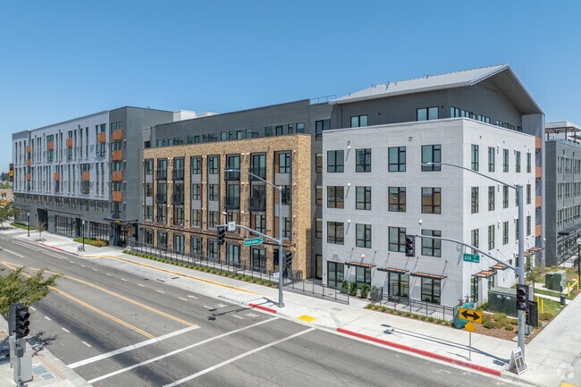
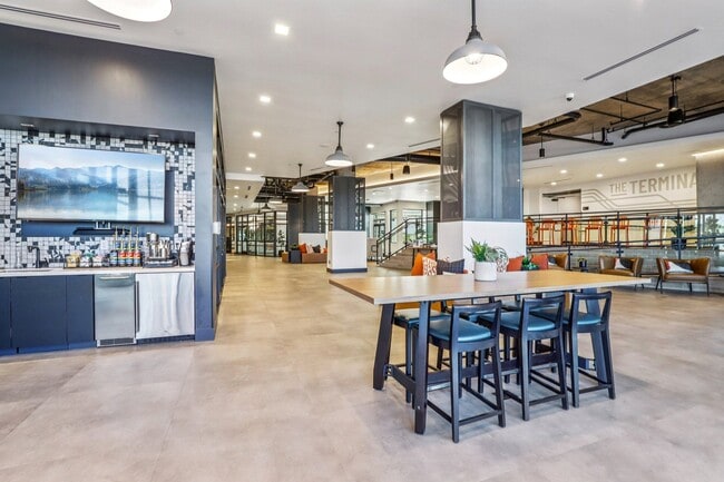
Property Record
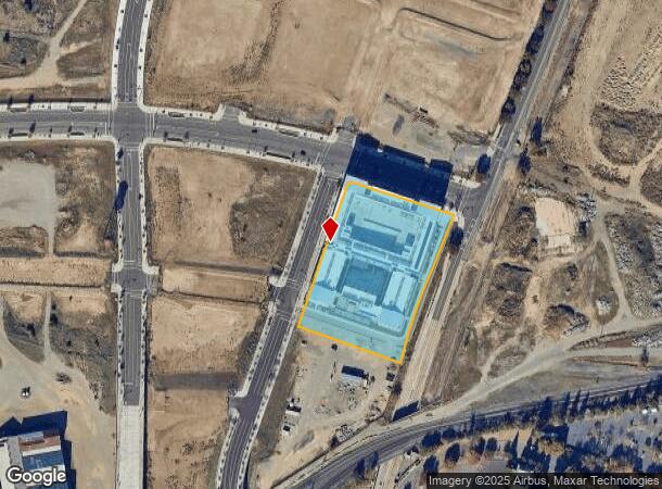
251 6Th St, Sacramento, CA 95811
NEARBY LISTINGS FOR SALE OR LEASE
Property Detail
251 6Th St
002-0010-069
ALL THAT POR. OF 203.161 ACRE PARCEL IN THE CITY OF SACRAMENTO AND A POR. OF PARCEL 2, DESCRIBED IN BK.201509030, PG1633, MORE PARCTICULARLY DESCRIBED AS :- BEGINNING AT THE MOST EASTERLY COR. OF 6TH STREET AS GRANTED TO CITY OF SACRAMENTOP
Apartment
Sacramento
X
California
06067C0180J
2.88 AC
2024
Southern Pacific/Richards
2025
Sacramento
005301
Sacramento--Roseville--Arden-Arcade, CA
DEMOGRAPHICS near 251 6Th St
1 Mile
3 Mile
5 Mile
2024 Total Population
16,188
163,909
360,430
2029 Population
16,485
166,134
364,832
Pop Growth 2024-2029
+ 1.83%
+ 1.36%
+ 1.22%
Average Age
40
38
38
2024 Total Households
6,261
69,275
142,171
HH Growth 2024-2029
+ 3.02%
+ 1.58%
+ 1.33%
Median Household Inc
$39,955
$72,588
$71,238
Avg Household Size
1.60
2.20
2.40
2024 Avg HH Vehicles
1.00
2.00
2.00
Median Home Value
$623,994
$493,860
$475,928
Median Year Built
1975
1970
1971
Nearby Places
Map Layers
Map Styles
 Street
 Aerial
- Restaurants
- Banks
- Shops
- Fitness
- Groceries
PUBLIC TRANSPORTATION
TRANSIT/SUBWAY
7Th & I/County Center (Gold Line - Sacramento Regional Transit District Light Rail (The RT))
DRIVE
WALK
Distance
7Th & I/County Center (Gold Line - Sacramento Regional Transit District Light Rail (The RT))
1 min
10 min
0.6 mi
Sacramento Valley Station (Gold Line - Sacramento Regional Transit District Light Rail (The RT))
DRIVE
WALK
Distance
Sacramento Valley Station (Gold Line - Sacramento Regional Transit District Light Rail (The RT))
2 min
11 min
0.6 mi
Township 9 Station (Wb) (13th - Richards/Township 9 - Sacramento Regional Transit)
DRIVE
WALK
Distance
Township 9 Station (Wb) (13th - Richards/Township 9 - Sacramento Regional Transit)
1 min
12 min
0.6 mi
Township 9 Station (Wb) (13th - Richards/Township 9 - Sacramento Regional Transit)
DRIVE
WALK
Distance
Township 9 Station (Wb) (13th - Richards/Township 9 - Sacramento Regional Transit)
1 min
13 min
0.7 mi
Alkali Flat/La Valentina (Blue Line - Sacramento Regional Transit District Light Rail (The RT))
DRIVE
WALK
Distance
Alkali Flat/La Valentina (Blue Line - Sacramento Regional Transit District Light Rail (The RT))
2 min
19 min
1.0 mi
COMMUTER RAIL
Sacramento (Capitol Corridor - Capitol Corridor Joint Powers Authority)
DRIVE
WALK
Distance
Sacramento (Capitol Corridor - Capitol Corridor Joint Powers Authority)
2 min
11 min
0.6 mi
AIRPORT
Sacramento International
DRIVE
WALK
Distance
Sacramento International
17 min
10.9 mi
Freight Ports
Port of Stockton
DRIVE
WALK
Distance
Port of Stockton
55 min
47.1 mi
SALE & LEASE HISTORY
LISTING DATE
SALE/LEASE

Jun 13, 2023
For Lease
Nearby Properties
Address
Land Use
TOTAL SIZE
Lot Size
Zoning
Address
Land Use
TOTAL SIZE
Lot Size
Zoning
1,095,507 SF
1.39 AC
H-SPD C-2-
Address
Land Use
TOTAL SIZE
Lot Size
Zoning
5.64 AC
C-3-SPD
Address
Land Use
TOTAL SIZE
Lot Size
Zoning
10.28 AC
H
Address
Land Use
TOTAL SIZE
Lot Size
Zoning
487,483 SF
1.12 AC
C-3-SPD
Address
Land Use
TOTAL SIZE
Lot Size
Zoning
756,831 SF
1.39 AC
C-2-SPD
Address
Land Use
TOTAL SIZE
Lot Size
Zoning
399,626 SF
2.41 AC
C-3-SPD
Address
Land Use
TOTAL SIZE
Lot Size
Zoning
366,730 SF
0.89 AC
C-3-SPD
Address
Land Use
TOTAL SIZE
Lot Size
Zoning
200,616 SF
2.54 AC
C-2-SPD
Address
Land Use
TOTAL SIZE
Lot Size
Zoning
594,942 SF
2.39 AC
C-3-SPD
Address
Land Use
TOTAL SIZE
Lot Size
Zoning
676,447 SF
1.43 AC
C-3-SPD
Address
Land Use
TOTAL SIZE
Lot Size
Zoning
193,521 SF
0.60 AC
C-3-SPD
Address
Land Use
TOTAL SIZE
Lot Size
Zoning
339,329 SF
6.40 AC
R-5-PUD-SP
Address
Land Use
TOTAL SIZE
Lot Size
Zoning
213,557 SF
2.33 AC
C-3-SPD
Address
Land Use
TOTAL SIZE
Lot Size
Zoning
0.65 AC
C-4-SPD
Address
Land Use
TOTAL SIZE
Lot Size
Zoning
467,970 SF
4.59 AC
W-F
Address
Land Use
TOTAL SIZE
Lot Size
Zoning
410,420 SF
0.95 AC
C-3-SPD
Address
Land Use
TOTAL SIZE
Lot Size
Zoning
320,072 SF
2.65 AC
C-2
Address
Land Use
TOTAL SIZE
Lot Size
Zoning
318,616 SF
16.40 AC
R-2B-PUD
Address
Land Use
TOTAL SIZE
Lot Size
Zoning
R-4-PUD C-
Address
Land Use
TOTAL SIZE
Lot Size
Zoning
0.13 AC
WF
Address
Land Use
TOTAL SIZE
Lot Size
Zoning
26,712 SF
1.90 AC
R-5-PUD-SP
Address
Land Use
TOTAL SIZE
Lot Size
Zoning
26,712 SF
1.85 AC
R-5-PUD-SP
Address
Land Use
TOTAL SIZE
Lot Size
Zoning
508,916 SF
0.71 AC
C-3-SPD
Address
Land Use
TOTAL SIZE
Lot Size
Zoning
303,254 SF
10.63 AC
OB-PUD
Address
Land Use
TOTAL SIZE
Lot Size
Zoning
246,417 SF
1.19 AC
C-3-SPD
Address
Land Use
TOTAL SIZE
Lot Size
Zoning
405,074 SF
2.39 AC
C-3-SPD
Address
Land Use
TOTAL SIZE
Lot Size
Zoning
119,055 SF
1.18 AC
C-2-SPD
Address
Land Use
TOTAL SIZE
Lot Size
Zoning
383,000 SF
25.52 AC
M-1
Address
Land Use
TOTAL SIZE
Lot Size
Zoning
0.90 AC
C-3-SPD
The World's #1 Commercial Real Estate Marketplace
Connect with us
© 2025 CoStar Group
The information above has been obtained from sources believed reliable. While we do not doubt its accuracy we have not verified it and make no guarantee, warranty or representation about it. It is your responsibility to independently confirm its accuracy and completeness. Any projections, opinions, assumptions, or estimates used are for example only and do not represent the current or future performance of the property. The value of this transaction to you depends on tax and other factors which should be evaluated by your tax, financial, and legal advisors. You and your advisors should conduct a careful, independent investigation of the property to determine to your satisfaction the suitability of the property for your needs.