No Photo
Property Record
251 E Klatt Rd, Anchorage, AK 99515

Save to a Folder
{{folder.Name}}
{{folder.ListingIds.length}} Properties
{{folder.ListingIds.length}} Property
Create a New Folder
Property Detail
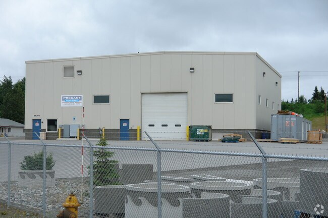
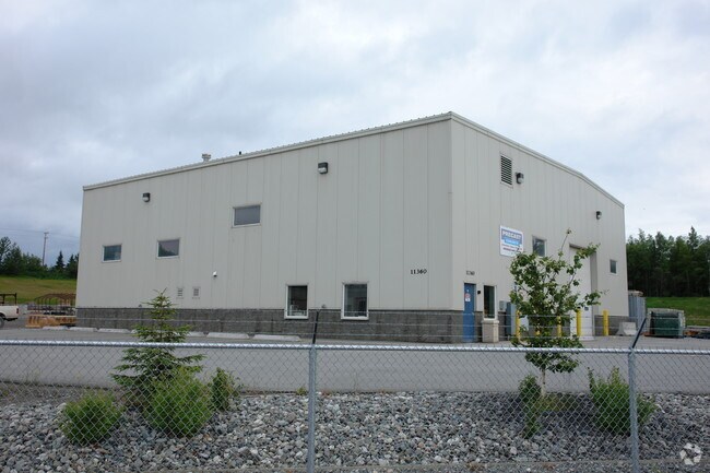
251 E Klatt Rd
01613318000
TURNAGAIN INDUSTRIAL PARK BLK 2 TR D1
Officebuilding
ANCHORAGE
I2
Alaska
B and X Area of moderate flood hazard, usually the area between the limits of the 100-year and 500-year floods.
10.81 AC
2025
Dimond South-20
2025
Anchorage
002712
Anchorage, AK
2,084 SF
NEARBY LISTINGS FOR SALE OR LEASE
-
-
View all Anchorage listings for sale on LoopNet.com
DEMOGRAPHICS near 251 E Klatt Rd
1 mile
3 mile
5 mile
2025 Total Population
6,352
65,206
122,783
2030 Population
6,291
64,870
122,530
Pop Growth 2025-2030
(0.96%)
(0.52%)
(0.21%)
Average Age
38
38
39
2025 Total Households
2,407
24,017
46,073
HH Growth 2025-2030
(1.00%)
(0.51%)
(0.17%)
Median Household Inc
$108,191
$111,781
$111,810
Avg Household Size
2.60
2.60
2.60
2025 Avg HH Vehicles
2.00
2.00
2.00
Median Home Value
$407,569
$411,475
$416,677
Median Year Built
1986
1985
1983
Nearby Places
Map Layers
Map Styles
 Street
 Aerial
Layers
 Traffic
 Biking
Places
Listings with unknown addresses are not visible on the map
- Restaurants
- Banks
- Shops
- Fitness
- Groceries
PUBLIC TRANSPORTATION
AIRPORT
Ted Stevens Anchorage International
Drive
Walk
Distance
Ted Stevens Anchorage International
14 min
8.3 mi
Merrill Field
Drive
Walk
Distance
Merrill Field
16 min
8.6 mi
Freight Ports
Port of Anchorage
Drive
Walk
Distance
Port of Anchorage
19 min
10.0 mi
Nearby Properties
Address
Land Use
TOTAL SIZE
Lot Size
Zoning
Address
Land Use
TOTAL SIZE
Lot Size
Zoning
381,477 SF
33.30 AC
B3
Address
Land Use
TOTAL SIZE
Lot Size
Zoning
267,442 SF
61.04 AC
PLI
Address
Land Use
TOTAL SIZE
Lot Size
Zoning
265,000 SF
49.89 AC
PLISL
Address
Land Use
TOTAL SIZE
Lot Size
Zoning
69 AC
PR
Address
Land Use
TOTAL SIZE
Lot Size
Zoning
150,075 SF
29.17 AC
PLI
Address
Land Use
TOTAL SIZE
Lot Size
Zoning
164,774 SF
29.26 AC
PLI
Address
Land Use
TOTAL SIZE
Lot Size
Zoning
154,455 SF
16.38 AC
I1
Address
Land Use
TOTAL SIZE
Lot Size
Zoning
79,808 SF
19.54 AC
I2
Address
Land Use
TOTAL SIZE
Lot Size
Zoning
170,381 SF
10.70 AC
I2
Address
Land Use
TOTAL SIZE
Lot Size
Zoning
151,322 SF
9.18 AC
I1
Address
Land Use
TOTAL SIZE
Lot Size
Zoning
178,437 SF
16.02 AC
B3SL
Address
Land Use
TOTAL SIZE
Lot Size
Zoning
149,219 SF
14.56 AC
B3
Address
Land Use
TOTAL SIZE
Lot Size
Zoning
136,593 SF
9.15 AC
I2
Address
Land Use
TOTAL SIZE
Lot Size
Zoning
52,890 SF
10.64 AC
PLI
Address
Land Use
TOTAL SIZE
Lot Size
Zoning
63,305 SF
12.11 AC
I1
Address
Land Use
TOTAL SIZE
Lot Size
Zoning
109,447 SF
4.54 AC
B3SL
Address
Land Use
TOTAL SIZE
Lot Size
Zoning
83,970 SF
12.16 AC
I1
Address
Land Use
TOTAL SIZE
Lot Size
Zoning
50,413 SF
2.42 AC
B3
Address
Land Use
TOTAL SIZE
Lot Size
Zoning
166,065 SF
11.71 AC
B3
Address
Land Use
TOTAL SIZE
Lot Size
Zoning
171,492 SF
17.08 AC
I1
Address
Land Use
TOTAL SIZE
Lot Size
Zoning
152,964 SF
16.02 AC
I1
Address
Land Use
TOTAL SIZE
Lot Size
Zoning
110,811 SF
6.93 AC
I1
Address
Land Use
TOTAL SIZE
Lot Size
Zoning
46,101 SF
37.80 AC
I2
Address
Land Use
TOTAL SIZE
Lot Size
Zoning
112,590 SF
10.58 AC
I2
Address
Land Use
TOTAL SIZE
Lot Size
Zoning
10,064 SF
12.22 AC
I2
Address
Land Use
TOTAL SIZE
Lot Size
Zoning
73,505 SF
8.78 AC
I2
Address
Land Use
TOTAL SIZE
Lot Size
Zoning
99,959 SF
1.82 AC
B3
Address
Land Use
TOTAL SIZE
Lot Size
Zoning
28.77 AC
I2
Address
Land Use
TOTAL SIZE
Lot Size
Zoning
34,180 SF
10 AC
I1
Address
Land Use
TOTAL SIZE
Lot Size
Zoning
155,516 SF
12.07 AC
B3
The World's #1 Commercial Real Estate Marketplace
Connect with us
© 2026 CoStar Group
The information above has been obtained from sources believed reliable. While we do not doubt its accuracy we have not verified it and make no guarantee, warranty or representation about it. It is your responsibility to independently confirm its accuracy and completeness. Any projections, opinions, assumptions, or estimates used are for example only and do not represent the current or future performance of the property. The value of this transaction to you depends on tax and other factors which should be evaluated by your tax, financial, and legal advisors. You and your advisors should conduct a careful, independent investigation of the property to determine to your satisfaction the suitability of the property for your needs.