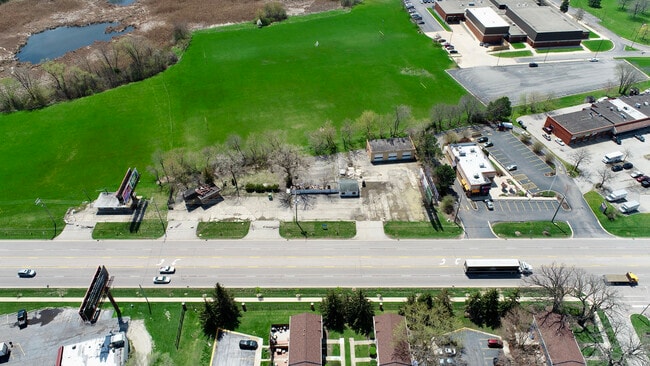
Property Record
251 E Lake St, Bartlett, IL 60103


NEARBY LISTINGS FOR SALE OR LEASE
Property Detail
251 E Lake St
06-26-304-002-0000
PART S4SW4 S26 T41N R09E 3P
Commercialbuilding
Cook
X
Illinois
17031C0168J
0.35 AC
2023
Far Northwest
2025
Chicago
804505
Chicago-Naperville-Elgin, IL-IN
3,595 SF
DEMOGRAPHICS near 251 E Lake St
1 Mile
3 Mile
5 Mile
2024 Total Population
14,958
102,749
222,523
2029 Population
14,505
99,644
215,993
Pop Growth 2024-2029
(3.03%)
(3.02%)
(2.93%)
Average Age
38
40
40
2024 Total Households
4,888
34,956
76,318
HH Growth 2024-2029
(3.36%)
(3.34%)
(3.23%)
Median Household Inc
$76,999
$89,308
$92,117
Avg Household Size
2.90
2.80
2.80
2024 Avg HH Vehicles
2.00
2.00
2.00
Median Home Value
$234,118
$250,860
$267,358
Median Year Built
1975
1979
1979
Nearby Places
Map Layers
Map Styles
 Street
 Aerial
- Restaurants
- Banks
- Shops
- Fitness
- Groceries
PUBLIC TRANSPORTATION
COMMUTER RAIL
Bartlett Station (Milwaukee District West Line - Northeast Illinois Regional Commuter Railroad (Metra))
DRIVE
WALK
Distance
Bartlett Station (Milwaukee District West Line - Northeast Illinois Regional Commuter Railroad (Metra))
3 min
1.0 mi
Hanover Park Station (Milwaukee District West Line - Northeast Illinois Regional Commuter Railroad (Metra))
DRIVE
WALK
Distance
Hanover Park Station (Milwaukee District West Line - Northeast Illinois Regional Commuter Railroad (Metra))
3 min
2.0 mi
AIRPORT
Chicago O'Hare International
DRIVE
WALK
Distance
Chicago O'Hare International
34 min
21.3 mi
Chicago Midway International
DRIVE
WALK
Distance
Chicago Midway International
45 min
32.7 mi
Freight Ports
Port Milwaukee
DRIVE
WALK
Distance
Port Milwaukee
112 min
82.3 mi
Nearby Properties
Address
Land Use
TOTAL SIZE
Lot Size
Zoning
Address
Land Use
TOTAL SIZE
Lot Size
Zoning
421,722 SF
34.61 AC
Address
Land Use
TOTAL SIZE
Lot Size
Zoning
400,000 SF
31.67 AC
I
Address
Land Use
TOTAL SIZE
Lot Size
Zoning
356,177 SF
18.27 AC
I
Address
Land Use
TOTAL SIZE
Lot Size
Zoning
320,504 SF
17.60 AC
I
Address
Land Use
TOTAL SIZE
Lot Size
Zoning
328,208 SF
5.62 AC
Address
Land Use
TOTAL SIZE
Lot Size
Zoning
130,923 SF
13.15 AC
Address
Land Use
TOTAL SIZE
Lot Size
Zoning
300,000 SF
16.56 AC
I
Address
Land Use
TOTAL SIZE
Lot Size
Zoning
272,606 SF
15.92 AC
I
Address
Land Use
TOTAL SIZE
Lot Size
Zoning
224,794 SF
Address
Land Use
TOTAL SIZE
Lot Size
Zoning
250,000 SF
12.44 AC
I
Address
Land Use
TOTAL SIZE
Lot Size
Zoning
30,000 SF
1.04 AC
Address
Land Use
TOTAL SIZE
Lot Size
Zoning
94,497 SF
9.43 AC
C
Address
Land Use
TOTAL SIZE
Lot Size
Zoning
241,807 SF
11.83 AC
I
Address
Land Use
TOTAL SIZE
Lot Size
Zoning
401,250 SF
73.98 AC
Address
Land Use
TOTAL SIZE
Lot Size
Zoning
64,182 SF
2.62 AC
Address
Land Use
TOTAL SIZE
Lot Size
Zoning
207,000 SF
11.72 AC
Address
Land Use
TOTAL SIZE
Lot Size
Zoning
348,500 SF
23.57 AC
Address
Land Use
TOTAL SIZE
Lot Size
Zoning
76,744 SF
2.41 AC
Address
Land Use
TOTAL SIZE
Lot Size
Zoning
207,000 SF
11.80 AC
Address
Land Use
TOTAL SIZE
Lot Size
Zoning
179,497 SF
12.33 AC
Address
Land Use
TOTAL SIZE
Lot Size
Zoning
436,500 SF
Address
Land Use
TOTAL SIZE
Lot Size
Zoning
423,726 SF
35.97 AC
Address
Land Use
TOTAL SIZE
Lot Size
Zoning
186,000 SF
10.50 AC
Address
Land Use
TOTAL SIZE
Lot Size
Zoning
Address
Land Use
TOTAL SIZE
Lot Size
Zoning
11,132 SF
2 AC
Address
Land Use
TOTAL SIZE
Lot Size
Zoning
160,414 SF
10.62 AC
I
Address
Land Use
TOTAL SIZE
Lot Size
Zoning
11.12 AC
Address
Land Use
TOTAL SIZE
Lot Size
Zoning
3,205 SF
2.35 AC
Address
Land Use
TOTAL SIZE
Lot Size
Zoning
167,166 SF
12.85 AC
Address
Land Use
TOTAL SIZE
Lot Size
Zoning
293,632 SF
The World's #1 Commercial Real Estate Marketplace
Connect with us
© 2026 CoStar Group
The information above has been obtained from sources believed reliable. While we do not doubt its accuracy we have not verified it and make no guarantee, warranty or representation about it. It is your responsibility to independently confirm its accuracy and completeness. Any projections, opinions, assumptions, or estimates used are for example only and do not represent the current or future performance of the property. The value of this transaction to you depends on tax and other factors which should be evaluated by your tax, financial, and legal advisors. You and your advisors should conduct a careful, independent investigation of the property to determine to your satisfaction the suitability of the property for your needs.