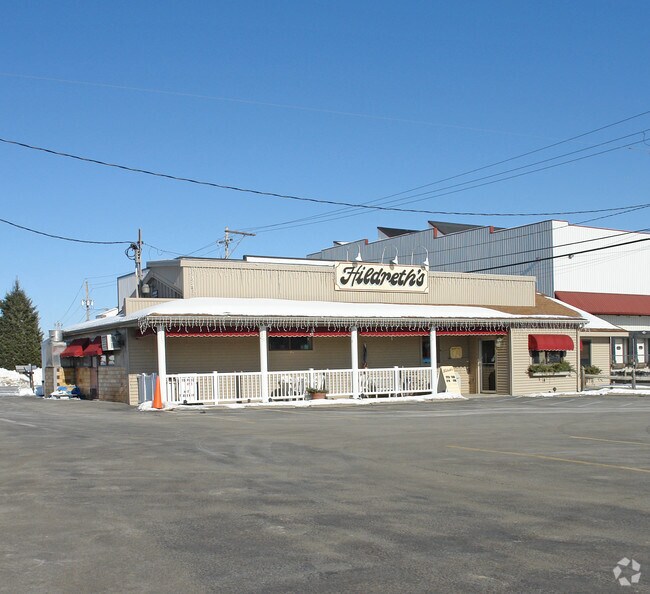
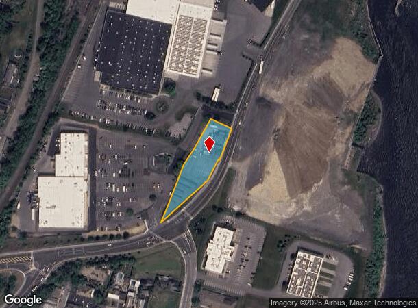
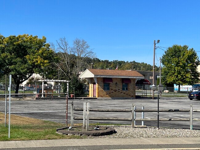
Property Record
251 N Main St, Mechanicville, NY 12118

NEARBY LISTINGS FOR SALE OR LEASE
-
-
View all Mechanicville listings for sale on LoopNet.com
Property Detail
251 N Main St
Albany-Schenectady-Troy, NY
RESTAURANT
411000-262-038-0001-006-000-0000
Saratoga
Restaurantbuilding
New York
2024
6.000
2024
0.93 AC
062505
Saratoga County
2,376 SF
Albany/Schenectady/Troy
DEMOGRAPHICS near 251 N Main St
1 Mile
3 Mile
5 Mile
2024 Total Population
6,387
12,755
25,944
2029 Population
6,452
13,043
26,439
Pop Growth 2024-2029
+ 1.02%
+ 2.26%
+ 1.91%
Average Age
40
42
42
2024 Total Households
2,778
5,399
10,809
HH Growth 2024-2029
+ 0.97%
+ 2.19%
+ 1.82%
Median Household Inc
$65,929
$81,292
$89,367
Avg Household Size
2.20
2.30
2.30
2024 Avg HH Vehicles
2.00
2.00
2.00
Median Home Value
$207,675
$244,364
$281,554
Median Year Built
1952
1971
1985
Nearby Places
Map Layers
Map Styles
 Street
 Aerial
- Restaurants
- Banks
- Shops
- Fitness
- Groceries
PUBLIC TRANSPORTATION
AIRPORT
Albany International
DRIVE
WALK
Distance
Albany International
26 min
15.5 mi
Freight Ports
Albany, NY Port
DRIVE
WALK
Distance
Albany, NY Port
39 min
24.9 mi
SALE & LEASE HISTORY
LISTING DATE
SALE/LEASE

Oct 06, 2023
For Sale
Nearby Properties
Address
Land Use
TOTAL SIZE
Lot Size
Zoning
Address
Land Use
TOTAL SIZE
Lot Size
Zoning
3,147 SF
2.98 AC
T5
Address
Land Use
TOTAL SIZE
Lot Size
Zoning
255,966 SF
12.19 AC
T5
Address
Land Use
TOTAL SIZE
Lot Size
Zoning
195,403 SF
111.24 AC
04 - FARM
Address
Land Use
TOTAL SIZE
Lot Size
Zoning
Address
Land Use
TOTAL SIZE
Lot Size
Zoning
3,744 SF
PDD
Address
Land Use
TOTAL SIZE
Lot Size
Zoning
14,136 SF
20.64 AC
BP
Address
Land Use
TOTAL SIZE
Lot Size
Zoning
5.53 AC
ID
Address
Land Use
TOTAL SIZE
Lot Size
Zoning
700 SF
PDD
Address
Land Use
TOTAL SIZE
Lot Size
Zoning
77,088 SF
1.62 AC
05 - COMME
Address
Land Use
TOTAL SIZE
Lot Size
Zoning
4,444 SF
91.82 AC
PDD
Address
Land Use
TOTAL SIZE
Lot Size
Zoning
Address
Land Use
TOTAL SIZE
Lot Size
Zoning
Address
Land Use
TOTAL SIZE
Lot Size
Zoning
62,866 SF
4.21 AC
T5
Address
Land Use
TOTAL SIZE
Lot Size
Zoning
24,540 SF
2.01 AC
03 - MULTI
Address
Land Use
TOTAL SIZE
Lot Size
Zoning
46,921 SF
5.20 AC
05 - COMME
Address
Land Use
TOTAL SIZE
Lot Size
Zoning
35,474 SF
34.96 AC
05 - COMME
Address
Land Use
TOTAL SIZE
Lot Size
Zoning
3,680 SF
0.72 AC
B
Address
Land Use
TOTAL SIZE
Lot Size
Zoning
6,300 SF
3.28 AC
08 - GOVER
Address
Land Use
TOTAL SIZE
Lot Size
Zoning
5,474 SF
4.68 AC
08 - GOVER
Address
Land Use
TOTAL SIZE
Lot Size
Zoning
85,852 SF
16.59 AC
06 - INDUS
Address
Land Use
TOTAL SIZE
Lot Size
Zoning
13,400 SF
28.72 AC
06 - INDUS
Address
Land Use
TOTAL SIZE
Lot Size
Zoning
2,200 AC
RR
Address
Land Use
TOTAL SIZE
Lot Size
Zoning
29,356 SF
6.65 AC
GC
Address
Land Use
TOTAL SIZE
Lot Size
Zoning
9,801 SF
5.71 AC
RR
Address
Land Use
TOTAL SIZE
Lot Size
Zoning
10,800 SF
0.85 AC
02 - SINGL
Address
Land Use
TOTAL SIZE
Lot Size
Zoning
7,696 SF
0.97 AC
08 - GOVER
Address
Land Use
TOTAL SIZE
Lot Size
Zoning
22,220 SF
1.16 AC
02 - SINGL
Address
Land Use
TOTAL SIZE
Lot Size
Zoning
360 SF
PDD
Address
Land Use
TOTAL SIZE
Lot Size
Zoning
1,440 SF
111.64 AC
06 - INDUS
Address
Land Use
TOTAL SIZE
Lot Size
Zoning
5,504 SF
152.32 AC
04 - FARM
The World's #1 Commercial Real Estate Marketplace
Connect with us
© 2025 CoStar Group
The information above has been obtained from sources believed reliable. While we do not doubt its accuracy we have not verified it and make no guarantee, warranty or representation about it. It is your responsibility to independently confirm its accuracy and completeness. Any projections, opinions, assumptions, or estimates used are for example only and do not represent the current or future performance of the property. The value of this transaction to you depends on tax and other factors which should be evaluated by your tax, financial, and legal advisors. You and your advisors should conduct a careful, independent investigation of the property to determine to your satisfaction the suitability of the property for your needs.