Property Record
251 N Pine St, Grand Junction, MI 49056


NEARBY LISTINGS FOR SALE OR LEASE
-
-
View all Grand Junction listings for sale on LoopNet.com
Property Detail
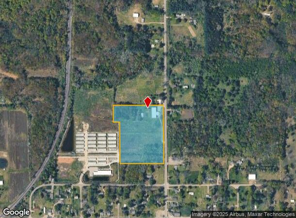
251 N Pine St
Kalamazoo-Portage, MI
Village Of Breedsville
80-40-541-403-10
1070-B 29-1-15 599-825 1047-980 1323-535 1456-459 1535-258 1540-204 * LOTS 8-12 INCLUSIVE AND THE N 1 ROD OF LOT 13, AND PART
Agriculturalland
Van Buren
X
Michigan
26159C0180C
4,6-13
2024
8.67 AC
2025
Van Buren County
010202
West Michigan
DEMOGRAPHICS near 251 N Pine St
1 Mile
3 Mile
5 Mile
2024 Total Population
368
2,731
7,939
2029 Population
374
2,789
8,042
Pop Growth 2024-2029
+ 1.63%
+ 2.12%
+ 1.30%
Average Age
40
40
40
2024 Total Households
134
1,023
2,969
HH Growth 2024-2029
+ 2.24%
+ 1.96%
+ 1.15%
Median Household Inc
$54,473
$48,749
$52,029
Avg Household Size
2.70
2.60
2.60
2024 Avg HH Vehicles
2.00
2.00
2.00
Median Home Value
$101,351
$118,795
$128,294
Median Year Built
1976
1974
1972
Nearby Places
Map Layers
Map Styles
 Street
 Aerial
- Restaurants
- Banks
- Shops
- Fitness
- Groceries
PUBLIC TRANSPORTATION
COMMUTER RAIL
Bangor Amtrak Station (Pere Marquette - Amtrak)
DRIVE
WALK
Distance
Bangor Amtrak Station (Pere Marquette - Amtrak)
10 min
5.1 mi
AIRPORT
Kalamazoo/Battle Creek International
DRIVE
WALK
Distance
Kalamazoo/Battle Creek International
56 min
34.1 mi
Freight Ports
Port Milwaukee
DRIVE
WALK
Distance
Port Milwaukee
266 min
216.3 mi
SALE & LEASE HISTORY
LISTING DATE
SALE/LEASE

May 10, 2019
For Sale
Nearby Properties
Address
Land Use
TOTAL SIZE
Lot Size
Zoning
Address
Land Use
TOTAL SIZE
Lot Size
Zoning
1,352 SF
242.50 AC
AG
Address
Land Use
TOTAL SIZE
Lot Size
Zoning
952 SF
57.94 AC
AG
Address
Land Use
TOTAL SIZE
Lot Size
Zoning
1,352 SF
198.66 AC
AG
Address
Land Use
TOTAL SIZE
Lot Size
Zoning
37,116 SF
38.20 AC
AG
Address
Land Use
TOTAL SIZE
Lot Size
Zoning
32,321 SF
9.88 AC
R3
Address
Land Use
TOTAL SIZE
Lot Size
Zoning
3,000 SF
227 AC
AG
Address
Land Use
TOTAL SIZE
Lot Size
Zoning
211.55 AC
UNZONED
Address
Land Use
TOTAL SIZE
Lot Size
Zoning
1,792 SF
63.29 AC
AG
Address
Land Use
TOTAL SIZE
Lot Size
Zoning
1,744 SF
80 AC
AG
Address
Land Use
TOTAL SIZE
Lot Size
Zoning
3,006 SF
116.10 AC
AG
Address
Land Use
TOTAL SIZE
Lot Size
Zoning
9,442 SF
20.01 AC
BREEDVILLE
Address
Land Use
TOTAL SIZE
Lot Size
Zoning
11,250 SF
2.30 AC
C
Address
Land Use
TOTAL SIZE
Lot Size
Zoning
920 SF
20 AC
AG
Address
Land Use
TOTAL SIZE
Lot Size
Zoning
1,200 SF
74.50 AC
AG
Address
Land Use
TOTAL SIZE
Lot Size
Zoning
9,130 SF
0.47 AC
C1
Address
Land Use
TOTAL SIZE
Lot Size
Zoning
75.75 AC
AG
Address
Land Use
TOTAL SIZE
Lot Size
Zoning
1,928 SF
80 AC
AG
Address
Land Use
TOTAL SIZE
Lot Size
Zoning
60 AC
AG
Address
Land Use
TOTAL SIZE
Lot Size
Zoning
9,800 SF
19.25 AC
C
Address
Land Use
TOTAL SIZE
Lot Size
Zoning
2,464 SF
137 AC
AG
Address
Land Use
TOTAL SIZE
Lot Size
Zoning
36,400 SF
6.50 AC
C
Address
Land Use
TOTAL SIZE
Lot Size
Zoning
2,167 SF
89.80 AC
AG
Address
Land Use
TOTAL SIZE
Lot Size
Zoning
1,728 SF
40 AC
AG
Address
Land Use
TOTAL SIZE
Lot Size
Zoning
142 AC
AG
Address
Land Use
TOTAL SIZE
Lot Size
Zoning
2,484 SF
37.66 AC
AG
Address
Land Use
TOTAL SIZE
Lot Size
Zoning
2,022 SF
56 AC
AG
Address
Land Use
TOTAL SIZE
Lot Size
Zoning
1,212 SF
82.61 AC
NO ZONI
Address
Land Use
TOTAL SIZE
Lot Size
Zoning
125 AC
AG
Address
Land Use
TOTAL SIZE
Lot Size
Zoning
5,058 SF
40 AC
AG
Address
Land Use
TOTAL SIZE
Lot Size
Zoning
1,714 SF
97.50 AC
AG
The World's #1 Commercial Real Estate Marketplace
Connect with us
© 2025 CoStar Group
The information above has been obtained from sources believed reliable. While we do not doubt its accuracy we have not verified it and make no guarantee, warranty or representation about it. It is your responsibility to independently confirm its accuracy and completeness. Any projections, opinions, assumptions, or estimates used are for example only and do not represent the current or future performance of the property. The value of this transaction to you depends on tax and other factors which should be evaluated by your tax, financial, and legal advisors. You and your advisors should conduct a careful, independent investigation of the property to determine to your satisfaction the suitability of the property for your needs.