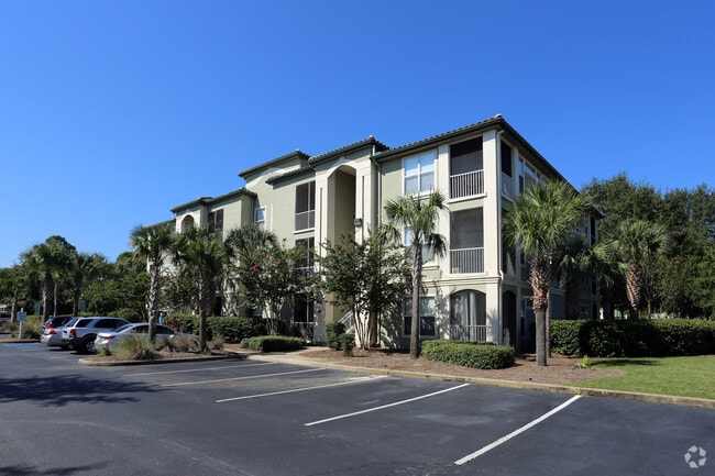
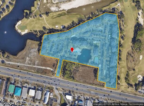
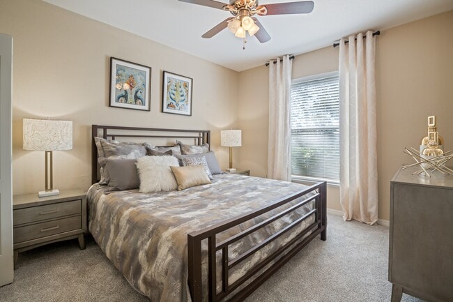
Property Record
251 Vinings Way Blvd, Destin, FL 32541
NEARBY LISTINGS FOR SALE OR LEASE
-
-
View all Destin listings for sale on LoopNet.com
Property Detail
251 Vinings Way Blvd
Crestview-Fort Walton Beach-Destin, FL
Th Green Comm S/D
00-2S-22-0000-0001-A650
COM INT N R/W U.S. 98 AND W BDRY 5TH GREEN COMM S/D N76 DEG W ALG R/W 55FT N68 DEG W ALG R/W 252 FT N84 DEG W ALG R/W 187FT TO POB CONT ALG R/W 166FT N13 DEG E60 FT N76 DEG W 117FT N4 DEG E192 FT N76 DEG W 517 FT S13 DEG W250 FT TO N R/W N76 DEG W AL
Multifamilydwelling
Okaloosa
X
Florida
12091C0493J
a650
2025
16 AC
2025
Fort Walton Beach
023308
Other Market Areas
319,886 SF
DEMOGRAPHICS near 251 Vinings Way Blvd
1 Mile
3 Mile
5 Mile
2024 Total Population
6,078
18,172
35,388
2029 Population
6,878
21,646
42,101
Pop Growth 2024-2029
+ 13.16%
+ 19.12%
+ 18.97%
Average Age
46
47
47
2024 Total Households
2,681
8,626
16,476
HH Growth 2024-2029
+ 13.54%
+ 19.97%
+ 20.14%
Median Household Inc
$111,507
$84,740
$83,303
Avg Household Size
2.30
2.10
2.10
2024 Avg HH Vehicles
2.00
2.00
2.00
Median Home Value
$577,116
$575,429
$482,809
Median Year Built
1998
2000
1997
Nearby Places
Map Layers
Map Styles
 Street
 Aerial
- Restaurants
- Banks
- Shops
- Fitness
- Groceries
PUBLIC TRANSPORTATION
AIRPORT
Eglin AFB/Destin-Ft Walton Beach
DRIVE
WALK
Distance
Eglin AFB/Destin-Ft Walton Beach
47 min
18.8 mi
Freight Ports
Port of Panama City
DRIVE
WALK
Distance
Port of Panama City
69 min
45.4 mi
Nearby Properties
Address
Land Use
TOTAL SIZE
Lot Size
Zoning
Address
Land Use
TOTAL SIZE
Lot Size
Zoning
619,795 SF
47.80 AC
Address
Land Use
TOTAL SIZE
Lot Size
Zoning
110,181 SF
3.48 AC
Address
Land Use
TOTAL SIZE
Lot Size
Zoning
148,945 SF
12.83 AC
Address
Land Use
TOTAL SIZE
Lot Size
Zoning
125,459 SF
12.57 AC
Address
Land Use
TOTAL SIZE
Lot Size
Zoning
29,385 SF
211.96 AC
Address
Land Use
TOTAL SIZE
Lot Size
Zoning
181,240 SF
11.20 AC
Address
Land Use
TOTAL SIZE
Lot Size
Zoning
5.19 AC
GULFFR
Address
Land Use
TOTAL SIZE
Lot Size
Zoning
19,401 SF
6.66 AC
Address
Land Use
TOTAL SIZE
Lot Size
Zoning
223,790 SF
20.75 AC
Address
Land Use
TOTAL SIZE
Lot Size
Zoning
195,622 SF
17.68 AC
Address
Land Use
TOTAL SIZE
Lot Size
Zoning
135,154 SF
15.22 AC
Address
Land Use
TOTAL SIZE
Lot Size
Zoning
28,327 SF
1.45 AC
Address
Land Use
TOTAL SIZE
Lot Size
Zoning
66,001 SF
1.25 AC
HWY 98
Address
Land Use
TOTAL SIZE
Lot Size
Zoning
113,053 SF
7.25 AC
Address
Land Use
TOTAL SIZE
Lot Size
Zoning
36,890 SF
2.23 AC
Address
Land Use
TOTAL SIZE
Lot Size
Zoning
231,112 SF
23.03 AC
Address
Land Use
TOTAL SIZE
Lot Size
Zoning
49,123 SF
2.36 AC
Address
Land Use
TOTAL SIZE
Lot Size
Zoning
201,131 SF
11.29 AC
Address
Land Use
TOTAL SIZE
Lot Size
Zoning
1.81 AC
GULFFR
Address
Land Use
TOTAL SIZE
Lot Size
Zoning
154,725 SF
15.69 AC
Address
Land Use
TOTAL SIZE
Lot Size
Zoning
33,420 SF
2.56 AC
Address
Land Use
TOTAL SIZE
Lot Size
Zoning
56,505 SF
2.34 AC
Address
Land Use
TOTAL SIZE
Lot Size
Zoning
123,120 SF
4.11 AC
HWY 98
Address
Land Use
TOTAL SIZE
Lot Size
Zoning
74,803 SF
6.97 AC
Address
Land Use
TOTAL SIZE
Lot Size
Zoning
19,487 SF
51.73 AC
Address
Land Use
TOTAL SIZE
Lot Size
Zoning
7,416 SF
25.45 AC
HWY 98
Address
Land Use
TOTAL SIZE
Lot Size
Zoning
22.80 AC
Address
Land Use
TOTAL SIZE
Lot Size
Zoning
126,224 SF
11.27 AC
Address
Land Use
TOTAL SIZE
Lot Size
Zoning
50,665 SF
5.47 AC
The World's #1 Commercial Real Estate Marketplace
Connect with us
© 2025 CoStar Group
The information above has been obtained from sources believed reliable. While we do not doubt its accuracy we have not verified it and make no guarantee, warranty or representation about it. It is your responsibility to independently confirm its accuracy and completeness. Any projections, opinions, assumptions, or estimates used are for example only and do not represent the current or future performance of the property. The value of this transaction to you depends on tax and other factors which should be evaluated by your tax, financial, and legal advisors. You and your advisors should conduct a careful, independent investigation of the property to determine to your satisfaction the suitability of the property for your needs.