Property Record
251 Violet St, Golden, CO 80401
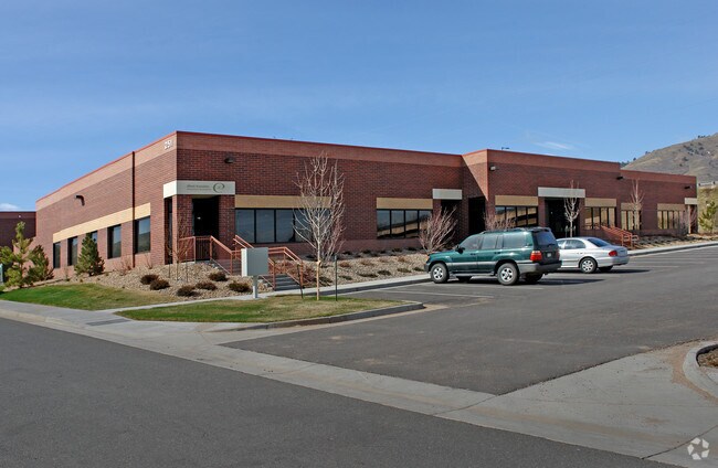
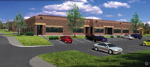
Property Detail
251 Violet St
Denver-Aurora-Centennial, CO
SECTION 11 TOWNSHIP 04 RANGE 70 QTR NW SUBDIVISIONCD 166263 SUBDIVISIONNAME CORPORATE CTR BUS PK FLG 3 L 1A CONDOS 3RD SUP BLOCK LOT 0120 TRACT
40-112-03-032
JEFFERSON
Industrialcondominium
Colorado
B and X Area of moderate flood hazard, usually the area between the limits of the 100-year and 500-year floods.
12
2025
0.16 AC
2025
West Denver
009856
Denver
6,943 SF
NEARBY LISTINGS FOR SALE OR LEASE
DEMOGRAPHICS near 251 Violet St
1 mile
3 mile
5 mile
2025 Total Population
6,499
34,375
107,311
2030 Population
6,479
34,465
107,188
Pop Growth 2025-2030
(0.31%)
+ 0.26%
(0.11%)
Average Age
40
40
42
2025 Total Households
2,716
14,035
44,875
HH Growth 2025-2030
(0.52%)
+ 0.26%
(0.11%)
Median Household Inc
$90,664
$95,956
$103,312
Avg Household Size
2.30
2.20
2.30
2025 Avg HH Vehicles
2.00
2.00
2.00
Median Home Value
$436,296
$732,566
$746,861
Median Year Built
1989
1980
1978
Nearby Places
Map Layers
Map Styles
 Street
 Aerial
Layers
 Traffic
 Biking
Places
Listings with unknown addresses are not visible on the map
- Restaurants
- Banks
- Shops
- Fitness
- Groceries
PUBLIC TRANSPORTATION
TRANSIT/SUBWAY
Jefferson County Govt Center/Golden (W Line - Denver Regional Transportation District Light Rail (TheRide))
Drive
Walk
Distance
Jefferson County Govt Center/Golden (W Line - Denver Regional Transportation District Light Rail (TheRide))
3 min
15 min
0.8 mi
COMMUTER RAIL
Wheat Ridge - Ward Station Track 1 (Union Station to Wheat Ridge Ward Station - Regional Transportation District)
Drive
Walk
Distance
Wheat Ridge - Ward Station Track 1 (Union Station to Wheat Ridge Ward Station - Regional Transportation District)
11 min
7.4 mi
Arvada Ridge Station Track 1 (Union Station to Wheat Ridge Ward Station - Regional Transportation District)
Drive
Walk
Distance
Arvada Ridge Station Track 1 (Union Station to Wheat Ridge Ward Station - Regional Transportation District)
12 min
8.4 mi
AIRPORT
Denver International
Drive
Walk
Distance
Denver International
45 min
36.0 mi
Freight Ports
Tulsa Port Of Catoosa
Drive
Walk
Distance
Tulsa Port Of Catoosa
742 min
721.5 mi
SALE & LEASE HISTORY
LISTING DATE
SALE/LEASE

Jan 08, 2021
For Sale
Nearby Properties
Address
Land Use
TOTAL SIZE
Lot Size
Zoning
Address
Land Use
TOTAL SIZE
Lot Size
Zoning
Address
Land Use
TOTAL SIZE
Lot Size
Zoning
367,452 SF
38.94 AC
Address
Land Use
TOTAL SIZE
Lot Size
Zoning
2,710,724 SF
32.87 AC
Address
Land Use
TOTAL SIZE
Lot Size
Zoning
1,193,158 SF
68.86 AC
Address
Land Use
TOTAL SIZE
Lot Size
Zoning
420,482 SF
66.03 AC
Address
Land Use
TOTAL SIZE
Lot Size
Zoning
25,925 SF
7.12 AC
Address
Land Use
TOTAL SIZE
Lot Size
Zoning
103,076 SF
1.28 AC
Address
Land Use
TOTAL SIZE
Lot Size
Zoning
352,259 SF
17.94 AC
Address
Land Use
TOTAL SIZE
Lot Size
Zoning
117,036 SF
1.38 AC
Address
Land Use
TOTAL SIZE
Lot Size
Zoning
52,103 SF
2.44 AC
Address
Land Use
TOTAL SIZE
Lot Size
Zoning
Address
Land Use
TOTAL SIZE
Lot Size
Zoning
135,113 SF
2.58 AC
Address
Land Use
TOTAL SIZE
Lot Size
Zoning
615,195 SF
23.48 AC
Address
Land Use
TOTAL SIZE
Lot Size
Zoning
322,105 SF
136.23 AC
Address
Land Use
TOTAL SIZE
Lot Size
Zoning
104,088 SF
1.31 AC
Address
Land Use
TOTAL SIZE
Lot Size
Zoning
162,271 SF
8.20 AC
Address
Land Use
TOTAL SIZE
Lot Size
Zoning
282,190 SF
6.42 AC
PD
Address
Land Use
TOTAL SIZE
Lot Size
Zoning
229,819 SF
29.97 AC
Address
Land Use
TOTAL SIZE
Lot Size
Zoning
188,554 SF
33.28 AC
Address
Land Use
TOTAL SIZE
Lot Size
Zoning
484,918 SF
58.36 AC
Address
Land Use
TOTAL SIZE
Lot Size
Zoning
39,374 SF
1.20 AC
Address
Land Use
TOTAL SIZE
Lot Size
Zoning
198,147 SF
2.55 AC
Address
Land Use
TOTAL SIZE
Lot Size
Zoning
118,522 SF
7.07 AC
PD
Address
Land Use
TOTAL SIZE
Lot Size
Zoning
55,030 SF
4.94 AC
Address
Land Use
TOTAL SIZE
Lot Size
Zoning
22,232 SF
2.18 AC
Address
Land Use
TOTAL SIZE
Lot Size
Zoning
220,462 SF
73.85 AC
R1
Address
Land Use
TOTAL SIZE
Lot Size
Zoning
327,549 SF
128.38 AC
Address
Land Use
TOTAL SIZE
Lot Size
Zoning
390,157 SF
10.02 AC
Address
Land Use
TOTAL SIZE
Lot Size
Zoning
454.79 AC
A2
Address
Land Use
TOTAL SIZE
Lot Size
Zoning
68,773 SF
9.90 AC
The World's #1 Commercial Real Estate Marketplace
Connect with us
© 2026 CoStar Group
The information above has been obtained from sources believed reliable. While we do not doubt its accuracy we have not verified it and make no guarantee, warranty or representation about it. It is your responsibility to independently confirm its accuracy and completeness. Any projections, opinions, assumptions, or estimates used are for example only and do not represent the current or future performance of the property. The value of this transaction to you depends on tax and other factors which should be evaluated by your tax, financial, and legal advisors. You and your advisors should conduct a careful, independent investigation of the property to determine to your satisfaction the suitability of the property for your needs.