Property Record
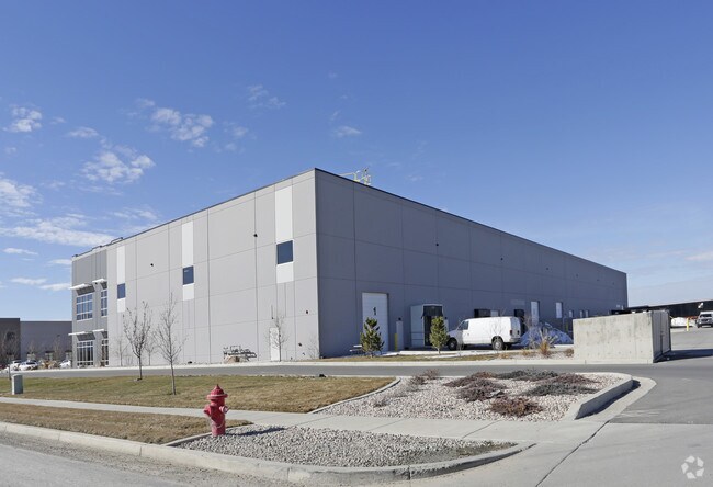
251 W 3100 N, Logan, UT 84341


NEARBY LISTINGS FOR SALE OR LEASE
Property Detail
251 W 3100 N
04-030-0016
For Irrigation Of 10 Acres
Realpropertynec
BEG BR 40 RDS E OF SW COR SE/4 SEC 9 T 12N R 1E & TH E 80 RDS TH N 20 RDS TH W 80 RDS TH S 20 RDS TO BEG EXCEPTING DITCH R/W
X
Cache
49005C0250D
Utah
2025
3.54 AC
2025
Cache County
000403
Salt Lake City
55,494 SF
Logan, UT-ID
DEMOGRAPHICS near 251 W 3100 N
1 Mile
3 Mile
5 Mile
2024 Total Population
1,552
40,008
88,675
2029 Population
1,735
45,266
100,003
Pop Growth 2024-2029
+ 11.79%
+ 13.14%
+ 12.77%
Average Age
31
31
31
2024 Total Households
464
12,738
28,795
HH Growth 2024-2029
+ 11.85%
+ 13.29%
+ 12.99%
Median Household Inc
$89,399
$62,142
$62,933
Avg Household Size
3.30
3.00
2.90
2024 Avg HH Vehicles
2.00
2.00
2.00
Median Home Value
$363,432
$374,193
$366,113
Median Year Built
1993
1997
1989
Nearby Places
Map Layers
Map Styles
 Street
 Aerial
- Restaurants
- Banks
- Shops
- Fitness
- Groceries
Nearby Properties
Address
Land Use
TOTAL SIZE
Lot Size
Zoning
Address
Land Use
TOTAL SIZE
Lot Size
Zoning
193,043 SF
28.79 AC
Address
Land Use
TOTAL SIZE
Lot Size
Zoning
342,162 SF
2.83 AC
Address
Land Use
TOTAL SIZE
Lot Size
Zoning
23,756 SF
16.99 AC
Address
Land Use
TOTAL SIZE
Lot Size
Zoning
124,161 SF
2.21 AC
Address
Land Use
TOTAL SIZE
Lot Size
Zoning
17.61 AC
Address
Land Use
TOTAL SIZE
Lot Size
Zoning
206,100 SF
19.96 AC
Address
Land Use
TOTAL SIZE
Lot Size
Zoning
238,540 SF
18.02 AC
Address
Land Use
TOTAL SIZE
Lot Size
Zoning
86,240 SF
9.85 AC
Address
Land Use
TOTAL SIZE
Lot Size
Zoning
26,440 SF
7.78 AC
Address
Land Use
TOTAL SIZE
Lot Size
Zoning
11.01 AC
Address
Land Use
TOTAL SIZE
Lot Size
Zoning
212,851 SF
19.88 AC
Address
Land Use
TOTAL SIZE
Lot Size
Zoning
9,327 SF
7.35 AC
Address
Land Use
TOTAL SIZE
Lot Size
Zoning
6,372 SF
9.22 AC
Address
Land Use
TOTAL SIZE
Lot Size
Zoning
114,290 SF
7 AC
Address
Land Use
TOTAL SIZE
Lot Size
Zoning
214,625 SF
17.90 AC
Address
Land Use
TOTAL SIZE
Lot Size
Zoning
131,871 SF
13.47 AC
Address
Land Use
TOTAL SIZE
Lot Size
Zoning
4.63 AC
Address
Land Use
TOTAL SIZE
Lot Size
Zoning
67,554 SF
10.22 AC
Address
Land Use
TOTAL SIZE
Lot Size
Zoning
103,658 SF
7.28 AC
Address
Land Use
TOTAL SIZE
Lot Size
Zoning
47,865 SF
2.28 AC
Address
Land Use
TOTAL SIZE
Lot Size
Zoning
39,582 SF
9.58 AC
Address
Land Use
TOTAL SIZE
Lot Size
Zoning
80,080 SF
6.36 AC
Address
Land Use
TOTAL SIZE
Lot Size
Zoning
55,500 SF
7.22 AC
Address
Land Use
TOTAL SIZE
Lot Size
Zoning
13,851 SF
7.68 AC
Address
Land Use
TOTAL SIZE
Lot Size
Zoning
6.19 AC
Address
Land Use
TOTAL SIZE
Lot Size
Zoning
28,167 SF
6.19 AC
Address
Land Use
TOTAL SIZE
Lot Size
Zoning
94,213 SF
7.15 AC
Address
Land Use
TOTAL SIZE
Lot Size
Zoning
97,110 SF
7.83 AC
Address
Land Use
TOTAL SIZE
Lot Size
Zoning
64,116 SF
18.55 AC
The World's #1 Commercial Real Estate Marketplace
Connect with us
© 2025 CoStar Group
The information above has been obtained from sources believed reliable. While we do not doubt its accuracy we have not verified it and make no guarantee, warranty or representation about it. It is your responsibility to independently confirm its accuracy and completeness. Any projections, opinions, assumptions, or estimates used are for example only and do not represent the current or future performance of the property. The value of this transaction to you depends on tax and other factors which should be evaluated by your tax, financial, and legal advisors. You and your advisors should conduct a careful, independent investigation of the property to determine to your satisfaction the suitability of the property for your needs.