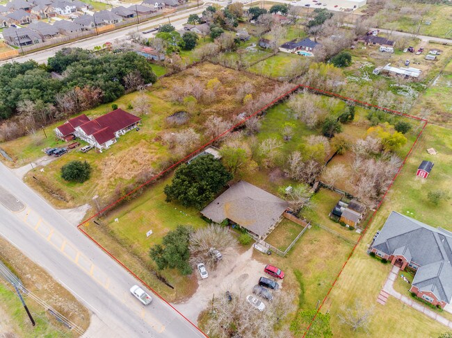
Property Record
2510 County Road 58, Rosharon, TX 77583

NEARBY LISTINGS FOR SALE OR LEASE
Property Detail
2510 County Road 58
Houston-The Woodlands-Sugar Land, TX
H T & B R R
0562-0032-117
Brazoria
Mobilemanufacturedhomeregardlessoflandownership
Texas
X
1.93 AC
48039C0020K
South
2,040 SF
Houston
DEMOGRAPHICS near 2510 County Road 58
1 Mile
3 Mile
5 Mile
2024 Total Population
9,521
53,450
147,105
2029 Population
10,766
61,308
169,393
Pop Growth 2024-2029
+ 13.08%
+ 14.70%
+ 15.15%
Average Age
33
34
35
2024 Total Households
2,893
16,471
47,333
HH Growth 2024-2029
+ 13.20%
+ 14.72%
+ 15.25%
Median Household Inc
$102,841
$110,623
$100,196
Avg Household Size
3.20
3.20
3.10
2024 Avg HH Vehicles
2.00
2.00
2.00
Median Home Value
$302,309
$317,670
$305,843
Median Year Built
2010
2010
2009
Nearby Places
Map Layers
Map Styles
 Street
 Aerial
- Restaurants
- Banks
- Shops
- Fitness
- Groceries
PUBLIC TRANSPORTATION
AIRPORT
William P Hobby
DRIVE
WALK
Distance
William P Hobby
30 min
17.2 mi
Freight Ports
Port of Houston
DRIVE
WALK
Distance
Port of Houston
35 min
24.0 mi
SALE & LEASE HISTORY
LISTING DATE
SALE/LEASE

Jan 08, 2019
For Sale
Nearby Properties
Address
Land Use
TOTAL SIZE
Lot Size
Zoning
Address
Land Use
TOTAL SIZE
Lot Size
Zoning
241,351 SF
60.11 AC
Address
Land Use
TOTAL SIZE
Lot Size
Zoning
372,280 SF
14.70 AC
0021
Address
Land Use
TOTAL SIZE
Lot Size
Zoning
323,168 SF
12.80 AC
Address
Land Use
TOTAL SIZE
Lot Size
Zoning
379,493 SF
14.27 AC
Address
Land Use
TOTAL SIZE
Lot Size
Zoning
66,998 SF
11.34 AC
Address
Land Use
TOTAL SIZE
Lot Size
Zoning
115,423 SF
12.13 AC
Address
Land Use
TOTAL SIZE
Lot Size
Zoning
70,033 SF
17.97 AC
Address
Land Use
TOTAL SIZE
Lot Size
Zoning
58,985 SF
4.34 AC
Address
Land Use
TOTAL SIZE
Lot Size
Zoning
152,722 SF
16.70 AC
Address
Land Use
TOTAL SIZE
Lot Size
Zoning
59,618 SF
4.50 AC
Address
Land Use
TOTAL SIZE
Lot Size
Zoning
15.28 AC
0015
Address
Land Use
TOTAL SIZE
Lot Size
Zoning
13.85 AC
Address
Land Use
TOTAL SIZE
Lot Size
Zoning
67,748 SF
9.28 AC
Address
Land Use
TOTAL SIZE
Lot Size
Zoning
132,938 SF
29 AC
MZY
Address
Land Use
TOTAL SIZE
Lot Size
Zoning
28,708 SF
9.57 AC
Address
Land Use
TOTAL SIZE
Lot Size
Zoning
44,735 SF
120.87 AC
0010
Address
Land Use
TOTAL SIZE
Lot Size
Zoning
125,723 SF
2.63 AC
Address
Land Use
TOTAL SIZE
Lot Size
Zoning
51,996 SF
10.08 AC
0012
Address
Land Use
TOTAL SIZE
Lot Size
Zoning
125,636 SF
2.25 AC
Address
Land Use
TOTAL SIZE
Lot Size
Zoning
214,827 SF
15.70 AC
0033
Address
Land Use
TOTAL SIZE
Lot Size
Zoning
4.30 AC
Address
Land Use
TOTAL SIZE
Lot Size
Zoning
94,094 SF
5.86 AC
Address
Land Use
TOTAL SIZE
Lot Size
Zoning
121,546 SF
2.39 AC
Address
Land Use
TOTAL SIZE
Lot Size
Zoning
98,957 SF
10.70 AC
Address
Land Use
TOTAL SIZE
Lot Size
Zoning
15,226 SF
1.56 AC
Address
Land Use
TOTAL SIZE
Lot Size
Zoning
75,548 SF
12.30 AC
Address
Land Use
TOTAL SIZE
Lot Size
Zoning
11,600 SF
1.45 AC
Address
Land Use
TOTAL SIZE
Lot Size
Zoning
22,160 SF
2.44 AC
Address
Land Use
TOTAL SIZE
Lot Size
Zoning
15,762 SF
1.66 AC
Address
Land Use
TOTAL SIZE
Lot Size
Zoning
23,626 SF
3.80 AC
The World's #1 Commercial Real Estate Marketplace
Connect with us
© 2025 CoStar Group
The information above has been obtained from sources believed reliable. While we do not doubt its accuracy we have not verified it and make no guarantee, warranty or representation about it. It is your responsibility to independently confirm its accuracy and completeness. Any projections, opinions, assumptions, or estimates used are for example only and do not represent the current or future performance of the property. The value of this transaction to you depends on tax and other factors which should be evaluated by your tax, financial, and legal advisors. You and your advisors should conduct a careful, independent investigation of the property to determine to your satisfaction the suitability of the property for your needs.