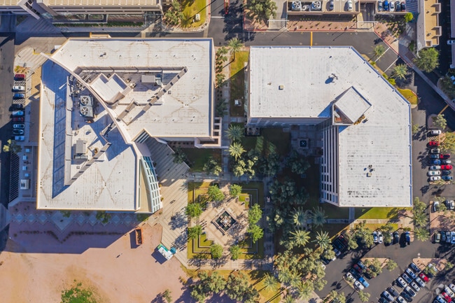
Property Record
2510 W Dunlap Ave, Phoenix, AZ 85021


Current Lease Availabilities
Property Detail
2510 W Dunlap Ave
149-12-022G
CANYON CORPORATE PLAZA MCR 461-20 PT LOT 2 DAF BEG AT NE COR SD LOT 2 TH S 475.64F POB TH CONT S 280.73F TH W 285.08F TH S 45D 07M W 168.55F BEG CUR CONC NW RAD 54.50F TH SWLY 40.67F ALG SD CUR TO RT TO REV CUR RAD 29.50F TH SWLY 45.18F ALG SD CUR TO
Officebuilding
Maricopa
C2
Arizona
C and X Area of minimal flood hazard, usually depicted on FIRMs as above the 500-year flood level.
2
2024
6.11 AC
2025
Northwest Phoenix
104402
Phoenix
184,587 SF
Phoenix-Mesa-Chandler, AZ
NEARBY LISTINGS FOR SALE OR LEASE
DEMOGRAPHICS near 2510 W Dunlap Ave
1 mile
3 mile
5 mile
2025 Total Population
15,415
180,040
461,763
2030 Population
15,974
186,120
478,500
Pop Growth 2025-2030
+ 3.63%
+ 3.38%
+ 3.62%
Average Age
35
37
38
2025 Total Households
6,438
66,850
172,365
HH Growth 2025-2030
+ 3.90%
+ 3.55%
+ 3.90%
Median Household Inc
$55,440
$61,011
$65,878
Avg Household Size
2.30
2.60
2.50
2025 Avg HH Vehicles
1.00
2.00
2.00
Median Home Value
$281,569
$369,728
$396,756
Median Year Built
1983
1974
1976
Nearby Places
Map Layers
Map Styles
 Street
 Aerial
Transit
 Traffic
 Biking
Places
Listings with unknown addresses are not visible on the map
- Restaurants
- Banks
- Shops
- Fitness
- Groceries
PUBLIC TRANSPORTATION
TRANSIT/SUBWAY
25Th Ave/Dunlap (Valley Metro Rail - Valley Metro (Phoenix Light Rail))
Drive
Walk
Distance
25Th Ave/Dunlap (Valley Metro Rail - Valley Metro (Phoenix Light Rail))
1 min
5 min
0.3 mi
Mountain View/25Th Ave (Valley Metro Rail - Valley Metro (Phoenix Light Rail))
Drive
Walk
Distance
Mountain View/25Th Ave (Valley Metro Rail - Valley Metro (Phoenix Light Rail))
3 min
6 min
0.3 mi
19Th Ave/Dunlap (Valley Metro Rail - Valley Metro (Phoenix Light Rail))
Drive
Walk
Distance
19Th Ave/Dunlap (Valley Metro Rail - Valley Metro (Phoenix Light Rail))
3 min
17 min
0.9 mi
Metro Pkwy (Valley Metro Rail - Valley Metro (Phoenix Light Rail))
Drive
Walk
Distance
Metro Pkwy (Valley Metro Rail - Valley Metro (Phoenix Light Rail))
4 min
19 min
1.0 mi
AIRPORT
Phoenix Sky Harbor International
Drive
Walk
Distance
Phoenix Sky Harbor International
24 min
16.1 mi
Freight Ports
Port of San Diego
Drive
Walk
Distance
Port of San Diego
403 min
360.3 mi
Nearby Properties
Address
Land Use
TOTAL SIZE
Lot Size
Zoning
Address
Land Use
TOTAL SIZE
Lot Size
Zoning
249,119 SF
15.40 AC
PUD
Address
Land Use
TOTAL SIZE
Lot Size
Zoning
10.70 AC
I-P
Address
Land Use
TOTAL SIZE
Lot Size
Zoning
98,760 SF
6.76 AC
A-1
Address
Land Use
TOTAL SIZE
Lot Size
Zoning
3.58 AC
Address
Land Use
TOTAL SIZE
Lot Size
Zoning
19,474 SF
8.43 AC
C-3
Address
Land Use
TOTAL SIZE
Lot Size
Zoning
558,361 SF
14.61 AC
C-2
Address
Land Use
TOTAL SIZE
Lot Size
Zoning
3,241 SF
2.13 AC
C-N
Address
Land Use
TOTAL SIZE
Lot Size
Zoning
74,376 SF
2.12 AC
C-N
Address
Land Use
TOTAL SIZE
Lot Size
Zoning
2.62 AC
IND.PK.
Address
Land Use
TOTAL SIZE
Lot Size
Zoning
215,150 SF
13.24 AC
R-3
Address
Land Use
TOTAL SIZE
Lot Size
Zoning
16,284 SF
3.77 AC
M-H
Address
Land Use
TOTAL SIZE
Lot Size
Zoning
276,102 SF
39.72 AC
AG
Address
Land Use
TOTAL SIZE
Lot Size
Zoning
4.43 AC
Address
Land Use
TOTAL SIZE
Lot Size
Zoning
146,867 SF
12.95 AC
CPGCP
Address
Land Use
TOTAL SIZE
Lot Size
Zoning
268,958 SF
38.42 AC
R-6
Address
Land Use
TOTAL SIZE
Lot Size
Zoning
469,322 SF
22.40 AC
M-H
Address
Land Use
TOTAL SIZE
Lot Size
Zoning
194,523 SF
37.27 AC
R-6
Address
Land Use
TOTAL SIZE
Lot Size
Zoning
212,227 SF
27.71 AC
R-6
Address
Land Use
TOTAL SIZE
Lot Size
Zoning
584,674 SF
27.83 AC
R-3A
Address
Land Use
TOTAL SIZE
Lot Size
Zoning
362,729 SF
21.85 AC
Address
Land Use
TOTAL SIZE
Lot Size
Zoning
398,829 SF
11.66 AC
M-H
Address
Land Use
TOTAL SIZE
Lot Size
Zoning
99,714 SF
11.72 AC
R-6
Address
Land Use
TOTAL SIZE
Lot Size
Zoning
533,505 SF
27.69 AC
Address
Land Use
TOTAL SIZE
Lot Size
Zoning
123,370 SF
0.82 AC
C-C
Address
Land Use
TOTAL SIZE
Lot Size
Zoning
154,128 SF
9.32 AC
I-1
Address
Land Use
TOTAL SIZE
Lot Size
Zoning
302,016 SF
28.06 AC
Address
Land Use
TOTAL SIZE
Lot Size
Zoning
114,671 SF
13.28 AC
R-6
Address
Land Use
TOTAL SIZE
Lot Size
Zoning
2.99 AC
C-R
Address
Land Use
TOTAL SIZE
Lot Size
Zoning
84,738 SF
8.83 AC
R-6
Address
Land Use
TOTAL SIZE
Lot Size
Zoning
228,072 SF
14.72 AC
C-C
The World's #1 Commercial Real Estate Marketplace
Connect with us
© 2026 CoStar Group
The information above has been obtained from sources believed reliable. While we do not doubt its accuracy we have not verified it and make no guarantee, warranty or representation about it. It is your responsibility to independently confirm its accuracy and completeness. Any projections, opinions, assumptions, or estimates used are for example only and do not represent the current or future performance of the property. The value of this transaction to you depends on tax and other factors which should be evaluated by your tax, financial, and legal advisors. You and your advisors should conduct a careful, independent investigation of the property to determine to your satisfaction the suitability of the property for your needs.