Property Record
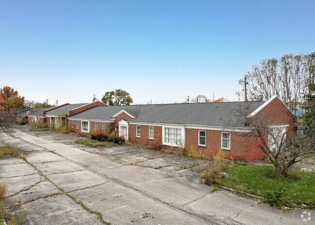
2511 E 46Th St, Indianapolis, IN 46205

Property Detail
2511 E 46Th St
49-07-17-100-034.000-801
IRREGULAR TRACT ATKINSON SQUARE 240FT X 317.6FT WL698.9FT NL X 208.6FT EL 393.3FT SL X 336.7FT ONALLISONVILLE RD BEG 215FT E OF NW COR S17 T16 R48.57AC
Apartment
Marion
ZO01
Indiana
B and X Area of moderate flood hazard, usually the area between the limits of the 100-year and 500-year floods.
52
2024
8.57 AC
2025
Uptown
322602
Indianapolis
25,340 SF
Indianapolis-Carmel-Greenwood, IN
NEARBY LISTINGS FOR SALE OR LEASE
DEMOGRAPHICS near 2511 E 46Th St
1 mile
3 mile
5 mile
2025 Total Population
9,148
105,158
259,194
2030 Population
9,310
107,475
265,809
Pop Growth 2025-2030
+ 1.77%
+ 2.20%
+ 2.55%
Average Age
37
38
38
2025 Total Households
4,664
45,670
113,250
HH Growth 2025-2030
+ 1.69%
+ 2.08%
+ 2.54%
Median Household Inc
$53,551
$65,870
$65,595
Avg Household Size
1.90
2.20
2.20
2025 Avg HH Vehicles
1.00
2.00
2.00
Median Home Value
$227,294
$293,405
$283,464
Median Year Built
1960
1954
1957
Nearby Places
Map Layers
Map Styles
 Street
 Aerial
Layers
 Traffic
 Biking
Places
Listings with unknown addresses are not visible on the map
- Restaurants
- Banks
- Shops
- Fitness
- Groceries
PUBLIC TRANSPORTATION
COMMUTER RAIL
Indianapolis (Cardinal - Amtrak)
Drive
Walk
Distance
Indianapolis (Cardinal - Amtrak)
14 min
7.3 mi
AIRPORT
Indianapolis International
Drive
Walk
Distance
Indianapolis International
35 min
20.2 mi
Freight Ports
Port of Toledo
Drive
Walk
Distance
Port of Toledo
259 min
219.2 mi
SALE & LEASE HISTORY
LISTING DATE
SALE/LEASE

Sep 24, 2016
For Lease
Jan 18, 2018
For Lease
Feb 21, 2017
For Lease
Aug 10, 2017
For Sale
Nearby Properties
Address
Land Use
TOTAL SIZE
Lot Size
Zoning
Address
Land Use
TOTAL SIZE
Lot Size
Zoning
4,808 SF
5.76 AC
ZO01
Address
Land Use
TOTAL SIZE
Lot Size
Zoning
143,890 SF
37.81 AC
ZO01
Address
Land Use
TOTAL SIZE
Lot Size
Zoning
866 SF
14.33 AC
ZO01
Address
Land Use
TOTAL SIZE
Lot Size
Zoning
76,657 SF
8.85 AC
ZO01
Address
Land Use
TOTAL SIZE
Lot Size
Zoning
207,800 SF
2.23 AC
ZO01
Address
Land Use
TOTAL SIZE
Lot Size
Zoning
2,142 SF
9.91 AC
ZO01
Address
Land Use
TOTAL SIZE
Lot Size
Zoning
3,200 SF
3.51 AC
ZO01
Address
Land Use
TOTAL SIZE
Lot Size
Zoning
23,195 SF
31.18 AC
Address
Land Use
TOTAL SIZE
Lot Size
Zoning
13,789 SF
3.93 AC
ZO01
Address
Land Use
TOTAL SIZE
Lot Size
Zoning
2,156 SF
0.46 AC
ZO01
Address
Land Use
TOTAL SIZE
Lot Size
Zoning
2,313 SF
35.45 AC
ZO01
Address
Land Use
TOTAL SIZE
Lot Size
Zoning
98,790 SF
0.18 AC
ZO01
Address
Land Use
TOTAL SIZE
Lot Size
Zoning
5,670 SF
25.69 AC
Address
Land Use
TOTAL SIZE
Lot Size
Zoning
2.81 AC
ZO01
Address
Land Use
TOTAL SIZE
Lot Size
Zoning
55,047 SF
2.01 AC
ZO01
Address
Land Use
TOTAL SIZE
Lot Size
Zoning
7,740 SF
2.04 AC
ZO01
Address
Land Use
TOTAL SIZE
Lot Size
Zoning
135,000 SF
3.31 AC
Address
Land Use
TOTAL SIZE
Lot Size
Zoning
1,903 SF
20.77 AC
ZO01
Address
Land Use
TOTAL SIZE
Lot Size
Zoning
1,528 SF
15.64 AC
ZO01
Address
Land Use
TOTAL SIZE
Lot Size
Zoning
98,160 SF
0.65 AC
ZO01
Address
Land Use
TOTAL SIZE
Lot Size
Zoning
17,621 SF
3.20 AC
ZO01
Address
Land Use
TOTAL SIZE
Lot Size
Zoning
17,469 SF
0.87 AC
ZO01
Address
Land Use
TOTAL SIZE
Lot Size
Zoning
2,951 SF
15.45 AC
ZO01
Address
Land Use
TOTAL SIZE
Lot Size
Zoning
66,953 SF
10.87 AC
ZO01
Address
Land Use
TOTAL SIZE
Lot Size
Zoning
1,551 SF
1.23 AC
ZO01
Address
Land Use
TOTAL SIZE
Lot Size
Zoning
29,624 SF
2.56 AC
ZO01
Address
Land Use
TOTAL SIZE
Lot Size
Zoning
2,927 SF
8.75 AC
ZO01
Address
Land Use
TOTAL SIZE
Lot Size
Zoning
188,212 SF
28.51 AC
Address
Land Use
TOTAL SIZE
Lot Size
Zoning
48,300 SF
36.34 AC
The World's #1 Commercial Real Estate Marketplace
Connect with us
© 2026 CoStar Group
The information above has been obtained from sources believed reliable. While we do not doubt its accuracy we have not verified it and make no guarantee, warranty or representation about it. It is your responsibility to independently confirm its accuracy and completeness. Any projections, opinions, assumptions, or estimates used are for example only and do not represent the current or future performance of the property. The value of this transaction to you depends on tax and other factors which should be evaluated by your tax, financial, and legal advisors. You and your advisors should conduct a careful, independent investigation of the property to determine to your satisfaction the suitability of the property for your needs.