Property Record
2511 W Mount Houston Rd, Houston, TX 77038

NEARBY LISTINGS FOR SALE OR LEASE
Property Detail
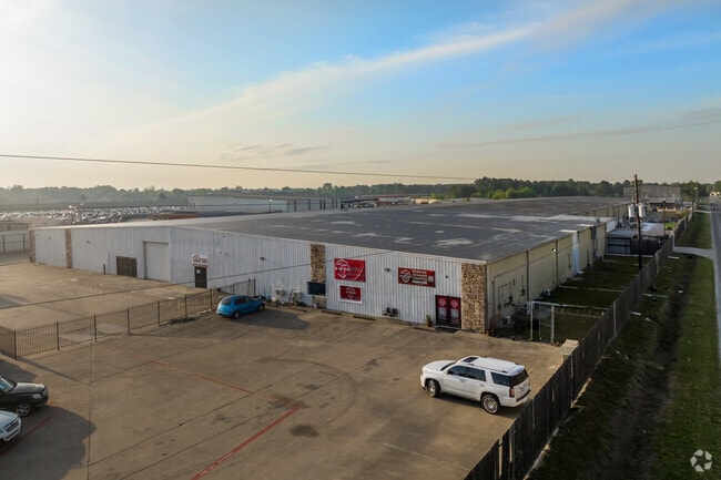
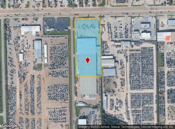
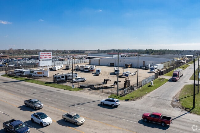
2511 W Mount Houston Rd
1169390000014
West Mount Houston Office Park
Warehouse
RES B1 WEST MOUNT HOUSTON OFFICE PARK
X
Harris
48201C0465M
Texas
2024
4.76 AC
2025
North Fwy/Tomball Pky
533402
Houston
91,353 SF
Houston-The Woodlands-Sugar Land, TX
DEMOGRAPHICS near 2511 W Mount Houston Rd
1 Mile
3 Mile
5 Mile
2024 Total Population
13,222
102,654
328,843
2029 Population
13,248
104,216
333,893
Pop Growth 2024-2029
+ 0.20%
+ 1.52%
+ 1.54%
Average Age
33
36
35
2024 Total Households
3,732
31,556
106,931
HH Growth 2024-2029
+ 0.21%
+ 1.57%
+ 1.58%
Median Household Inc
$48,351
$43,892
$43,649
Avg Household Size
3.50
3.20
3.00
2024 Avg HH Vehicles
2.00
2.00
2.00
Median Home Value
$165,818
$161,272
$171,852
Median Year Built
1991
1979
1979
Nearby Places
- Restaurants
- Banks
- Shops
- Fitness
- Groceries
PUBLIC TRANSPORTATION
AIRPORT
George Bush Intcntl/Houston
DRIVE
WALK
Distance
George Bush Intcntl/Houston
19 min
13.1 mi
William P Hobby
DRIVE
WALK
Distance
William P Hobby
39 min
24.4 mi
Freight Ports
Port of Houston
DRIVE
WALK
Distance
Port of Houston
31 min
19.9 mi
SALE & LEASE HISTORY
LISTING DATE
SALE/LEASE

Sep 20, 2024
For Sale
Sep 05, 2018
For Sale
May 09, 2023
For Sale
Mar 10, 2023
For Lease
Jan 03, 2018
For Sale
Feb 10, 2025
For Lease
Dec 12, 2017
For Lease
Nearby Properties
Address
Land Use
TOTAL SIZE
Lot Size
Zoning
Address
Land Use
TOTAL SIZE
Lot Size
Zoning
858,420 SF
60.71 AC
Address
Land Use
TOTAL SIZE
Lot Size
Zoning
145.62 AC
Address
Land Use
TOTAL SIZE
Lot Size
Zoning
594,105 SF
43.68 AC
Address
Land Use
TOTAL SIZE
Lot Size
Zoning
614,256 SF
31.25 AC
Address
Land Use
TOTAL SIZE
Lot Size
Zoning
608,784 SF
29.08 AC
Address
Land Use
TOTAL SIZE
Lot Size
Zoning
718,600 SF
42.09 AC
Address
Land Use
TOTAL SIZE
Lot Size
Zoning
504,000 SF
32.25 AC
Address
Land Use
TOTAL SIZE
Lot Size
Zoning
356,900 SF
19.38 AC
Address
Land Use
TOTAL SIZE
Lot Size
Zoning
284,476 SF
20 AC
Address
Land Use
TOTAL SIZE
Lot Size
Zoning
261,000 SF
13.89 AC
Address
Land Use
TOTAL SIZE
Lot Size
Zoning
250,660 SF
14.22 AC
Address
Land Use
TOTAL SIZE
Lot Size
Zoning
193,972 SF
14.59 AC
Address
Land Use
TOTAL SIZE
Lot Size
Zoning
221,810 SF
13.96 AC
Address
Land Use
TOTAL SIZE
Lot Size
Zoning
218,734 SF
11.24 AC
Address
Land Use
TOTAL SIZE
Lot Size
Zoning
333,286 SF
13.95 AC
Address
Land Use
TOTAL SIZE
Lot Size
Zoning
361,869 SF
39.62 AC
Address
Land Use
TOTAL SIZE
Lot Size
Zoning
264,996 SF
18.95 AC
Address
Land Use
TOTAL SIZE
Lot Size
Zoning
139,886 SF
10.02 AC
Address
Land Use
TOTAL SIZE
Lot Size
Zoning
190,543 SF
9.09 AC
Address
Land Use
TOTAL SIZE
Lot Size
Zoning
184,169 SF
8 AC
Address
Land Use
TOTAL SIZE
Lot Size
Zoning
239,721 SF
8.98 AC
Address
Land Use
TOTAL SIZE
Lot Size
Zoning
178,824 SF
5.85 AC
Address
Land Use
TOTAL SIZE
Lot Size
Zoning
209,397 SF
11.43 AC
Address
Land Use
TOTAL SIZE
Lot Size
Zoning
137,353 SF
15.25 AC
Address
Land Use
TOTAL SIZE
Lot Size
Zoning
145,200 SF
10.65 AC
Address
Land Use
TOTAL SIZE
Lot Size
Zoning
283,375 SF
13 AC
Address
Land Use
TOTAL SIZE
Lot Size
Zoning
105,200 SF
11.60 AC
Address
Land Use
TOTAL SIZE
Lot Size
Zoning
43.68 AC
Address
Land Use
TOTAL SIZE
Lot Size
Zoning
293,049 SF
27.06 AC
Address
Land Use
TOTAL SIZE
Lot Size
Zoning
328,951 SF
11.92 AC
The World's #1 Commercial Real Estate Marketplace
Connect with us
© 2025 CoStar Group
The information above has been obtained from sources believed reliable. While we do not doubt its accuracy we have not verified it and make no guarantee, warranty or representation about it. It is your responsibility to independently confirm its accuracy and completeness. Any projections, opinions, assumptions, or estimates used are for example only and do not represent the current or future performance of the property. The value of this transaction to you depends on tax and other factors which should be evaluated by your tax, financial, and legal advisors. You and your advisors should conduct a careful, independent investigation of the property to determine to your satisfaction the suitability of the property for your needs.