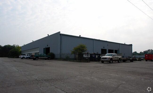
Property Record
25125 Trans X Rd, Novi, MI 48375


NEARBY LISTINGS FOR SALE OR LEASE
Property Detail
25125 Trans X Rd
22-23-326-008
T1N, R8E, SEC 23 PART OF SW 1/4 BEG AT PT DIST S 1137.46 FT & S 70-45-00 E1411.43 FT & S 00-04-52 W 1034.04 FT & N 89-40-40 E
Commercialnec
Oakland
X
Michigan
26163C0030E
3.34 AC
2024
Central I-96 Corridor
2023
Detroit
136601
Detroit-Warren-Dearborn, MI
12,306 SF
DEMOGRAPHICS near 25125 Trans X Rd
1 Mile
3 Mile
5 Mile
2024 Total Population
8,069
61,807
163,495
2029 Population
8,075
61,389
160,568
Pop Growth 2024-2029
+ 0.07%
(0.68%)
(1.79%)
Average Age
39
42
42
2024 Total Households
3,304
25,331
69,430
HH Growth 2024-2029
+ 0.18%
(0.63%)
(1.86%)
Median Household Inc
$105,994
$110,506
$98,214
Avg Household Size
2.40
2.40
2.30
2024 Avg HH Vehicles
2.00
2.00
2.00
Median Home Value
$331,703
$373,354
$371,147
Median Year Built
1987
1987
1987
Nearby Places
Map Layers
Map Styles
 Street
 Aerial
- Restaurants
- Banks
- Shops
- Fitness
- Groceries
PUBLIC TRANSPORTATION
AIRPORT
Detroit Metro Wayne County
DRIVE
WALK
Distance
Detroit Metro Wayne County
34 min
27.8 mi
Windsor International
DRIVE
WALK
Distance
Windsor International
60 min
38.3 mi
Freight Ports
Port of Toledo
DRIVE
WALK
Distance
Port of Toledo
83 min
69.4 mi
SALE & LEASE HISTORY
LISTING DATE
SALE/LEASE

Apr 17, 2019
For Sale
Apr 08, 2019
For Lease
Apr 08, 2019
For Sale
Nearby Properties
Address
Land Use
TOTAL SIZE
Lot Size
Zoning
Address
Land Use
TOTAL SIZE
Lot Size
Zoning
162,600 SF
102.81 AC
RM-1
Address
Land Use
TOTAL SIZE
Lot Size
Zoning
486,998 SF
24.18 AC
R-C
Address
Land Use
TOTAL SIZE
Lot Size
Zoning
886 SF
26.58 AC
GATEWY
Address
Land Use
TOTAL SIZE
Lot Size
Zoning
57.28 AC
RM-1
Address
Land Use
TOTAL SIZE
Lot Size
Zoning
152,130 SF
64.46 AC
R-C
Address
Land Use
TOTAL SIZE
Lot Size
Zoning
12,872 SF
43.06 AC
RM-1
Address
Land Use
TOTAL SIZE
Lot Size
Zoning
507,334 SF
49.09 AC
II
Address
Land Use
TOTAL SIZE
Lot Size
Zoning
20.71 AC
OSC
Address
Land Use
TOTAL SIZE
Lot Size
Zoning
9.72 AC
OS-1
Address
Land Use
TOTAL SIZE
Lot Size
Zoning
42.06 AC
RM-1
Address
Land Use
TOTAL SIZE
Lot Size
Zoning
1,792 SF
59.30 AC
OST
Address
Land Use
TOTAL SIZE
Lot Size
Zoning
17,277 SF
17.73 AC
R-A
Address
Land Use
TOTAL SIZE
Lot Size
Zoning
38 AC
RM-1
Address
Land Use
TOTAL SIZE
Lot Size
Zoning
14,463 SF
26.97 AC
TC-1
Address
Land Use
TOTAL SIZE
Lot Size
Zoning
144.50 AC
OSC
Address
Land Use
TOTAL SIZE
Lot Size
Zoning
63.31 AC
OST-EXO
Address
Land Use
TOTAL SIZE
Lot Size
Zoning
327,206 SF
29.93 AC
AI
Address
Land Use
TOTAL SIZE
Lot Size
Zoning
433,306 SF
39.80 AC
II
Address
Land Use
TOTAL SIZE
Lot Size
Zoning
184,225 SF
13.84 AC
OSC
Address
Land Use
TOTAL SIZE
Lot Size
Zoning
63,152 SF
14 AC
R-C
Address
Land Use
TOTAL SIZE
Lot Size
Zoning
103,882 SF
34.97 AC
TC
Address
Land Use
TOTAL SIZE
Lot Size
Zoning
278,387 SF
22.51 AC
II
Address
Land Use
TOTAL SIZE
Lot Size
Zoning
226,753 SF
27.92 AC
AI
Address
Land Use
TOTAL SIZE
Lot Size
Zoning
19.26 AC
R-A
Address
Land Use
TOTAL SIZE
Lot Size
Zoning
2,073 SF
116.28 AC
MH
Address
Land Use
TOTAL SIZE
Lot Size
Zoning
30.32 AC
RM-1
Address
Land Use
TOTAL SIZE
Lot Size
Zoning
5,339 SF
20.10 AC
R-3
Address
Land Use
TOTAL SIZE
Lot Size
Zoning
97,000 SF
18.75 AC
R-C
Address
Land Use
TOTAL SIZE
Lot Size
Zoning
OST-EXO
Address
Land Use
TOTAL SIZE
Lot Size
Zoning
439,433 SF
22.32 AC
I-1
The World's #1 Commercial Real Estate Marketplace
Connect with us
© 2025 CoStar Group
The information above has been obtained from sources believed reliable. While we do not doubt its accuracy we have not verified it and make no guarantee, warranty or representation about it. It is your responsibility to independently confirm its accuracy and completeness. Any projections, opinions, assumptions, or estimates used are for example only and do not represent the current or future performance of the property. The value of this transaction to you depends on tax and other factors which should be evaluated by your tax, financial, and legal advisors. You and your advisors should conduct a careful, independent investigation of the property to determine to your satisfaction the suitability of the property for your needs.