Property Record
2515 Harvest Ln, Owatonna, MN 55060

NEARBY LISTINGS FOR SALE OR LEASE
Property Detail
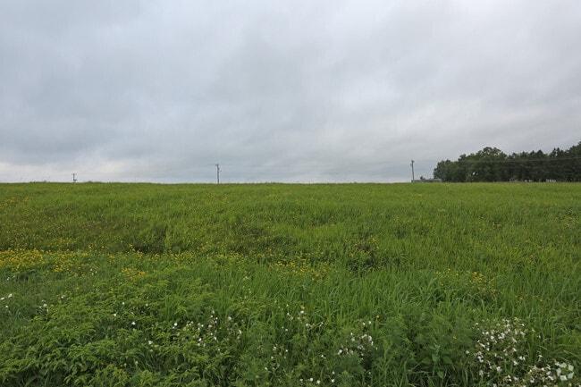
2515 Harvest Ln
Owatonna, MN
Daybreak Addition
17-592-0201
BLK 2 LOT 1 DAYBREAK ADDITION
Religious
Steele
X
Minnesota
27147C0132C
1
0
7 AC
2025
Minnesota South Area
960400
Other Market Areas
18,696 SF
DEMOGRAPHICS near 2515 Harvest Ln
1 Mile
3 Mile
5 Mile
2024 Total Population
627
18,506
30,013
2029 Population
615
18,533
30,022
Pop Growth 2024-2029
(1.91%)
+ 0.15%
+ 0.03%
Average Age
41
39
40
2024 Total Households
284
7,468
11,960
HH Growth 2024-2029
(1.76%)
+ 0.16%
+ 0.04%
Median Household Inc
$39,843
$66,920
$74,491
Avg Household Size
2.10
2.40
2.40
2024 Avg HH Vehicles
2.00
2.00
2.00
Median Home Value
$115,217
$185,927
$207,574
Median Year Built
1969
1972
1975
Nearby Places
Map Layers
Map Styles
 Street
 Aerial
- Restaurants
- Banks
- Shops
- Fitness
- Groceries
SALE & LEASE HISTORY
LISTING DATE
SALE/LEASE

Aug 21, 2017
For Sale
Nearby Properties
Address
Land Use
TOTAL SIZE
Lot Size
Zoning
Address
Land Use
TOTAL SIZE
Lot Size
Zoning
107,134 SF
19.48 AC
Address
Land Use
TOTAL SIZE
Lot Size
Zoning
139,037 SF
20 AC
Address
Land Use
TOTAL SIZE
Lot Size
Zoning
975,108 SF
54.99 AC
Address
Land Use
TOTAL SIZE
Lot Size
Zoning
134,234 SF
17.31 AC
Address
Land Use
TOTAL SIZE
Lot Size
Zoning
339,400 SF
148.03 AC
Address
Land Use
TOTAL SIZE
Lot Size
Zoning
56,981 SF
18.60 AC
Address
Land Use
TOTAL SIZE
Lot Size
Zoning
473,667 SF
52 AC
Address
Land Use
TOTAL SIZE
Lot Size
Zoning
184,335 SF
13.81 AC
Address
Land Use
TOTAL SIZE
Lot Size
Zoning
489,600 SF
33.86 AC
Address
Land Use
TOTAL SIZE
Lot Size
Zoning
46,729 SF
4.88 AC
Address
Land Use
TOTAL SIZE
Lot Size
Zoning
81,489 SF
7.46 AC
Address
Land Use
TOTAL SIZE
Lot Size
Zoning
2.21 AC
Address
Land Use
TOTAL SIZE
Lot Size
Zoning
56,723 SF
37.39 AC
Address
Land Use
TOTAL SIZE
Lot Size
Zoning
43,336 SF
46.29 AC
Address
Land Use
TOTAL SIZE
Lot Size
Zoning
52,792 SF
6.82 AC
Address
Land Use
TOTAL SIZE
Lot Size
Zoning
79,370 SF
2.66 AC
Address
Land Use
TOTAL SIZE
Lot Size
Zoning
265,824 SF
18.62 AC
Address
Land Use
TOTAL SIZE
Lot Size
Zoning
115,815 SF
21.06 AC
Address
Land Use
TOTAL SIZE
Lot Size
Zoning
164,342 SF
25.21 AC
Address
Land Use
TOTAL SIZE
Lot Size
Zoning
194,250 SF
11.67 AC
Address
Land Use
TOTAL SIZE
Lot Size
Zoning
64,440 SF
27.88 AC
Address
Land Use
TOTAL SIZE
Lot Size
Zoning
Address
Land Use
TOTAL SIZE
Lot Size
Zoning
37,840 SF
45 AC
Address
Land Use
TOTAL SIZE
Lot Size
Zoning
71,411 SF
3.22 AC
Address
Land Use
TOTAL SIZE
Lot Size
Zoning
69,676 SF
3.74 AC
Address
Land Use
TOTAL SIZE
Lot Size
Zoning
69,676 SF
2.93 AC
Address
Land Use
TOTAL SIZE
Lot Size
Zoning
66,747 SF
0.94 AC
Address
Land Use
TOTAL SIZE
Lot Size
Zoning
78,650 SF
224.09 AC
Address
Land Use
TOTAL SIZE
Lot Size
Zoning
54,395 SF
8.34 AC
Address
Land Use
TOTAL SIZE
Lot Size
Zoning
159,102 SF
15.96 AC
The World's #1 Commercial Real Estate Marketplace
Connect with us
© 2026 CoStar Group
The information above has been obtained from sources believed reliable. While we do not doubt its accuracy we have not verified it and make no guarantee, warranty or representation about it. It is your responsibility to independently confirm its accuracy and completeness. Any projections, opinions, assumptions, or estimates used are for example only and do not represent the current or future performance of the property. The value of this transaction to you depends on tax and other factors which should be evaluated by your tax, financial, and legal advisors. You and your advisors should conduct a careful, independent investigation of the property to determine to your satisfaction the suitability of the property for your needs.