Property Record
2517 Applebutter Rd, Hellertown, PA 18055

NEARBY LISTINGS FOR SALE OR LEASE
Property Detail
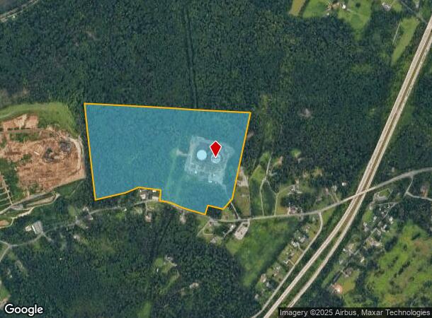
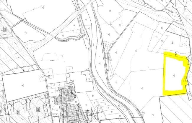
2517 Applebutter Rd
Shipyard
Northampton
X
Pennsylvania
42095C0268E
87.78 AC
2025
Lehigh Valley
2025
Philadelphia
018001
Allentown-Bethlehem-Easton, PA-NJ
1,800 SF
N8-14-15-0719
DEMOGRAPHICS near 2517 Applebutter Rd
1 Mile
3 Mile
5 Mile
2024 Total Population
330
29,566
118,500
2029 Population
332
29,652
118,964
Pop Growth 2024-2029
+ 0.61%
+ 0.29%
+ 0.39%
Average Age
44
43
41
2024 Total Households
121
11,448
46,022
HH Growth 2024-2029
+ 0.83%
+ 0.35%
+ 0.43%
Median Household Inc
$82,237
$93,147
$78,081
Avg Household Size
2.70
2.50
2.40
2024 Avg HH Vehicles
2.00
2.00
2.00
Median Home Value
$374,999
$276,878
$254,853
Median Year Built
1976
1982
1965
Nearby Places
Map Layers
Map Styles
 Street
 Aerial
- Restaurants
- Banks
- Shops
- Fitness
- Groceries
PUBLIC TRANSPORTATION
AIRPORT
Lehigh Valley International
DRIVE
WALK
Distance
Lehigh Valley International
25 min
11.0 mi
Freight Ports
Port of Philadelphia
DRIVE
WALK
Distance
Port of Philadelphia
93 min
54.9 mi
SALE & LEASE HISTORY
LISTING DATE
SALE/LEASE

Sep 24, 2016
For Sale
Nearby Properties
Address
Land Use
TOTAL SIZE
Lot Size
Zoning
Address
Land Use
TOTAL SIZE
Lot Size
Zoning
1,197,396 SF
57.03 AC
HI
Address
Land Use
TOTAL SIZE
Lot Size
Zoning
1,200,000 SF
107.27 AC
HI
Address
Land Use
TOTAL SIZE
Lot Size
Zoning
1,710,800 SF
68.08 AC
HI
Address
Land Use
TOTAL SIZE
Lot Size
Zoning
148,804 SF
22.75 AC
OB
Address
Land Use
TOTAL SIZE
Lot Size
Zoning
26,653 SF
13.51 AC
HI
Address
Land Use
TOTAL SIZE
Lot Size
Zoning
800,280 SF
18.20 AC
HI
Address
Land Use
TOTAL SIZE
Lot Size
Zoning
800,250 SF
40.07 AC
HI
Address
Land Use
TOTAL SIZE
Lot Size
Zoning
676,788 SF
39.39 AC
HI
Address
Land Use
TOTAL SIZE
Lot Size
Zoning
3,400 SF
65.07 AC
RM
Address
Land Use
TOTAL SIZE
Lot Size
Zoning
421,883 SF
34.66 AC
HI
Address
Land Use
TOTAL SIZE
Lot Size
Zoning
56,276 SF
14.91 AC
RR
Address
Land Use
TOTAL SIZE
Lot Size
Zoning
809,830 SF
25.68 AC
HI
Address
Land Use
TOTAL SIZE
Lot Size
Zoning
809,830 SF
21.93 AC
HI
Address
Land Use
TOTAL SIZE
Lot Size
Zoning
536,726 SF
12.02 AC
HI
Address
Land Use
TOTAL SIZE
Lot Size
Zoning
508,842 SF
26.64 AC
HI
Address
Land Use
TOTAL SIZE
Lot Size
Zoning
56,276 SF
6.94 AC
RR
Address
Land Use
TOTAL SIZE
Lot Size
Zoning
45.04 AC
HI
Address
Land Use
TOTAL SIZE
Lot Size
Zoning
182,845 SF
12.09 AC
HI
Address
Land Use
TOTAL SIZE
Lot Size
Zoning
137,060 SF
16.16 AC
OB
Address
Land Use
TOTAL SIZE
Lot Size
Zoning
3,055 SF
7.06 AC
OB
Address
Land Use
TOTAL SIZE
Lot Size
Zoning
246,960 SF
17.02 AC
HI
Address
Land Use
TOTAL SIZE
Lot Size
Zoning
73,506 SF
6.32 AC
OB
Address
Land Use
TOTAL SIZE
Lot Size
Zoning
10,240 SF
12.86 AC
RM
Address
Land Use
TOTAL SIZE
Lot Size
Zoning
1,536 SF
224.03 AC
RA
Address
Land Use
TOTAL SIZE
Lot Size
Zoning
56,276 SF
4.91 AC
RR
Address
Land Use
TOTAL SIZE
Lot Size
Zoning
297,384 SF
27.24 AC
HI
Address
Land Use
TOTAL SIZE
Lot Size
Zoning
56,516 SF
31.79 AC
HI
Address
Land Use
TOTAL SIZE
Lot Size
Zoning
183,401 SF
10.71 AC
OB
Address
Land Use
TOTAL SIZE
Lot Size
Zoning
213,970 SF
13.22 AC
HI
The World's #1 Commercial Real Estate Marketplace
Connect with us
© 2025 CoStar Group
The information above has been obtained from sources believed reliable. While we do not doubt its accuracy we have not verified it and make no guarantee, warranty or representation about it. It is your responsibility to independently confirm its accuracy and completeness. Any projections, opinions, assumptions, or estimates used are for example only and do not represent the current or future performance of the property. The value of this transaction to you depends on tax and other factors which should be evaluated by your tax, financial, and legal advisors. You and your advisors should conduct a careful, independent investigation of the property to determine to your satisfaction the suitability of the property for your needs.