Property Record
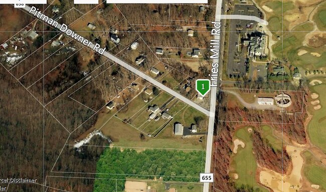
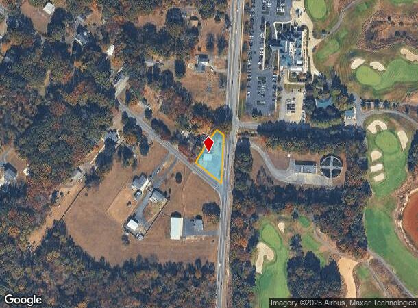
2517 Fries Mill Rd, Williamstown, NJ 08094
NEARBY LISTINGS FOR SALE OR LEASE
Property Detail
2517 Fries Mill Rd
11-14801-0000-00027
Gloucester
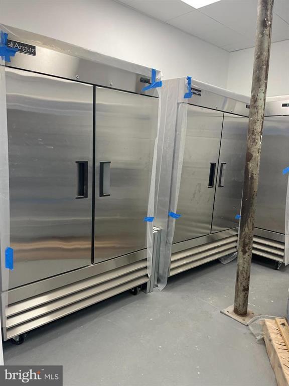
Storebuilding
New Jersey
X
27
34015C0208E
0.36 AC
2024
Gloucester County
2025
Philadelphia
501609
Philadelphia-Camden-Wilmington, PA-NJ-DE-MD
3,366 SF
DEMOGRAPHICS near 2517 Fries Mill Rd
1 Mile
3 Mile
5 Mile
2024 Total Population
1,979
42,265
141,084
2029 Population
2,059
43,664
145,086
Pop Growth 2024-2029
+ 4.04%
+ 3.31%
+ 2.84%
Average Age
41
41
40
2024 Total Households
701
15,623
49,428
HH Growth 2024-2029
+ 4.42%
+ 3.41%
+ 3.00%
Median Household Inc
$89,962
$94,313
$99,299
Avg Household Size
2.70
2.60
2.70
2024 Avg HH Vehicles
2.00
2.00
2.00
Median Home Value
$339,302
$279,825
$255,136
Median Year Built
1996
1985
1982
Nearby Places
Map Layers
Map Styles
 Street
 Aerial
- Restaurants
- Banks
- Shops
- Fitness
- Groceries
PUBLIC TRANSPORTATION
AIRPORT
Philadelphia International
DRIVE
WALK
Distance
Philadelphia International
41 min
25.0 mi
Freight Ports
Broadway Terminal - Pier 5
DRIVE
WALK
Distance
Broadway Terminal - Pier 5
25 min
16.4 mi
SALE & LEASE HISTORY
LISTING DATE
SALE/LEASE

Mar 24, 2017
For Sale
Jan 16, 2019
For Sale
Jan 09, 2017
For Sale
Feb 11, 2020
For Sale
Aug 11, 2024
For Sale
Nearby Properties
Address
Land Use
TOTAL SIZE
Lot Size
Zoning
Address
Land Use
TOTAL SIZE
Lot Size
Zoning
14.21 AC
INS
Address
Land Use
TOTAL SIZE
Lot Size
Zoning
64.09 AC
HC
Address
Land Use
TOTAL SIZE
Lot Size
Zoning
38.92 AC
HC
Address
Land Use
TOTAL SIZE
Lot Size
Zoning
46.45 AC
RGMR
Address
Land Use
TOTAL SIZE
Lot Size
Zoning
74.69 AC
RGMR
Address
Land Use
TOTAL SIZE
Lot Size
Zoning
26.77 AC
HC
Address
Land Use
TOTAL SIZE
Lot Size
Zoning
14.07 AC
Address
Land Use
TOTAL SIZE
Lot Size
Zoning
18.02 AC
HC
Address
Land Use
TOTAL SIZE
Lot Size
Zoning
26.35 AC
R4
Address
Land Use
TOTAL SIZE
Lot Size
Zoning
14.57 AC
P
Address
Land Use
TOTAL SIZE
Lot Size
Zoning
37.40 AC
CF/I
Address
Land Use
TOTAL SIZE
Lot Size
Zoning
14.92 AC
HC
Address
Land Use
TOTAL SIZE
Lot Size
Zoning
7.04 AC
INS
Address
Land Use
TOTAL SIZE
Lot Size
Zoning
4.76 AC
Address
Land Use
TOTAL SIZE
Lot Size
Zoning
136,951 SF
18 AC
HC
Address
Land Use
TOTAL SIZE
Lot Size
Zoning
13.69 AC
CC
Address
Land Use
TOTAL SIZE
Lot Size
Zoning
15.45 AC
HC
Address
Land Use
TOTAL SIZE
Lot Size
Zoning
19.86 AC
HC
Address
Land Use
TOTAL SIZE
Lot Size
Zoning
6.27 AC
R
Address
Land Use
TOTAL SIZE
Lot Size
Zoning
21.14 AC
CF/I
Address
Land Use
TOTAL SIZE
Lot Size
Zoning
13.94 AC
INS
Address
Land Use
TOTAL SIZE
Lot Size
Zoning
25.12 AC
PR3
Address
Land Use
TOTAL SIZE
Lot Size
Zoning
20.08 AC
INS
Address
Land Use
TOTAL SIZE
Lot Size
Zoning
35.07 AC
Address
Land Use
TOTAL SIZE
Lot Size
Zoning
9.76 AC
R2
Address
Land Use
TOTAL SIZE
Lot Size
Zoning
31.75 AC
INS
Address
Land Use
TOTAL SIZE
Lot Size
Zoning
7.69 AC
RG30
Address
Land Use
TOTAL SIZE
Lot Size
Zoning
5.60 AC
Address
Land Use
TOTAL SIZE
Lot Size
Zoning
4.50 AC
R
Address
Land Use
TOTAL SIZE
Lot Size
Zoning
19.98 AC
INS
The World's #1 Commercial Real Estate Marketplace
Connect with us
© 2025 CoStar Group
The information above has been obtained from sources believed reliable. While we do not doubt its accuracy we have not verified it and make no guarantee, warranty or representation about it. It is your responsibility to independently confirm its accuracy and completeness. Any projections, opinions, assumptions, or estimates used are for example only and do not represent the current or future performance of the property. The value of this transaction to you depends on tax and other factors which should be evaluated by your tax, financial, and legal advisors. You and your advisors should conduct a careful, independent investigation of the property to determine to your satisfaction the suitability of the property for your needs.