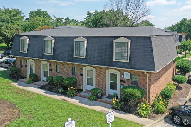
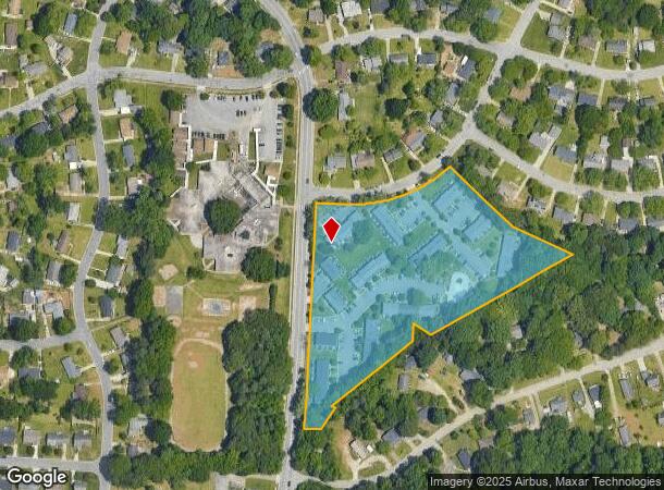
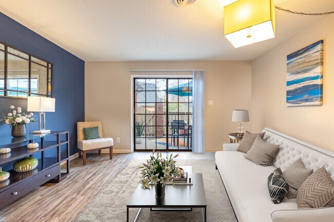
Property Record
2517 Lourance Blvd, Greensboro, NC 27407
NEARBY LISTINGS FOR SALE OR LEASE
Property Detail
2517 Lourance Blvd
Greensboro-High Point, NC
Four Seasons
0040775
FOUR SEASONS APTS/LOURANCE
Apartment
Guilford
X
North Carolina
3710785300J
26
2024
6.78 AC
2025
Rolling Roads
012610
Greensboro/Winston-Salem
45,045 SF
DEMOGRAPHICS near 2517 Lourance Blvd
1 Mile
3 Mile
5 Mile
2024 Total Population
9,380
76,832
170,159
2029 Population
9,266
76,606
169,954
Pop Growth 2024-2029
(1.22%)
(0.29%)
(0.12%)
Average Age
38
36
37
2024 Total Households
3,746
30,074
67,837
HH Growth 2024-2029
(1.23%)
(0.23%)
(0.03%)
Median Household Inc
$46,714
$44,834
$51,060
Avg Household Size
2.40
2.30
2.20
2024 Avg HH Vehicles
2.00
2.00
2.00
Median Home Value
$123,817
$136,514
$177,061
Median Year Built
1980
1979
1979
Nearby Places
Map Layers
Map Styles
 Street
 Aerial
- Restaurants
- Banks
- Shops
- Fitness
- Groceries
PUBLIC TRANSPORTATION
COMMUTER RAIL
Greensboro Station (Piedmont - North Carolina by Train (NC Train))
DRIVE
WALK
Distance
Greensboro Station (Piedmont - North Carolina by Train (NC Train))
8 min
4.6 mi
AIRPORT
Piedmont Triad International
DRIVE
WALK
Distance
Piedmont Triad International
21 min
9.7 mi
Freight Ports
Port of Wilmington
DRIVE
WALK
Distance
Port of Wilmington
246 min
212.8 mi
Nearby Properties
Address
Land Use
TOTAL SIZE
Lot Size
Zoning
Address
Land Use
TOTAL SIZE
Lot Size
Zoning
1,864,781 SF
96.17 AC
PI
Address
Land Use
TOTAL SIZE
Lot Size
Zoning
671,937 SF
44.01 AC
PI
Address
Land Use
TOTAL SIZE
Lot Size
Zoning
733,612 SF
19.38 AC
PI
Address
Land Use
TOTAL SIZE
Lot Size
Zoning
1,307,155 SF
60.56 AC
C-H
Address
Land Use
TOTAL SIZE
Lot Size
Zoning
957,290 SF
18.71 AC
C-H
Address
Land Use
TOTAL SIZE
Lot Size
Zoning
446,318 SF
125.67 AC
LI
Address
Land Use
TOTAL SIZE
Lot Size
Zoning
228,253 SF
11.21 AC
RM-18
Address
Land Use
TOTAL SIZE
Lot Size
Zoning
412,479 SF
19.68 AC
RM-26
Address
Land Use
TOTAL SIZE
Lot Size
Zoning
287,581 SF
39.35 AC
PI
Address
Land Use
TOTAL SIZE
Lot Size
Zoning
361,604 SF
16.55 AC
RM-18
Address
Land Use
TOTAL SIZE
Lot Size
Zoning
291,464 SF
17.51 AC
PI
Address
Land Use
TOTAL SIZE
Lot Size
Zoning
252,351 SF
9.48 AC
RM-18
Address
Land Use
TOTAL SIZE
Lot Size
Zoning
300,901 SF
20.39 AC
RM-18
Address
Land Use
TOTAL SIZE
Lot Size
Zoning
231,863 SF
7.96 AC
PUD
Address
Land Use
TOTAL SIZE
Lot Size
Zoning
182,499 SF
6.74 AC
O
Address
Land Use
TOTAL SIZE
Lot Size
Zoning
280,200 SF
19.28 AC
RM-12
Address
Land Use
TOTAL SIZE
Lot Size
Zoning
188,655 SF
13.16 AC
RM-18
Address
Land Use
TOTAL SIZE
Lot Size
Zoning
234,712 SF
13 AC
PI
Address
Land Use
TOTAL SIZE
Lot Size
Zoning
116,713 SF
4.53 AC
C-M
Address
Land Use
TOTAL SIZE
Lot Size
Zoning
211,723 SF
20.24 AC
RM-18
Address
Land Use
TOTAL SIZE
Lot Size
Zoning
582,543 SF
47.07 AC
C-M
Address
Land Use
TOTAL SIZE
Lot Size
Zoning
135,516 SF
3.53 AC
PI
Address
Land Use
TOTAL SIZE
Lot Size
Zoning
48,532 SF
11.60 AC
HI
Address
Land Use
TOTAL SIZE
Lot Size
Zoning
250,084 SF
5.46 AC
PI
Address
Land Use
TOTAL SIZE
Lot Size
Zoning
104,984 SF
1.97 AC
C-M
Address
Land Use
TOTAL SIZE
Lot Size
Zoning
153,507 SF
8.93 AC
PUD
Address
Land Use
TOTAL SIZE
Lot Size
Zoning
157,646 SF
6.42 AC
PUD
Address
Land Use
TOTAL SIZE
Lot Size
Zoning
104,984 SF
3.18 AC
C-M
Address
Land Use
TOTAL SIZE
Lot Size
Zoning
336,760 SF
55.13 AC
LI
Address
Land Use
TOTAL SIZE
Lot Size
Zoning
170,161 SF
4.18 AC
PUD
The World's #1 Commercial Real Estate Marketplace
Connect with us
© 2026 CoStar Group
The information above has been obtained from sources believed reliable. While we do not doubt its accuracy we have not verified it and make no guarantee, warranty or representation about it. It is your responsibility to independently confirm its accuracy and completeness. Any projections, opinions, assumptions, or estimates used are for example only and do not represent the current or future performance of the property. The value of this transaction to you depends on tax and other factors which should be evaluated by your tax, financial, and legal advisors. You and your advisors should conduct a careful, independent investigation of the property to determine to your satisfaction the suitability of the property for your needs.