Property Record
2518 Hamstrom Rd, Portage, IN 46368
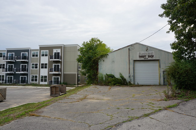
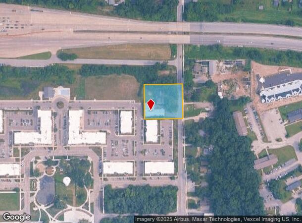
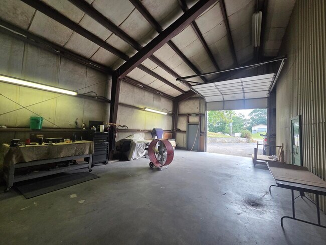
This Property Is For Sale
NEARBY LISTINGS FOR SALE OR LEASE
Property Detail
2518 Hamstrom Rd
Chicago-Naperville-Elgin, IL-IN-WI
Porter
64-05-13-201-013.000-016
Indiana
Sfr
0.75 AC
X
Porter County
18127C0108D
Chicago
8,384 SF
DEMOGRAPHICS near 2518 Hamstrom Rd
1 Mile
3 Mile
5 Mile
2024 Total Population
8,599
42,813
78,680
2029 Population
8,849
43,815
80,098
Pop Growth 2024-2029
+ 2.91%
+ 2.34%
+ 1.80%
Average Age
40
40
40
2024 Total Households
3,174
16,424
30,654
HH Growth 2024-2029
+ 3.02%
+ 2.39%
+ 1.84%
Median Household Inc
$79,771
$70,167
$65,942
Avg Household Size
2.60
2.50
2.50
2024 Avg HH Vehicles
2.00
2.00
2.00
Median Home Value
$223,570
$189,235
$181,071
Median Year Built
1978
1978
1975
Nearby Places
- Restaurants
- Banks
- Shops
- Fitness
- Groceries
PUBLIC TRANSPORTATION
COMMUTER RAIL
Ogden Dunes (Portage) Station (South Shore Line - Northern Indiana Commuter Transportation District (South Shore Line))
DRIVE
WALK
Distance
Ogden Dunes (Portage) Station (South Shore Line - Northern Indiana Commuter Transportation District (South Shore Line))
9 min
4.1 mi
Miller (Gary) Station (South Shore Line - Northern Indiana Commuter Transportation District (South Shore Line))
DRIVE
WALK
Distance
Miller (Gary) Station (South Shore Line - Northern Indiana Commuter Transportation District (South Shore Line))
13 min
6.4 mi
Freight Ports
Port Milwaukee
DRIVE
WALK
Distance
Port Milwaukee
159 min
126.0 mi
Nearby Properties
Address
Land Use
TOTAL SIZE
Lot Size
Zoning
Address
Land Use
TOTAL SIZE
Lot Size
Zoning
511,056 SF
131 SF
Address
Land Use
TOTAL SIZE
Lot Size
Zoning
567,109 SF
131 SF
Address
Land Use
TOTAL SIZE
Lot Size
Zoning
218,452 SF
87 SF
Address
Land Use
TOTAL SIZE
Lot Size
Zoning
400,440 SF
87 SF
Address
Land Use
TOTAL SIZE
Lot Size
Zoning
168,126 SF
44 SF
Address
Land Use
TOTAL SIZE
Lot Size
Zoning
169,427 SF
44 SF
Address
Land Use
TOTAL SIZE
Lot Size
Zoning
199,296 SF
87 SF
Address
Land Use
TOTAL SIZE
Lot Size
Zoning
215,770 SF
87 SF
Address
Land Use
TOTAL SIZE
Lot Size
Zoning
133,249 SF
44 SF
Address
Land Use
TOTAL SIZE
Lot Size
Zoning
112,216 SF
44 SF
Address
Land Use
TOTAL SIZE
Lot Size
Zoning
140,434 SF
15.26 AC
Address
Land Use
TOTAL SIZE
Lot Size
Zoning
69,459 SF
13.97 AC
Address
Land Use
TOTAL SIZE
Lot Size
Zoning
223,221 SF
87 SF
Address
Land Use
TOTAL SIZE
Lot Size
Zoning
118,798 SF
44 SF
Address
Land Use
TOTAL SIZE
Lot Size
Zoning
50,382 SF
9.83 AC
Address
Land Use
TOTAL SIZE
Lot Size
Zoning
95,281 SF
44 SF
Address
Land Use
TOTAL SIZE
Lot Size
Zoning
191,547 SF
87 SF
Address
Land Use
TOTAL SIZE
Lot Size
Zoning
78,620 SF
87 SF
Address
Land Use
TOTAL SIZE
Lot Size
Zoning
233,491 SF
174 SF
Address
Land Use
TOTAL SIZE
Lot Size
Zoning
73,376 SF
44 SF
Address
Land Use
TOTAL SIZE
Lot Size
Zoning
116,310 SF
131 SF
Address
Land Use
TOTAL SIZE
Lot Size
Zoning
48,955 SF
14.50 AC
Address
Land Use
TOTAL SIZE
Lot Size
Zoning
67,925 SF
2.97 AC
Address
Land Use
TOTAL SIZE
Lot Size
Zoning
124,160 SF
87 SF
Address
Land Use
TOTAL SIZE
Lot Size
Zoning
70,762 SF
3.04 AC
Address
Land Use
TOTAL SIZE
Lot Size
Zoning
96,488 SF
44 SF
Address
Land Use
TOTAL SIZE
Lot Size
Zoning
70,454 SF
1.14 AC
Address
Land Use
TOTAL SIZE
Lot Size
Zoning
70,454 SF
1.20 AC
Address
Land Use
TOTAL SIZE
Lot Size
Zoning
147,024 SF
44 SF
Address
Land Use
TOTAL SIZE
Lot Size
Zoning
61,561 SF
3.71 AC
The World's #1 Commercial Real Estate Marketplace
Connect with us
© 2025 CoStar Group
The information above has been obtained from sources believed reliable. While we do not doubt its accuracy we have not verified it and make no guarantee, warranty or representation about it. It is your responsibility to independently confirm its accuracy and completeness. Any projections, opinions, assumptions, or estimates used are for example only and do not represent the current or future performance of the property. The value of this transaction to you depends on tax and other factors which should be evaluated by your tax, financial, and legal advisors. You and your advisors should conduct a careful, independent investigation of the property to determine to your satisfaction the suitability of the property for your needs.