Property Record
2519 N Piedras St, El Paso, TX 79930


This Property Is For Sale
NEARBY LISTINGS FOR SALE OR LEASE
Property Detail
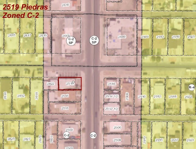
2519 N Piedras St
El Paso, TX
Highland Park
H453-999-1190-4500
119 HIGHLAND PARK N 40 FT OF 17 TO 19 (3000 SQ FT)
Commercialnec
El Paso
2024
Texas
2025
0.07 AC
001001
Northeast
880 SF
El Paso
DEMOGRAPHICS near 2519 N Piedras St
1 Mile
3 Mile
5 Mile
2024 Total Population
18,082
90,581
175,263
2029 Population
18,519
92,664
178,863
Pop Growth 2024-2029
+ 2.42%
+ 2.30%
+ 2.05%
Average Age
40
38
38
2024 Total Households
7,353
35,586
68,212
HH Growth 2024-2029
+ 2.75%
+ 2.27%
+ 2.05%
Median Household Inc
$45,474
$35,164
$35,198
Avg Household Size
2.40
2.40
2.40
2024 Avg HH Vehicles
2.00
2.00
2.00
Median Home Value
$128,580
$141,212
$144,269
Median Year Built
1954
1959
1966
Nearby Places
Map Layers
Map Styles
 Street
 Aerial
- Restaurants
- Banks
- Shops
- Fitness
- Groceries
PUBLIC TRANSPORTATION
AIRPORT
El Paso International
DRIVE
WALK
Distance
El Paso International
20 min
9.9 mi
Nearby Properties
Address
Land Use
TOTAL SIZE
Lot Size
Zoning
Address
Land Use
TOTAL SIZE
Lot Size
Zoning
237,300 SF
4.99 AC
M1
Address
Land Use
TOTAL SIZE
Lot Size
Zoning
315,094 SF
2.22 AC
M1S
Address
Land Use
TOTAL SIZE
Lot Size
Zoning
230,968 SF
10.69 AC
C4
Address
Land Use
TOTAL SIZE
Lot Size
Zoning
89,935 SF
7.01 AC
PMD
Address
Land Use
TOTAL SIZE
Lot Size
Zoning
169,031 SF
1.22 AC
SP
Address
Land Use
TOTAL SIZE
Lot Size
Zoning
313,532 SF
5.73 AC
C1S
Address
Land Use
TOTAL SIZE
Lot Size
Zoning
289,146 SF
11.87 AC
C1S
Address
Land Use
TOTAL SIZE
Lot Size
Zoning
213,351 SF
12 AC
C3S
Address
Land Use
TOTAL SIZE
Lot Size
Zoning
128,916 SF
1.50 AC
C5
Address
Land Use
TOTAL SIZE
Lot Size
Zoning
142,858 SF
0.17 AC
R3H
Address
Land Use
TOTAL SIZE
Lot Size
Zoning
156,184 SF
8.39 AC
R5S
Address
Land Use
TOTAL SIZE
Lot Size
Zoning
97,809 SF
20.31 AC
C3S
Address
Land Use
TOTAL SIZE
Lot Size
Zoning
114,289 SF
3.03 AC
R5
Address
Land Use
TOTAL SIZE
Lot Size
Zoning
185,087 SF
10.27 AC
A3S
Address
Land Use
TOTAL SIZE
Lot Size
Zoning
229,821 SF
10.18 AC
A2
Address
Land Use
TOTAL SIZE
Lot Size
Zoning
231,480 SF
12.77 AC
C4S
Address
Land Use
TOTAL SIZE
Lot Size
Zoning
105,970 SF
7.45 AC
C4
Address
Land Use
TOTAL SIZE
Lot Size
Zoning
55,208 SF
5.34 AC
SD
Address
Land Use
TOTAL SIZE
Lot Size
Zoning
221,370 SF
0.73 AC
GMU
Address
Land Use
TOTAL SIZE
Lot Size
Zoning
138,825 SF
23.17 AC
R3
Address
Land Use
TOTAL SIZE
Lot Size
Zoning
195,358 SF
13.53 AC
R5
Address
Land Use
TOTAL SIZE
Lot Size
Zoning
164,884 SF
14.65 AC
C4
Address
Land Use
TOTAL SIZE
Lot Size
Zoning
92,100 SF
5.23 AC
C1
Address
Land Use
TOTAL SIZE
Lot Size
Zoning
112,692 SF
C4
Address
Land Use
TOTAL SIZE
Lot Size
Zoning
180,932 SF
13.99 AC
R4H
Address
Land Use
TOTAL SIZE
Lot Size
Zoning
109,585 SF
1.97 AC
SD
Address
Land Use
TOTAL SIZE
Lot Size
Zoning
254,768 SF
10.11 AC
A2
Address
Land Use
TOTAL SIZE
Lot Size
Zoning
288,077 SF
8.82 AC
C4
Address
Land Use
TOTAL SIZE
Lot Size
Zoning
330,995 SF
1.55 AC
A3S
Address
Land Use
TOTAL SIZE
Lot Size
Zoning
113,523 SF
7.29 AC
A3O
The World's #1 Commercial Real Estate Marketplace
Connect with us
© 2026 CoStar Group
The information above has been obtained from sources believed reliable. While we do not doubt its accuracy we have not verified it and make no guarantee, warranty or representation about it. It is your responsibility to independently confirm its accuracy and completeness. Any projections, opinions, assumptions, or estimates used are for example only and do not represent the current or future performance of the property. The value of this transaction to you depends on tax and other factors which should be evaluated by your tax, financial, and legal advisors. You and your advisors should conduct a careful, independent investigation of the property to determine to your satisfaction the suitability of the property for your needs.