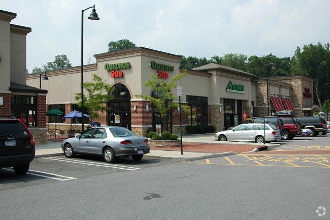
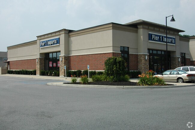
Property Record
2519 South Rd, Poughkeepsie, NY 12601

NEARBY LISTINGS FOR SALE OR LEASE
Property Detail
2519 South Rd
Kiryas Joel-Poughkeepsie-Newburgh, NY
Spackenkill Dev Llc
134689-6060-02-975536-0000
3.77 AC (S)
Regionalshoppingcenterormallwithanchorstore
Dutchess
X
New York
36027C0366E
975
2025
3.77 AC
2024
Fishkill
140500
Westchester/So Connecticut
29,949 SF
DEMOGRAPHICS near 2519 South Rd
1 Mile
3 Mile
5 Mile
2024 Total Population
3,546
49,844
104,038
2029 Population
3,547
49,776
104,060
Pop Growth 2024-2029
+ 0.03%
(0.14%)
+ 0.02%
Average Age
44
41
40
2024 Total Households
1,568
19,317
39,623
HH Growth 2024-2029
+ 0.06%
(0.07%)
+ 0.08%
Median Household Inc
$89,437
$75,201
$75,497
Avg Household Size
2.20
2.40
2.40
2024 Avg HH Vehicles
2.00
2.00
2.00
Median Home Value
$364,322
$306,669
$300,465
Median Year Built
1968
1961
1965
Nearby Places
Map Layers
Map Styles
 Street
 Aerial
- Restaurants
- Banks
- Shops
- Fitness
- Groceries
PUBLIC TRANSPORTATION
COMMUTER RAIL
Poughkeepsie Station (Hudson Line - Metro-North Commuter Railroad Company (Metro-North))
DRIVE
WALK
Distance
Poughkeepsie Station (Hudson Line - Metro-North Commuter Railroad Company (Metro-North))
5 min
3.5 mi
New Hamburg Station (Hudson Line - Metro-North Commuter Railroad Company (Metro-North))
DRIVE
WALK
Distance
New Hamburg Station (Hudson Line - Metro-North Commuter Railroad Company (Metro-North))
13 min
6.3 mi
AIRPORT
New York Stewart International
DRIVE
WALK
Distance
New York Stewart International
36 min
23.3 mi
Freight Ports
Port of New Haven
DRIVE
WALK
Distance
Port of New Haven
105 min
77.4 mi
Nearby Properties
Address
Land Use
TOTAL SIZE
Lot Size
Zoning
Address
Land Use
TOTAL SIZE
Lot Size
Zoning
640,854 SF
21.22 AC
H-M
Address
Land Use
TOTAL SIZE
Lot Size
Zoning
1,279,884 SF
255.89 AC
IN
Address
Land Use
TOTAL SIZE
Lot Size
Zoning
193.80 AC
IH
Address
Land Use
TOTAL SIZE
Lot Size
Zoning
488,904 SF
12.90 AC
R-3
Address
Land Use
TOTAL SIZE
Lot Size
Zoning
802,007 SF
78.21 AC
BH
Address
Land Use
TOTAL SIZE
Lot Size
Zoning
3 AC
R-D
Address
Land Use
TOTAL SIZE
Lot Size
Zoning
11,803 SF
99.04 AC
IH
Address
Land Use
TOTAL SIZE
Lot Size
Zoning
50,363 SF
47.88 AC
IH/R1
Address
Land Use
TOTAL SIZE
Lot Size
Zoning
16,947 SF
6.40 AC
IH
Address
Land Use
TOTAL SIZE
Lot Size
Zoning
105,762 SF
2.41 AC
H-M
Address
Land Use
TOTAL SIZE
Lot Size
Zoning
4 AC
R-1
Address
Land Use
TOTAL SIZE
Lot Size
Zoning
179,351 SF
18.34 AC
IN
Address
Land Use
TOTAL SIZE
Lot Size
Zoning
2.53 AC
R-D
Address
Land Use
TOTAL SIZE
Lot Size
Zoning
23,044 SF
12.60 AC
R-5
Address
Land Use
TOTAL SIZE
Lot Size
Zoning
126,616 SF
25.57 AC
R20
Address
Land Use
TOTAL SIZE
Lot Size
Zoning
30,420 SF
11.30 AC
R-2
Address
Land Use
TOTAL SIZE
Lot Size
Zoning
55,299 SF
1.45 AC
C-1
Address
Land Use
TOTAL SIZE
Lot Size
Zoning
31,608 SF
57 AC
IN
Address
Land Use
TOTAL SIZE
Lot Size
Zoning
297,663 SF
4.45 AC
H-M
Address
Land Use
TOTAL SIZE
Lot Size
Zoning
56,477 SF
38.98 AC
IN
Address
Land Use
TOTAL SIZE
Lot Size
Zoning
115,817 SF
5.93 AC
R5
Address
Land Use
TOTAL SIZE
Lot Size
Zoning
272,228 SF
25.20 AC
BSC
Address
Land Use
TOTAL SIZE
Lot Size
Zoning
66,956 SF
9.60 AC
R4
Address
Land Use
TOTAL SIZE
Lot Size
Zoning
6.70 AC
R-1.5A
Address
Land Use
TOTAL SIZE
Lot Size
Zoning
123,650 SF
2.10 AC
ATC
Address
Land Use
TOTAL SIZE
Lot Size
Zoning
101,527 SF
13 AC
ATC
Address
Land Use
TOTAL SIZE
Lot Size
Zoning
73,130 SF
2.55 AC
H-M
Address
Land Use
TOTAL SIZE
Lot Size
Zoning
55,752 SF
16.14 AC
RM
Address
Land Use
TOTAL SIZE
Lot Size
Zoning
114,443 SF
43.60 AC
IN
Address
Land Use
TOTAL SIZE
Lot Size
Zoning
147,858 SF
12.45 AC
BSC
The World's #1 Commercial Real Estate Marketplace
Connect with us
© 2026 CoStar Group
The information above has been obtained from sources believed reliable. While we do not doubt its accuracy we have not verified it and make no guarantee, warranty or representation about it. It is your responsibility to independently confirm its accuracy and completeness. Any projections, opinions, assumptions, or estimates used are for example only and do not represent the current or future performance of the property. The value of this transaction to you depends on tax and other factors which should be evaluated by your tax, financial, and legal advisors. You and your advisors should conduct a careful, independent investigation of the property to determine to your satisfaction the suitability of the property for your needs.