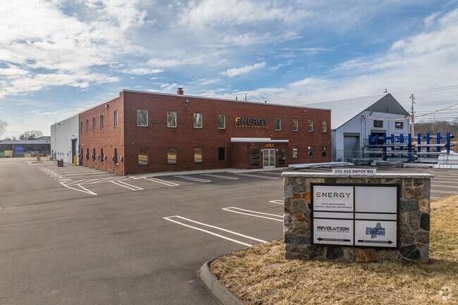
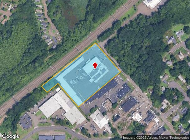
Property Record
113 Hawley Ave, Milford, CT 06460

Current Lease Availabilities
NEARBY LISTINGS FOR SALE OR LEASE
Property Detail
113 Hawley Ave
New Haven-Milford, CT
Villager
MILF-000060-000742-000008-000003
New Haven
Condominium
Connecticut
X
Milford
09009C0551J
Westchester/So Connecticut
977 SF
DEMOGRAPHICS near 113 Hawley Ave
1 Mile
3 Mile
5 Mile
2024 Total Population
6,940
48,300
113,201
2029 Population
6,940
48,324
112,674
Pop Growth 2024-2029
0.00%
+ 0.05%
(0.47%)
Average Age
45
45
42
2024 Total Households
3,039
19,999
44,972
HH Growth 2024-2029
+ 0.03%
+ 0.06%
(0.47%)
Median Household Inc
$90,922
$97,905
$86,182
Avg Household Size
2.30
2.30
2.40
2024 Avg HH Vehicles
2.00
2.00
2.00
Median Home Value
$295,776
$325,843
$312,762
Median Year Built
1973
1964
1962
Nearby Places
- Restaurants
- Banks
- Shops
- Fitness
- Groceries
PUBLIC TRANSPORTATION
COMMUTER RAIL
West Haven (New Haven - Metro-North Railroad)
DRIVE
WALK
Distance
West Haven (New Haven - Metro-North Railroad)
7 min
3.8 mi
Milford Station (New Haven Line - Metro-North Commuter Railroad Company (Metro-North))
DRIVE
WALK
Distance
Milford Station (New Haven Line - Metro-North Commuter Railroad Company (Metro-North))
8 min
4.1 mi
AIRPORT
Tweed/New Haven
DRIVE
WALK
Distance
Tweed/New Haven
21 min
11.2 mi
Freight Ports
Port of New Haven
DRIVE
WALK
Distance
Port of New Haven
16 min
8.4 mi
Nearby Properties
Address
Land Use
TOTAL SIZE
Lot Size
Zoning
Address
Land Use
TOTAL SIZE
Lot Size
Zoning
50.14 AC
PRD
Address
Land Use
TOTAL SIZE
Lot Size
Zoning
74.86 AC
SCD
Address
Land Use
TOTAL SIZE
Lot Size
Zoning
42.52 AC
PF
Address
Land Use
TOTAL SIZE
Lot Size
Zoning
29.78 AC
PRD
Address
Land Use
TOTAL SIZE
Lot Size
Zoning
35.05 AC
LI-2
Address
Land Use
TOTAL SIZE
Lot Size
Zoning
1,628 SF
22.65 AC
OSAH
Address
Land Use
TOTAL SIZE
Lot Size
Zoning
214,516 SF
35.88 AC
RA
Address
Land Use
TOTAL SIZE
Lot Size
Zoning
287.63 AC
OS
Address
Land Use
TOTAL SIZE
Lot Size
Zoning
125,676 SF
22.12 AC
BOP
Address
Land Use
TOTAL SIZE
Lot Size
Zoning
6.86 AC
RA
Address
Land Use
TOTAL SIZE
Lot Size
Zoning
26,736 SF
10.86 AC
CDD1
Address
Land Use
TOTAL SIZE
Lot Size
Zoning
154,315 SF
4.29 AC
SCR
Address
Land Use
TOTAL SIZE
Lot Size
Zoning
9 AC
LI-4
Address
Land Use
TOTAL SIZE
Lot Size
Zoning
162,464 SF
7.51 AC
SLD
Address
Land Use
TOTAL SIZE
Lot Size
Zoning
181,277 SF
4.58 AC
CDD5
Address
Land Use
TOTAL SIZE
Lot Size
Zoning
8,060 SF
27.12 AC
RPD
Address
Land Use
TOTAL SIZE
Lot Size
Zoning
20.33 AC
LI-3
Address
Land Use
TOTAL SIZE
Lot Size
Zoning
75,670 SF
34.18 AC
R2
Address
Land Use
TOTAL SIZE
Lot Size
Zoning
6.01 AC
LI-2
Address
Land Use
TOTAL SIZE
Lot Size
Zoning
6,941 SF
8.02 AC
TOD
Address
Land Use
TOTAL SIZE
Lot Size
Zoning
55,894 SF
8.25 AC
LI-2
Address
Land Use
TOTAL SIZE
Lot Size
Zoning
18.14 AC
ID
Address
Land Use
TOTAL SIZE
Lot Size
Zoning
15.51 AC
C-2
Address
Land Use
TOTAL SIZE
Lot Size
Zoning
138,970 SF
14.34 AC
CDD5
Address
Land Use
TOTAL SIZE
Lot Size
Zoning
20,216 SF
10.62 AC
R2
Address
Land Use
TOTAL SIZE
Lot Size
Zoning
14,183 SF
16.40 AC
R18
Address
Land Use
TOTAL SIZE
Lot Size
Zoning
47,225 SF
41.33 AC
LI-2
Address
Land Use
TOTAL SIZE
Lot Size
Zoning
97,527 SF
3.70 AC
LI-2
Address
Land Use
TOTAL SIZE
Lot Size
Zoning
21.50 AC
LI
Address
Land Use
TOTAL SIZE
Lot Size
Zoning
127,654 SF
16.55 AC
PF
The World's #1 Commercial Real Estate Marketplace
Connect with us
© 2025 CoStar Group
The information above has been obtained from sources believed reliable. While we do not doubt its accuracy we have not verified it and make no guarantee, warranty or representation about it. It is your responsibility to independently confirm its accuracy and completeness. Any projections, opinions, assumptions, or estimates used are for example only and do not represent the current or future performance of the property. The value of this transaction to you depends on tax and other factors which should be evaluated by your tax, financial, and legal advisors. You and your advisors should conduct a careful, independent investigation of the property to determine to your satisfaction the suitability of the property for your needs.