Property Record
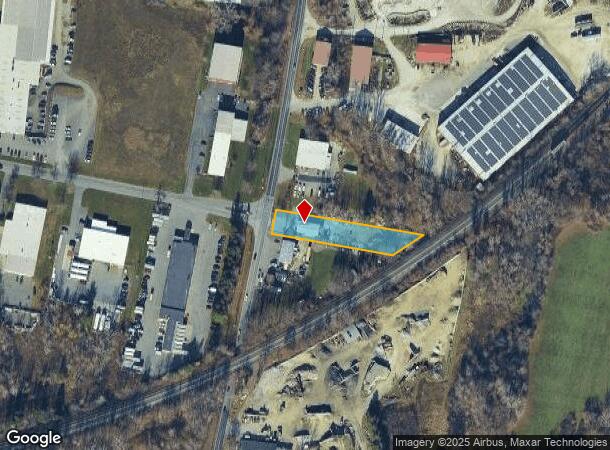
252 Hubbard Ave, Dalton, MA 01226


NEARBY LISTINGS FOR SALE OR LEASE
Property Detail
252 Hubbard Ave
DALT-000124-000000-000005
Berkshire
Commercialbuilding
Massachusetts
2025
5
2025
0.65 AC
912100
Other Market Areas
1,800 SF
Pittsfield, MA
DEMOGRAPHICS near 252 Hubbard Ave
1 Mile
3 Mile
5 Mile
2024 Total Population
2,294
22,953
48,168
2029 Population
2,254
22,464
47,327
Pop Growth 2024-2029
(1.74%)
(2.13%)
(1.75%)
Average Age
48
44
44
2024 Total Households
1,018
10,145
21,618
HH Growth 2024-2029
(1.96%)
(2.30%)
(1.82%)
Median Household Inc
$80,251
$62,559
$57,582
Avg Household Size
2.10
2.20
2.10
2024 Avg HH Vehicles
2.00
2.00
1.00
Median Home Value
$254,504
$219,129
$222,010
Median Year Built
1961
1952
1950
Nearby Places
Map Layers
Map Styles
 Street
 Aerial
- Restaurants
- Banks
- Shops
- Fitness
- Groceries
PUBLIC TRANSPORTATION
COMMUTER RAIL
DRIVE
WALK
Distance
10 min
4.0 mi
AIRPORT
Albany International
DRIVE
WALK
Distance
Albany International
81 min
49.4 mi
Freight Ports
Albany, NY Port
DRIVE
WALK
Distance
Albany, NY Port
72 min
44.0 mi
Nearby Properties
Address
Land Use
TOTAL SIZE
Lot Size
Zoning
Address
Land Use
TOTAL SIZE
Lot Size
Zoning
92 AC
R-4
Address
Land Use
TOTAL SIZE
Lot Size
Zoning
600 SF
19.89 AC
R20
Address
Land Use
TOTAL SIZE
Lot Size
Zoning
Address
Land Use
TOTAL SIZE
Lot Size
Zoning
6.15 AC
IG
Address
Land Use
TOTAL SIZE
Lot Size
Zoning
14.63 AC
IG
Address
Land Use
TOTAL SIZE
Lot Size
Zoning
165,400 SF
0.49 AC
IG
Address
Land Use
TOTAL SIZE
Lot Size
Zoning
237.50 AC
R6
Address
Land Use
TOTAL SIZE
Lot Size
Zoning
22.83 AC
I2
Address
Land Use
TOTAL SIZE
Lot Size
Zoning
14.40 AC
I1
Address
Land Use
TOTAL SIZE
Lot Size
Zoning
11.60 AC
I2
Address
Land Use
TOTAL SIZE
Lot Size
Zoning
57,170 SF
18.87 AC
R1
Address
Land Use
TOTAL SIZE
Lot Size
Zoning
12.50 AC
RG
Address
Land Use
TOTAL SIZE
Lot Size
Zoning
87,081 SF
11.50 AC
IG
Address
Land Use
TOTAL SIZE
Lot Size
Zoning
242,525 SF
12.52 AC
BC
Address
Land Use
TOTAL SIZE
Lot Size
Zoning
128,036 SF
14.92 AC
IG
Address
Land Use
TOTAL SIZE
Lot Size
Zoning
79,095 SF
14.89 AC
IG
Address
Land Use
TOTAL SIZE
Lot Size
Zoning
183,260 SF
6 AC
IG
Address
Land Use
TOTAL SIZE
Lot Size
Zoning
11.77 AC
IG
Address
Land Use
TOTAL SIZE
Lot Size
Zoning
37,551 SF
6.50 AC
R6
Address
Land Use
TOTAL SIZE
Lot Size
Zoning
86.21 AC
MC
Address
Land Use
TOTAL SIZE
Lot Size
Zoning
102,954 SF
11.98 AC
IG
Address
Land Use
TOTAL SIZE
Lot Size
Zoning
82,160 SF
5.40 AC
RM
Address
Land Use
TOTAL SIZE
Lot Size
Zoning
35 AC
RG
Address
Land Use
TOTAL SIZE
Lot Size
Zoning
8.20 AC
R-3
Address
Land Use
TOTAL SIZE
Lot Size
Zoning
57,646 SF
10.60 AC
R12
Address
Land Use
TOTAL SIZE
Lot Size
Zoning
28 AC
I2
Address
Land Use
TOTAL SIZE
Lot Size
Zoning
60.30 AC
IG
Address
Land Use
TOTAL SIZE
Lot Size
Zoning
124,490 SF
8.22 AC
B
Address
Land Use
TOTAL SIZE
Lot Size
Zoning
56,120 SF
11.90 AC
R12
Address
Land Use
TOTAL SIZE
Lot Size
Zoning
10.90 AC
R12
The World's #1 Commercial Real Estate Marketplace
Connect with us
© 2025 CoStar Group
The information above has been obtained from sources believed reliable. While we do not doubt its accuracy we have not verified it and make no guarantee, warranty or representation about it. It is your responsibility to independently confirm its accuracy and completeness. Any projections, opinions, assumptions, or estimates used are for example only and do not represent the current or future performance of the property. The value of this transaction to you depends on tax and other factors which should be evaluated by your tax, financial, and legal advisors. You and your advisors should conduct a careful, independent investigation of the property to determine to your satisfaction the suitability of the property for your needs.