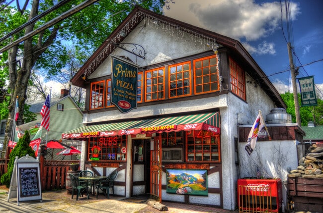
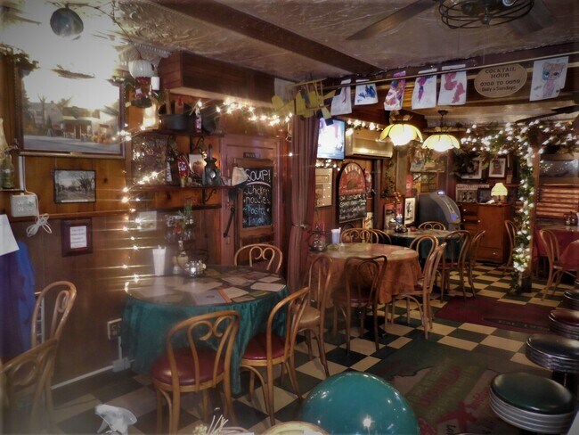
Property Record
252 Main St, Cornwall, NY 12518

Current Lease Availabilities
NEARBY LISTINGS FOR SALE OR LEASE
Property Detail
252 Main St
New York-Jersey City-White Plains, NY-NJ
Orange
332489-022-000-0012-005.000-0000
New York
Townhouserowhouse
0.16 AC
X
Newburgh
36071C0341E
Northern New Jersey
3,016 SF
DEMOGRAPHICS near 252 Main St
1 Mile
3 Mile
5 Mile
2024 Total Population
6,437
24,979
70,412
2029 Population
6,542
25,577
71,757
Pop Growth 2024-2029
+ 1.63%
+ 2.39%
+ 1.91%
Average Age
41
42
38
2024 Total Households
2,558
10,053
24,403
HH Growth 2024-2029
+ 1.80%
+ 2.59%
+ 2.03%
Median Household Inc
$104,695
$95,902
$84,383
Avg Household Size
2.50
2.40
2.60
2024 Avg HH Vehicles
2.00
2.00
2.00
Median Home Value
$345,252
$319,507
$315,358
Median Year Built
1956
1969
1962
Nearby Places
Map Layers
Map Styles
 Street
 Aerial
- Restaurants
- Banks
- Shops
- Fitness
- Groceries
PUBLIC TRANSPORTATION
COMMUTER RAIL
Salisbury Mills Cornwall (Bergen County/Port Jervis Line - NJ Transit Commuter Rail (NJ Transit), Main/Port Jervis Line - NJ Transit Commuter Rail (NJ Transit))
DRIVE
WALK
Distance
Salisbury Mills Cornwall (Bergen County/Port Jervis Line - NJ Transit Commuter Rail (NJ Transit), Main/Port Jervis Line - NJ Transit Commuter Rail (NJ Transit))
11 min
4.7 mi
AIRPORT
New York Stewart International
DRIVE
WALK
Distance
New York Stewart International
16 min
8.1 mi
Freight Ports
NY - Red Hook Container Terminal
DRIVE
WALK
Distance
NY - Red Hook Container Terminal
95 min
67.7 mi
Nearby Properties
Address
Land Use
TOTAL SIZE
Lot Size
Zoning
Address
Land Use
TOTAL SIZE
Lot Size
Zoning
183,335 SF
12.40 AC
Address
Land Use
TOTAL SIZE
Lot Size
Zoning
115,270 SF
49.30 AC
Address
Land Use
TOTAL SIZE
Lot Size
Zoning
364,010 SF
83 AC
R2
Address
Land Use
TOTAL SIZE
Lot Size
Zoning
50 AC
Address
Land Use
TOTAL SIZE
Lot Size
Zoning
1.72 AC
R1
Address
Land Use
TOTAL SIZE
Lot Size
Zoning
Address
Land Use
TOTAL SIZE
Lot Size
Zoning
249,379 SF
29.34 AC
Address
Land Use
TOTAL SIZE
Lot Size
Zoning
173,706 SF
11.10 AC
Address
Land Use
TOTAL SIZE
Lot Size
Zoning
101,510 SF
12.80 AC
Address
Land Use
TOTAL SIZE
Lot Size
Zoning
20,518 SF
1.70 AC
Address
Land Use
TOTAL SIZE
Lot Size
Zoning
139,016 SF
3 AC
Address
Land Use
TOTAL SIZE
Lot Size
Zoning
35,012 SF
Address
Land Use
TOTAL SIZE
Lot Size
Zoning
Address
Land Use
TOTAL SIZE
Lot Size
Zoning
25,800 SF
7.90 AC
R4
Address
Land Use
TOTAL SIZE
Lot Size
Zoning
50,096 SF
4.80 AC
Address
Land Use
TOTAL SIZE
Lot Size
Zoning
43,604 SF
0.66 AC
Address
Land Use
TOTAL SIZE
Lot Size
Zoning
8,053 SF
8.40 AC
Address
Land Use
TOTAL SIZE
Lot Size
Zoning
37,616 SF
25.10 AC
Address
Land Use
TOTAL SIZE
Lot Size
Zoning
29.50 AC
Address
Land Use
TOTAL SIZE
Lot Size
Zoning
18,592 SF
26.50 AC
Address
Land Use
TOTAL SIZE
Lot Size
Zoning
35,018 SF
3.80 AC
Address
Land Use
TOTAL SIZE
Lot Size
Zoning
Address
Land Use
TOTAL SIZE
Lot Size
Zoning
60,076 SF
3.60 AC
02
Address
Land Use
TOTAL SIZE
Lot Size
Zoning
56,004 SF
5.30 AC
R4
Address
Land Use
TOTAL SIZE
Lot Size
Zoning
179.20 AC
Address
Land Use
TOTAL SIZE
Lot Size
Zoning
76.06 AC
PI
Address
Land Use
TOTAL SIZE
Lot Size
Zoning
15.10 AC
R-5
Address
Land Use
TOTAL SIZE
Lot Size
Zoning
12,040 SF
1.22 AC
Address
Land Use
TOTAL SIZE
Lot Size
Zoning
44.70 AC
02
Address
Land Use
TOTAL SIZE
Lot Size
Zoning
17,420 SF
21 AC
The World's #1 Commercial Real Estate Marketplace
Connect with us
© 2025 CoStar Group
The information above has been obtained from sources believed reliable. While we do not doubt its accuracy we have not verified it and make no guarantee, warranty or representation about it. It is your responsibility to independently confirm its accuracy and completeness. Any projections, opinions, assumptions, or estimates used are for example only and do not represent the current or future performance of the property. The value of this transaction to you depends on tax and other factors which should be evaluated by your tax, financial, and legal advisors. You and your advisors should conduct a careful, independent investigation of the property to determine to your satisfaction the suitability of the property for your needs.