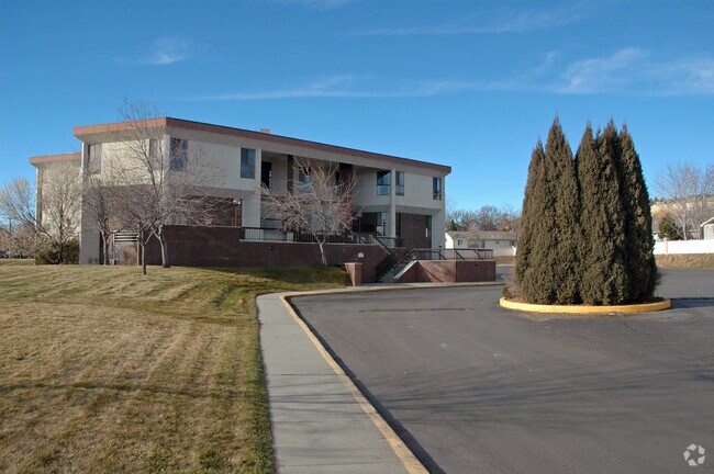
Property Record
2520 17Th St W, Billings, MT 59102


NEARBY LISTINGS FOR SALE OR LEASE
Property Detail
2520 17Th St W
Billings, MT
Morledge Family Medical Village Sub (11)
03-1032-36-2-19-01-0000
MORLEDGE FAMILY MEDICAL VILLAGE SUB (11), S36, T01 N, R25 E, BLOCK 1, LOT 1
Commercialnec
Yellowstone
X
Montana
30111C1270E
1
2024
0.79 AC
2025
Billings
001100
Other Market Areas
10,611 SF
DEMOGRAPHICS near 2520 17Th St W
1 Mile
3 Mile
5 Mile
2024 Total Population
11,143
65,786
119,134
2029 Population
12,058
71,127
129,301
Pop Growth 2024-2029
+ 8.21%
+ 8.12%
+ 8.53%
Average Age
41
41
40
2024 Total Households
4,733
28,953
50,657
HH Growth 2024-2029
+ 8.49%
+ 8.28%
+ 8.70%
Median Household Inc
$87,083
$66,665
$68,201
Avg Household Size
2.20
2.20
2.20
2024 Avg HH Vehicles
2.00
2.00
2.00
Median Home Value
$333,046
$287,606
$291,288
Median Year Built
1964
1968
1978
Nearby Places
Map Layers
Map Styles
 Street
 Aerial
- Restaurants
- Banks
- Shops
- Fitness
- Groceries
PUBLIC TRANSPORTATION
AIRPORT
Billings Logan International
DRIVE
WALK
Distance
Billings Logan International
21 min
6.3 mi
Freight Ports
Port of Everett
DRIVE
WALK
Distance
Port of Everett
887 min
841.4 mi
Nearby Properties
Address
Land Use
TOTAL SIZE
Lot Size
Zoning
Address
Land Use
TOTAL SIZE
Lot Size
Zoning
650,098 SF
53.35 AC
CI
Address
Land Use
TOTAL SIZE
Lot Size
Zoning
704,701 SF
9.06 AC
MCPZD
Address
Land Use
TOTAL SIZE
Lot Size
Zoning
615,777 SF
5.85 AC
MCPZD
Address
Land Use
TOTAL SIZE
Lot Size
Zoning
483,842 SF
55.14 AC
P
Address
Land Use
TOTAL SIZE
Lot Size
Zoning
1,542.56 AC
P
Address
Land Use
TOTAL SIZE
Lot Size
Zoning
198,096 SF
7.48 AC
MCPZD
Address
Land Use
TOTAL SIZE
Lot Size
Zoning
167,261 SF
10.55 AC
R-150
Address
Land Use
TOTAL SIZE
Lot Size
Zoning
9.37 AC
P
Address
Land Use
TOTAL SIZE
Lot Size
Zoning
258,977 SF
18.05 AC
CI
Address
Land Use
TOTAL SIZE
Lot Size
Zoning
116,250 SF
9.39 AC
Address
Land Use
TOTAL SIZE
Lot Size
Zoning
138,502 SF
18.97 AC
Address
Land Use
TOTAL SIZE
Lot Size
Zoning
76,098 SF
0.80 AC
CBD
Address
Land Use
TOTAL SIZE
Lot Size
Zoning
168,124 SF
14.39 AC
HC
Address
Land Use
TOTAL SIZE
Lot Size
Zoning
537,468 SF
36.83 AC
CC
Address
Land Use
TOTAL SIZE
Lot Size
Zoning
108,000 SF
2.07 AC
CBD
Address
Land Use
TOTAL SIZE
Lot Size
Zoning
145,168 SF
0.96 AC
CBD
Address
Land Use
TOTAL SIZE
Lot Size
Zoning
218,478 SF
18.19 AC
CI
Address
Land Use
TOTAL SIZE
Lot Size
Zoning
109,714 SF
NC
Address
Land Use
TOTAL SIZE
Lot Size
Zoning
71,600 SF
0.15 AC
CBD
Address
Land Use
TOTAL SIZE
Lot Size
Zoning
188,907 SF
3.83 AC
CC
Address
Land Use
TOTAL SIZE
Lot Size
Zoning
149,797 SF
12.95 AC
CC
Address
Land Use
TOTAL SIZE
Lot Size
Zoning
234,444 SF
4.98 AC
MCPZD
Address
Land Use
TOTAL SIZE
Lot Size
Zoning
26.09 AC
Address
Land Use
TOTAL SIZE
Lot Size
Zoning
63,650 SF
4.13 AC
MCPZD
Address
Land Use
TOTAL SIZE
Lot Size
Zoning
1,200 SF
57.17 AC
P
Address
Land Use
TOTAL SIZE
Lot Size
Zoning
409,620 SF
27.42 AC
CI
Address
Land Use
TOTAL SIZE
Lot Size
Zoning
135,273 SF
3.76 AC
R-60
Address
Land Use
TOTAL SIZE
Lot Size
Zoning
141,186 SF
2.62 AC
CBD
Address
Land Use
TOTAL SIZE
Lot Size
Zoning
180,859 SF
14.39 AC
R-96
Address
Land Use
TOTAL SIZE
Lot Size
Zoning
48,717 SF
1.53 AC
MCPZD
The World's #1 Commercial Real Estate Marketplace
Connect with us
© 2026 CoStar Group
The information above has been obtained from sources believed reliable. While we do not doubt its accuracy we have not verified it and make no guarantee, warranty or representation about it. It is your responsibility to independently confirm its accuracy and completeness. Any projections, opinions, assumptions, or estimates used are for example only and do not represent the current or future performance of the property. The value of this transaction to you depends on tax and other factors which should be evaluated by your tax, financial, and legal advisors. You and your advisors should conduct a careful, independent investigation of the property to determine to your satisfaction the suitability of the property for your needs.