Property Record
2520 Basin Cir, Hanahan, SC 29410
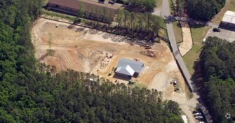
Property Detail
2520 Basin Cir
Charleston-North Charleston, SC
SILVER CUP SPLOT 81 & 82PARCEL A (06/2018)
266-00-00-002
BERKELEY
Vacantlandnec
South Carolina
HANAHAN -
81&82
AE The base floodplain where base flood elevations are provided. AE Zones are now used on new format FIRMs instead of A1-A30 Zones.
922.90 AC
2025
Outlying Berkeley County
2025
Charleston/N Charleston
021000
NEARBY LISTINGS FOR SALE OR LEASE
DEMOGRAPHICS near 2520 Basin Cir
1 mile
3 mile
5 mile
2025 Total Population
605
29,548
95,583
2030 Population
662
32,120
104,165
Pop Growth 2025-2030
+ 9.42%
+ 8.70%
+ 8.98%
Average Age
39
38
37
2025 Total Households
262
11,992
37,015
HH Growth 2025-2030
+ 9.54%
+ 8.86%
+ 9.09%
Median Household Inc
$51,530
$71,827
$65,702
Avg Household Size
2.20
2.40
2.40
2025 Avg HH Vehicles
1.00
2.00
2.00
Median Home Value
$340,740
$345,063
$308,625
Median Year Built
1976
1981
1987
Nearby Places
Map Layers
Map Styles
 Street
 Aerial
Transit
 Traffic
 Biking
Places
Listings with unknown addresses are not visible on the map
- Restaurants
- Banks
- Shops
- Fitness
- Groceries
PUBLIC TRANSPORTATION
COMMUTER RAIL
Charleston Amtrak Station (Palmetto - Amtrak, Silver Meteor - Amtrak)
Drive
Walk
Distance
Charleston Amtrak Station (Palmetto - Amtrak, Silver Meteor - Amtrak)
14 min
5.2 mi
AIRPORT
Charleston AFB/International
Drive
Walk
Distance
Charleston AFB/International
23 min
11.1 mi
Freight Ports
North Charleston Terminal
Drive
Walk
Distance
North Charleston Terminal
9 min
2.5 mi
Nearby Properties
Address
Land Use
TOTAL SIZE
Lot Size
Zoning
Address
Land Use
TOTAL SIZE
Lot Size
Zoning
56,268 SF
29.66 AC
BERKELEY C
Address
Land Use
TOTAL SIZE
Lot Size
Zoning
28,677 SF
15.56 AC
BERKELEY C
Address
Land Use
TOTAL SIZE
Lot Size
Zoning
6,848 SF
43.53 AC
CHARLESTON
Address
Land Use
TOTAL SIZE
Lot Size
Zoning
870 SF
14.87 AC
BERKELEY C
Address
Land Use
TOTAL SIZE
Lot Size
Zoning
202,154 SF
16.34 AC
Address
Land Use
TOTAL SIZE
Lot Size
Zoning
278,800 SF
18.17 AC
CHARLESTON
Address
Land Use
TOTAL SIZE
Lot Size
Zoning
197,100 SF
34.14 AC
HANAHAN -
Address
Land Use
TOTAL SIZE
Lot Size
Zoning
351,000 SF
17.66 AC
CHARLESTON
Address
Land Use
TOTAL SIZE
Lot Size
Zoning
105,666 SF
8.25 AC
Address
Land Use
TOTAL SIZE
Lot Size
Zoning
300,000 SF
20.85 AC
CHARLESTON
Address
Land Use
TOTAL SIZE
Lot Size
Zoning
250,000 SF
28.97 AC
CHARLESTON
Address
Land Use
TOTAL SIZE
Lot Size
Zoning
260,000 SF
14.33 AC
CHARLESTON
Address
Land Use
TOTAL SIZE
Lot Size
Zoning
75,005 SF
14.66 AC
CHARLESTON
Address
Land Use
TOTAL SIZE
Lot Size
Zoning
3,672 SF
3.62 AC
HANAHAN -
Address
Land Use
TOTAL SIZE
Lot Size
Zoning
203,200 SF
20.16 AC
BERKELEY C
Address
Land Use
TOTAL SIZE
Lot Size
Zoning
190,175 SF
24.36 AC
CHARLESTON
Address
Land Use
TOTAL SIZE
Lot Size
Zoning
200,000 SF
15.25 AC
CHARLESTON
Address
Land Use
TOTAL SIZE
Lot Size
Zoning
68,208 SF
21.38 AC
HANAHAN -
Address
Land Use
TOTAL SIZE
Lot Size
Zoning
83,215 SF
1.98 AC
CHARLESTON
Address
Land Use
TOTAL SIZE
Lot Size
Zoning
112,000 SF
7.02 AC
CHARLESTON
Address
Land Use
TOTAL SIZE
Lot Size
Zoning
100,000 SF
6.70 AC
BERKELEY C
Address
Land Use
TOTAL SIZE
Lot Size
Zoning
54,449 SF
10.56 AC
HANAHAN -
Address
Land Use
TOTAL SIZE
Lot Size
Zoning
210,664 SF
8.87 AC
HANAHAN -
Address
Land Use
TOTAL SIZE
Lot Size
Zoning
9,691 SF
10.34 AC
Address
Land Use
TOTAL SIZE
Lot Size
Zoning
50,400 SF
6.80 AC
CHARLESTON
Address
Land Use
TOTAL SIZE
Lot Size
Zoning
14,775 SF
1.52 AC
HANAHAN -
Address
Land Use
TOTAL SIZE
Lot Size
Zoning
78,764 SF
4.15 AC
HANAHAN -
Address
Land Use
TOTAL SIZE
Lot Size
Zoning
175,800 SF
7.30 AC
HANAHAN -
Address
Land Use
TOTAL SIZE
Lot Size
Zoning
47,984 SF
2.97 AC
HANAHAN -
The World's #1 Commercial Real Estate Marketplace
Connect with us
© 2026 CoStar Group
The information above has been obtained from sources believed reliable. While we do not doubt its accuracy we have not verified it and make no guarantee, warranty or representation about it. It is your responsibility to independently confirm its accuracy and completeness. Any projections, opinions, assumptions, or estimates used are for example only and do not represent the current or future performance of the property. The value of this transaction to you depends on tax and other factors which should be evaluated by your tax, financial, and legal advisors. You and your advisors should conduct a careful, independent investigation of the property to determine to your satisfaction the suitability of the property for your needs.