Property Record
2520 Mock Rd, Columbus, OH 43219
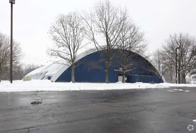


Property Detail
2520 Mock Rd
010-129754
MOCK RD R17 T1 1/4T3 102.4703 ACRES
Municipalproperty
Franklin
AE The base floodplain where base flood elevations are provided. AE Zones are now used on new format FIRMs instead of A1-A30 Zones.
Ohio
0
102.47 AC
2025
North Central
007520
Columbus
28,080 SF
Columbus, OH
NEARBY LISTINGS FOR SALE OR LEASE
DEMOGRAPHICS near 2520 Mock Rd
1 mile
3 mile
5 mile
2025 Total Population
11,134
104,230
382,409
2030 Population
11,491
108,215
397,081
Pop Growth 2025-2030
+ 3.21%
+ 3.82%
+ 3.84%
Average Age
37
37
36
2025 Total Households
4,051
40,430
157,684
HH Growth 2025-2030
+ 3.51%
+ 3.90%
+ 4.13%
Median Household Inc
$46,178
$47,971
$57,270
Avg Household Size
2.50
2.50
2.20
2025 Avg HH Vehicles
2.00
2.00
2.00
Median Home Value
$132,812
$187,137
$282,049
Median Year Built
1971
1963
1967
Nearby Places
Map Layers
Map Styles
 Street
 Aerial
Layers
 Traffic
 Biking
Places
Listings with unknown addresses are not visible on the map
- Restaurants
- Banks
- Shops
- Fitness
- Groceries
PUBLIC TRANSPORTATION
AIRPORT
John Glenn Columbus International
Drive
Walk
Distance
John Glenn Columbus International
9 min
5.2 mi
Rickenbacker International
Drive
Walk
Distance
Rickenbacker International
27 min
14.7 mi
Freight Ports
Port of Toledo
Drive
Walk
Distance
Port of Toledo
185 min
148.6 mi
Nearby Properties
Address
Land Use
TOTAL SIZE
Lot Size
Zoning
Address
Land Use
TOTAL SIZE
Lot Size
Zoning
1,256,678 SF
1,292.62 AC
Address
Land Use
TOTAL SIZE
Lot Size
Zoning
382,270 SF
319.59 AC
Address
Land Use
TOTAL SIZE
Lot Size
Zoning
284,481 SF
94.09 AC
Address
Land Use
TOTAL SIZE
Lot Size
Zoning
570,003 SF
29.71 AC
Address
Land Use
TOTAL SIZE
Lot Size
Zoning
770,975 SF
64.63 AC
Address
Land Use
TOTAL SIZE
Lot Size
Zoning
516,485 SF
50.03 AC
Address
Land Use
TOTAL SIZE
Lot Size
Zoning
242,064 SF
18.02 AC
Address
Land Use
TOTAL SIZE
Lot Size
Zoning
240,432 SF
16.59 AC
Address
Land Use
TOTAL SIZE
Lot Size
Zoning
537,537 SF
77.62 AC
Address
Land Use
TOTAL SIZE
Lot Size
Zoning
299,220 SF
29.68 AC
Address
Land Use
TOTAL SIZE
Lot Size
Zoning
183,352 SF
55.41 AC
Address
Land Use
TOTAL SIZE
Lot Size
Zoning
214,424 SF
18.57 AC
Address
Land Use
TOTAL SIZE
Lot Size
Zoning
668,209 SF
61.10 AC
Address
Land Use
TOTAL SIZE
Lot Size
Zoning
274,272 SF
6.45 AC
Address
Land Use
TOTAL SIZE
Lot Size
Zoning
35,434 SF
17.56 AC
Address
Land Use
TOTAL SIZE
Lot Size
Zoning
218,403 SF
9.98 AC
Address
Land Use
TOTAL SIZE
Lot Size
Zoning
332,616 SF
26.90 AC
Address
Land Use
TOTAL SIZE
Lot Size
Zoning
209,542 SF
27.50 AC
Address
Land Use
TOTAL SIZE
Lot Size
Zoning
331,458 SF
15.37 AC
Address
Land Use
TOTAL SIZE
Lot Size
Zoning
42,596 SF
37.05 AC
Address
Land Use
TOTAL SIZE
Lot Size
Zoning
67,166 SF
11.03 AC
Address
Land Use
TOTAL SIZE
Lot Size
Zoning
202,956 SF
13.40 AC
Address
Land Use
TOTAL SIZE
Lot Size
Zoning
706,471 SF
41.34 AC
Address
Land Use
TOTAL SIZE
Lot Size
Zoning
120,412 SF
30.67 AC
Address
Land Use
TOTAL SIZE
Lot Size
Zoning
205,370 SF
19.82 AC
Address
Land Use
TOTAL SIZE
Lot Size
Zoning
281,405 SF
32.82 AC
Address
Land Use
TOTAL SIZE
Lot Size
Zoning
125,035 SF
9.12 AC
Address
Land Use
TOTAL SIZE
Lot Size
Zoning
123,542 SF
18.20 AC
Address
Land Use
TOTAL SIZE
Lot Size
Zoning
171,832 SF
17.77 AC
Address
Land Use
TOTAL SIZE
Lot Size
Zoning
75,649 SF
19.54 AC
The World's #1 Commercial Real Estate Marketplace
Connect with us
© 2026 CoStar Group
The information above has been obtained from sources believed reliable. While we do not doubt its accuracy we have not verified it and make no guarantee, warranty or representation about it. It is your responsibility to independently confirm its accuracy and completeness. Any projections, opinions, assumptions, or estimates used are for example only and do not represent the current or future performance of the property. The value of this transaction to you depends on tax and other factors which should be evaluated by your tax, financial, and legal advisors. You and your advisors should conduct a careful, independent investigation of the property to determine to your satisfaction the suitability of the property for your needs.