Property Record
2520 New Leicester Hwy, Leicester, NC 28748

NEARBY LISTINGS FOR SALE OR LEASE
-
-
View all Leicester listings for sale on LoopNet.com
Property Detail
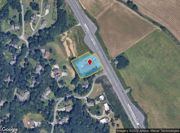
2520 New Leicester Hwy
9701-70-2963-00000
PLAT: 0000-0000
Uspostalservice
Buncombe
X
North Carolina
3700970100J
1.33 AC
0
Buncombe County
2025
Asheville
002609
Asheville, NC
7,188 SF
DEMOGRAPHICS near 2520 New Leicester Hwy
1 Mile
3 Mile
5 Mile
2024 Total Population
1,162
12,187
30,324
2029 Population
1,202
12,668
31,459
Pop Growth 2024-2029
+ 3.44%
+ 3.95%
+ 3.74%
Average Age
43
42
41
2024 Total Households
457
4,882
12,068
HH Growth 2024-2029
+ 2.84%
+ 3.48%
+ 3.26%
Median Household Inc
$59,027
$54,771
$57,242
Avg Household Size
2.50
2.40
2.40
2024 Avg HH Vehicles
2.00
2.00
2.00
Median Home Value
$248,484
$255,286
$256,900
Median Year Built
1993
1992
1991
Nearby Places
- Restaurants
- Banks
- Shops
- Fitness
- Groceries
PUBLIC TRANSPORTATION
AIRPORT
Asheville Regional
DRIVE
WALK
Distance
Asheville Regional
31 min
19.9 mi
Freight Ports
North Charleston Terminal
DRIVE
WALK
Distance
North Charleston Terminal
302 min
263.6 mi
Nearby Properties
Address
Land Use
TOTAL SIZE
Lot Size
Zoning
Address
Land Use
TOTAL SIZE
Lot Size
Zoning
311,958 SF
33.93 AC
OU
Address
Land Use
TOTAL SIZE
Lot Size
Zoning
20,530 SF
22.48 AC
OU
Address
Land Use
TOTAL SIZE
Lot Size
Zoning
17,549 SF
10.20 AC
OU
Address
Land Use
TOTAL SIZE
Lot Size
Zoning
15,428 SF
44.40 AC
OU
Address
Land Use
TOTAL SIZE
Lot Size
Zoning
43,190 SF
5.52 AC
OU
Address
Land Use
TOTAL SIZE
Lot Size
Zoning
12,286 SF
3.19 AC
OU
Address
Land Use
TOTAL SIZE
Lot Size
Zoning
12,000 SF
10 AC
OU
Address
Land Use
TOTAL SIZE
Lot Size
Zoning
49,300 SF
34.83 AC
OU
Address
Land Use
TOTAL SIZE
Lot Size
Zoning
13,431 SF
64.60 AC
OU
Address
Land Use
TOTAL SIZE
Lot Size
Zoning
19,824 SF
13.69 AC
OU
Address
Land Use
TOTAL SIZE
Lot Size
Zoning
17,512 SF
2.89 AC
OU
Address
Land Use
TOTAL SIZE
Lot Size
Zoning
7,302 SF
2.30 AC
OU
Address
Land Use
TOTAL SIZE
Lot Size
Zoning
10,952 SF
3.35 AC
OU
Address
Land Use
TOTAL SIZE
Lot Size
Zoning
8,120 SF
16.79 AC
OU
Address
Land Use
TOTAL SIZE
Lot Size
Zoning
12,000 SF
4.21 AC
OU
Address
Land Use
TOTAL SIZE
Lot Size
Zoning
6,412 SF
1.39 AC
NS
Address
Land Use
TOTAL SIZE
Lot Size
Zoning
3,796 SF
102.75 AC
OU
Address
Land Use
TOTAL SIZE
Lot Size
Zoning
6,316 SF
2.75 AC
OU
Address
Land Use
TOTAL SIZE
Lot Size
Zoning
9,100 SF
2.08 AC
OU
Address
Land Use
TOTAL SIZE
Lot Size
Zoning
3,527 SF
103.78 AC
OU
Address
Land Use
TOTAL SIZE
Lot Size
Zoning
9,042 SF
2.13 AC
OU
Address
Land Use
TOTAL SIZE
Lot Size
Zoning
7,267 SF
2 AC
OU
Address
Land Use
TOTAL SIZE
Lot Size
Zoning
9,560 SF
59.37 AC
OU
Address
Land Use
TOTAL SIZE
Lot Size
Zoning
7,362 SF
7.32 AC
OU
Address
Land Use
TOTAL SIZE
Lot Size
Zoning
1,104 SF
163.39 AC
OU
Address
Land Use
TOTAL SIZE
Lot Size
Zoning
6,098 SF
10.19 AC
OU
Address
Land Use
TOTAL SIZE
Lot Size
Zoning
11,240 SF
6.15 AC
OU
Address
Land Use
TOTAL SIZE
Lot Size
Zoning
7,360 SF
8.83 AC
OU
Address
Land Use
TOTAL SIZE
Lot Size
Zoning
5,352 SF
51.33 AC
OU
Address
Land Use
TOTAL SIZE
Lot Size
Zoning
6,302 SF
8.07 AC
OU
The World's #1 Commercial Real Estate Marketplace
Connect with us
© 2025 CoStar Group
The information above has been obtained from sources believed reliable. While we do not doubt its accuracy we have not verified it and make no guarantee, warranty or representation about it. It is your responsibility to independently confirm its accuracy and completeness. Any projections, opinions, assumptions, or estimates used are for example only and do not represent the current or future performance of the property. The value of this transaction to you depends on tax and other factors which should be evaluated by your tax, financial, and legal advisors. You and your advisors should conduct a careful, independent investigation of the property to determine to your satisfaction the suitability of the property for your needs.