Property Record
2520 Se 43Rd St, Pleasant Hill, IA 50327


NEARBY LISTINGS FOR SALE OR LEASE
Property Detail
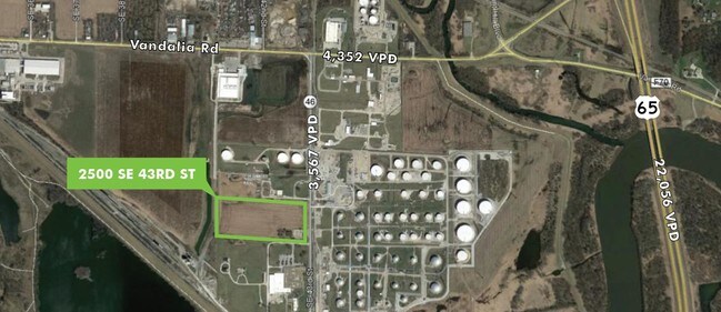
2520 Se 43Rd St
050-04291004000
Sec 17-78-23
Miscellaneous
PARCEL D BEG 2087.54F S OF N 1/4 COR OF SEC THN S 559.14F W 1314.77F N 568.63F E 1316.05F TO POB SE 1/4 NW 1/4 LESS .213A RD EAS SEC 17-78-23
X
Polk
19153C0370F
Iowa
2024
16.80 AC
2025
Northeast
005300
Des Moines
1,215 SF
Des Moines-West Des Moines, IA
DEMOGRAPHICS near 2520 Se 43Rd St
1 Mile
3 Mile
5 Mile
2024 Total Population
0
26,523
107,306
2029 Population
0
27,440
111,747
Pop Growth 2024-2029
0.00%
+ 3.46%
+ 4.14%
Average Age
0
38
38
2024 Total Households
0
9,778
42,432
HH Growth 2024-2029
0.00%
+ 3.63%
+ 4.43%
Median Household Inc
$0
$71,795
$61,312
Avg Household Size
.00
2.60
2.40
2024 Avg HH Vehicles
.00
2.00
2.00
Median Home Value
$0
$201,531
$161,644
Median Year Built
0
1986
1973
Nearby Places
Map Layers
Map Styles
 Street
 Aerial
- Restaurants
- Banks
- Shops
- Fitness
- Groceries
PUBLIC TRANSPORTATION
AIRPORT
Des Moines International
DRIVE
WALK
Distance
Des Moines International
24 min
11.3 mi
Freight Ports
Port Milwaukee
DRIVE
WALK
Distance
Port Milwaukee
419 min
373.8 mi
SALE & LEASE HISTORY
LISTING DATE
SALE/LEASE

Nov 05, 2019
For Sale
Nearby Properties
Address
Land Use
TOTAL SIZE
Lot Size
Zoning
Address
Land Use
TOTAL SIZE
Lot Size
Zoning
475,929 SF
49.86 AC
M2
Address
Land Use
TOTAL SIZE
Lot Size
Zoning
342,000 SF
22.18 AC
Address
Land Use
TOTAL SIZE
Lot Size
Zoning
90,964 SF
25.42 AC
Address
Land Use
TOTAL SIZE
Lot Size
Zoning
218,593 SF
19.31 AC
M-2
Address
Land Use
TOTAL SIZE
Lot Size
Zoning
175,854 SF
22.81 AC
Address
Land Use
TOTAL SIZE
Lot Size
Zoning
1,890,511 SF
39.03 AC
M-2
Address
Land Use
TOTAL SIZE
Lot Size
Zoning
178,415 SF
13.35 AC
R-6
Address
Land Use
TOTAL SIZE
Lot Size
Zoning
155,276 SF
6.66 AC
R-4
Address
Land Use
TOTAL SIZE
Lot Size
Zoning
201,072 SF
26.81 AC
Address
Land Use
TOTAL SIZE
Lot Size
Zoning
38.16 AC
PUD
Address
Land Use
TOTAL SIZE
Lot Size
Zoning
155,640 SF
9.15 AC
R-6
Address
Land Use
TOTAL SIZE
Lot Size
Zoning
138,490 SF
10.01 AC
R-6
Address
Land Use
TOTAL SIZE
Lot Size
Zoning
104,872 SF
27.68 AC
Address
Land Use
TOTAL SIZE
Lot Size
Zoning
65,079 SF
6.19 AC
R-2
Address
Land Use
TOTAL SIZE
Lot Size
Zoning
58,366 SF
11.58 AC
Address
Land Use
TOTAL SIZE
Lot Size
Zoning
123,059 SF
27.23 AC
M2
Address
Land Use
TOTAL SIZE
Lot Size
Zoning
72,986 SF
50.42 AC
Address
Land Use
TOTAL SIZE
Lot Size
Zoning
67,104 SF
4.04 AC
R-6
Address
Land Use
TOTAL SIZE
Lot Size
Zoning
1,326 SF
5.15 AC
I-3
Address
Land Use
TOTAL SIZE
Lot Size
Zoning
56,281 SF
5.80 AC
C-1
Address
Land Use
TOTAL SIZE
Lot Size
Zoning
38,172 SF
3.27 AC
C-2
Address
Land Use
TOTAL SIZE
Lot Size
Zoning
49,708 SF
7.33 AC
R-3
Address
Land Use
TOTAL SIZE
Lot Size
Zoning
67,602 SF
3.71 AC
R-3
Address
Land Use
TOTAL SIZE
Lot Size
Zoning
34,562 SF
2.01 AC
R-3
Address
Land Use
TOTAL SIZE
Lot Size
Zoning
2,368 SF
19.47 AC
I-3
Address
Land Use
TOTAL SIZE
Lot Size
Zoning
23,900 SF
8.49 AC
Address
Land Use
TOTAL SIZE
Lot Size
Zoning
60,216 SF
3.91 AC
R-6
Address
Land Use
TOTAL SIZE
Lot Size
Zoning
27,440 SF
3.47 AC
C-3
Address
Land Use
TOTAL SIZE
Lot Size
Zoning
27,996 SF
4.25 AC
R-1
The World's #1 Commercial Real Estate Marketplace
Connect with us
© 2026 CoStar Group
The information above has been obtained from sources believed reliable. While we do not doubt its accuracy we have not verified it and make no guarantee, warranty or representation about it. It is your responsibility to independently confirm its accuracy and completeness. Any projections, opinions, assumptions, or estimates used are for example only and do not represent the current or future performance of the property. The value of this transaction to you depends on tax and other factors which should be evaluated by your tax, financial, and legal advisors. You and your advisors should conduct a careful, independent investigation of the property to determine to your satisfaction the suitability of the property for your needs.