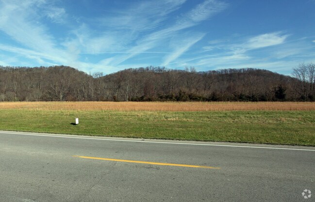
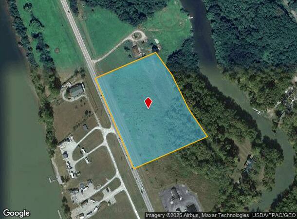
Property Record
2520 Us Highway 52, Aberdeen, OH 45101
NEARBY LISTINGS FOR SALE OR LEASE
Property Detail
2520 Us Highway 52
Cincinnati, OH-KY-IN
J Hoppers Military Survey #1620
15-023152-0200
S 1620 6.484 A LAND ABERDEEN VILLAGE RULH LSD
Residentialacreage
Brown
AE
Ohio
21161C0084E
6.48 AC
2024
Brown County
2024
Cincinnati/Dayton
951600
DEMOGRAPHICS near 2520 Us Highway 52
1 Mile
3 Mile
5 Mile
2024 Total Population
170
3,822
11,980
2029 Population
173
3,870
12,031
Pop Growth 2024-2029
+ 1.76%
+ 1.26%
+ 0.43%
Average Age
45
43
42
2024 Total Households
74
1,692
5,294
HH Growth 2024-2029
+ 1.35%
+ 1.30%
+ 0.49%
Median Household Inc
$49,999
$43,966
$41,828
Avg Household Size
2.30
2.20
2.20
2024 Avg HH Vehicles
2.00
2.00
2.00
Median Home Value
$140,000
$166,572
$141,308
Median Year Built
1976
1975
1966
Nearby Places
Map Layers
Map Styles
 Street
 Aerial
- Restaurants
- Banks
- Shops
- Fitness
- Groceries
PUBLIC TRANSPORTATION
COMMUTER RAIL
Maysville Amtrak Station (Cardinal - Amtrak)
DRIVE
WALK
Distance
Maysville Amtrak Station (Cardinal - Amtrak)
7 min
4.3 mi
Freight Ports
Port of Toledo
DRIVE
WALK
Distance
Port of Toledo
314 min
259.5 mi
SALE & LEASE HISTORY
LISTING DATE
SALE/LEASE

Sep 25, 2016
For Lease
Nearby Properties
Address
Land Use
TOTAL SIZE
Lot Size
Zoning
Address
Land Use
TOTAL SIZE
Lot Size
Zoning
241.05 AC
Address
Land Use
TOTAL SIZE
Lot Size
Zoning
18 AC
Address
Land Use
TOTAL SIZE
Lot Size
Zoning
9.54 AC
Address
Land Use
TOTAL SIZE
Lot Size
Zoning
12,096 SF
4.19 AC
Address
Land Use
TOTAL SIZE
Lot Size
Zoning
12,412 SF
0.57 AC
Address
Land Use
TOTAL SIZE
Lot Size
Zoning
11,184 SF
0.13 AC
Address
Land Use
TOTAL SIZE
Lot Size
Zoning
3.79 AC
Address
Land Use
TOTAL SIZE
Lot Size
Zoning
10,688 SF
1.61 AC
Address
Land Use
TOTAL SIZE
Lot Size
Zoning
28,324 SF
1.31 AC
Address
Land Use
TOTAL SIZE
Lot Size
Zoning
Address
Land Use
TOTAL SIZE
Lot Size
Zoning
68.18 AC
Address
Land Use
TOTAL SIZE
Lot Size
Zoning
287.06 AC
Address
Land Use
TOTAL SIZE
Lot Size
Zoning
6,276 SF
18.69 AC
Address
Land Use
TOTAL SIZE
Lot Size
Zoning
28,324 SF
0.63 AC
Address
Land Use
TOTAL SIZE
Lot Size
Zoning
12 AC
COMMERCIAL
Address
Land Use
TOTAL SIZE
Lot Size
Zoning
3.01 AC
Address
Land Use
TOTAL SIZE
Lot Size
Zoning
1,440 SF
14.53 AC
Address
Land Use
TOTAL SIZE
Lot Size
Zoning
2.79 AC
Address
Land Use
TOTAL SIZE
Lot Size
Zoning
0.90 AC
Address
Land Use
TOTAL SIZE
Lot Size
Zoning
147.25 AC
Address
Land Use
TOTAL SIZE
Lot Size
Zoning
270.78 AC
Address
Land Use
TOTAL SIZE
Lot Size
Zoning
5.10 AC
Address
Land Use
TOTAL SIZE
Lot Size
Zoning
1.62 AC
Address
Land Use
TOTAL SIZE
Lot Size
Zoning
221.73 AC
Address
Land Use
TOTAL SIZE
Lot Size
Zoning
6.07 AC
Address
Land Use
TOTAL SIZE
Lot Size
Zoning
1.90 AC
Address
Land Use
TOTAL SIZE
Lot Size
Zoning
1,820 SF
139.15 AC
Address
Land Use
TOTAL SIZE
Lot Size
Zoning
10.50 AC
Address
Land Use
TOTAL SIZE
Lot Size
Zoning
3.74 AC
Address
Land Use
TOTAL SIZE
Lot Size
Zoning
0.76 AC
The World's #1 Commercial Real Estate Marketplace
Connect with us
© 2025 CoStar Group
The information above has been obtained from sources believed reliable. While we do not doubt its accuracy we have not verified it and make no guarantee, warranty or representation about it. It is your responsibility to independently confirm its accuracy and completeness. Any projections, opinions, assumptions, or estimates used are for example only and do not represent the current or future performance of the property. The value of this transaction to you depends on tax and other factors which should be evaluated by your tax, financial, and legal advisors. You and your advisors should conduct a careful, independent investigation of the property to determine to your satisfaction the suitability of the property for your needs.