Property Record
2521 Glendale Ave, Toledo, OH 43614
NEARBY LISTINGS FOR SALE OR LEASE
Property Detail
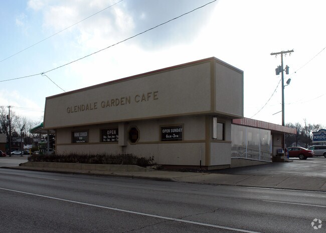
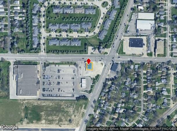
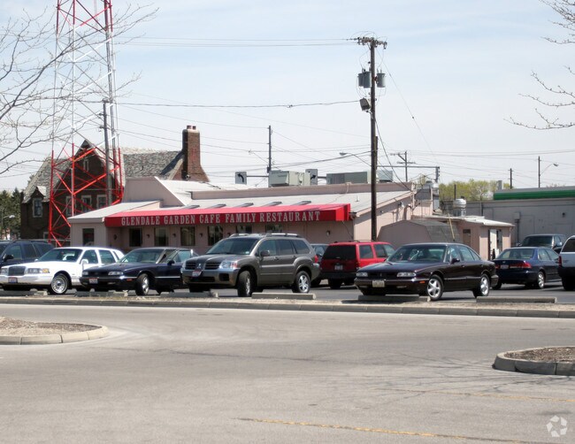
2521 Glendale Ave
Toledo, OH
Rancamp Place
18-08481
3 16 SW 1/4 N 104.37 FT PT S OF GLENDALE AVE E OF W 608.80
Restaurantbuilding
Lucas
X
Ohio
39173C0026D
318
2024
0.12 AC
2024
South/Southwest
006802
Toledo
3,368 SF
DEMOGRAPHICS near 2521 Glendale Ave
1 Mile
3 Mile
5 Mile
2024 Total Population
8,651
72,242
192,377
2029 Population
8,463
71,467
191,558
Pop Growth 2024-2029
(2.17%)
(1.07%)
(0.43%)
Average Age
41
40
39
2024 Total Households
3,923
32,042
84,330
HH Growth 2024-2029
(2.19%)
(1.12%)
(0.48%)
Median Household Inc
$51,576
$47,500
$47,507
Avg Household Size
2.10
2.20
2.10
2024 Avg HH Vehicles
2.00
2.00
2.00
Median Home Value
$129,699
$123,241
$132,181
Median Year Built
1952
1959
1962
Nearby Places
Map Layers
Map Styles
 Street
 Aerial
- Restaurants
- Banks
- Shops
- Fitness
- Groceries
PUBLIC TRANSPORTATION
COMMUTER RAIL
DRIVE
WALK
Distance
6 min
4.0 mi
AIRPORT
Eugene F Kranz Toledo Express
DRIVE
WALK
Distance
Eugene F Kranz Toledo Express
28 min
14.8 mi
Nearby Properties
Address
Land Use
TOTAL SIZE
Lot Size
Zoning
Address
Land Use
TOTAL SIZE
Lot Size
Zoning
1,237,446 SF
193.94 AC
10-RS12
Address
Land Use
TOTAL SIZE
Lot Size
Zoning
513,157 SF
39.38 AC
10-MX
Address
Land Use
TOTAL SIZE
Lot Size
Zoning
598,713 SF
59.75 AC
Address
Land Use
TOTAL SIZE
Lot Size
Zoning
323,421 SF
134.98 AC
10-MX
Address
Land Use
TOTAL SIZE
Lot Size
Zoning
245,237 SF
31.72 AC
10-MX
Address
Land Use
TOTAL SIZE
Lot Size
Zoning
11.16 AC
10-RM24
Address
Land Use
TOTAL SIZE
Lot Size
Zoning
393,343 SF
62.48 AC
10-IC
Address
Land Use
TOTAL SIZE
Lot Size
Zoning
174,496 SF
7.30 AC
Address
Land Use
TOTAL SIZE
Lot Size
Zoning
123,064 SF
10 AC
10-RS6
Address
Land Use
TOTAL SIZE
Lot Size
Zoning
170,960 SF
4 AC
10-RS6
Address
Land Use
TOTAL SIZE
Lot Size
Zoning
269,263 SF
55.93 AC
16-R2
Address
Land Use
TOTAL SIZE
Lot Size
Zoning
94,439 SF
9 AC
10-CO
Address
Land Use
TOTAL SIZE
Lot Size
Zoning
316,351 SF
30.65 AC
10-IC
Address
Land Use
TOTAL SIZE
Lot Size
Zoning
94,891 SF
18.80 AC
10-RS6
Address
Land Use
TOTAL SIZE
Lot Size
Zoning
81,672 SF
14.93 AC
10-RS9
Address
Land Use
TOTAL SIZE
Lot Size
Zoning
210,996 SF
22.18 AC
10-CRSO
Address
Land Use
TOTAL SIZE
Lot Size
Zoning
172,739 SF
10.93 AC
10-IL
Address
Land Use
TOTAL SIZE
Lot Size
Zoning
131,201 SF
10 AC
10-CUP
Address
Land Use
TOTAL SIZE
Lot Size
Zoning
69,007 SF
15.93 AC
Address
Land Use
TOTAL SIZE
Lot Size
Zoning
102,516 SF
0.85 AC
10-CR
Address
Land Use
TOTAL SIZE
Lot Size
Zoning
363,176 SF
11.72 AC
10-RM36
Address
Land Use
TOTAL SIZE
Lot Size
Zoning
48,321 SF
93.94 AC
10-RS12
Address
Land Use
TOTAL SIZE
Lot Size
Zoning
128,000 SF
9.37 AC
Address
Land Use
TOTAL SIZE
Lot Size
Zoning
94,088 SF
2.68 AC
10-IG
Address
Land Use
TOTAL SIZE
Lot Size
Zoning
78,685 SF
14.86 AC
10-RS12
Address
Land Use
TOTAL SIZE
Lot Size
Zoning
60,805 SF
9.38 AC
10-RS12
Address
Land Use
TOTAL SIZE
Lot Size
Zoning
123,975 SF
6.03 AC
Address
Land Use
TOTAL SIZE
Lot Size
Zoning
115,607 SF
42.88 AC
16-R2
Address
Land Use
TOTAL SIZE
Lot Size
Zoning
47,944 SF
7.58 AC
10-RS6
Address
Land Use
TOTAL SIZE
Lot Size
Zoning
2 AC
10-RS6
The World's #1 Commercial Real Estate Marketplace
Connect with us
© 2025 CoStar Group
The information above has been obtained from sources believed reliable. While we do not doubt its accuracy we have not verified it and make no guarantee, warranty or representation about it. It is your responsibility to independently confirm its accuracy and completeness. Any projections, opinions, assumptions, or estimates used are for example only and do not represent the current or future performance of the property. The value of this transaction to you depends on tax and other factors which should be evaluated by your tax, financial, and legal advisors. You and your advisors should conduct a careful, independent investigation of the property to determine to your satisfaction the suitability of the property for your needs.