Property Record
25210 E 32Nd Ter S, Independence, MO 64015


NEARBY LISTINGS FOR SALE OR LEASE
-
-
-
-
-
No Photo
-
-
View all Independence listings for sale on LoopNet.com
Property Detail
25210 E 32Nd Ter S
Kansas City, MO-KS
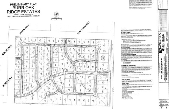
Burr Oak Ridge Estates
24-740-27-03-00-0-00-000
BURR OAK RIDGE ESTATES---LOT 13
Recreationalacreage
Jackson
X
Missouri
29095C0316G
13
2024
0.35 AC
2025
East Jackson County
014124
Kansas City
DEMOGRAPHICS near 25210 E 32Nd Ter S
1 Mile
3 Mile
5 Mile
2024 Total Population
2,647
33,462
82,184
2029 Population
2,618
33,001
81,268
Pop Growth 2024-2029
(1.10%)
(1.38%)
(1.11%)
Average Age
39
40
40
2024 Total Households
903
12,539
31,366
HH Growth 2024-2029
(1.22%)
(1.47%)
(1.17%)
Median Household Inc
$91,264
$83,934
$78,783
Avg Household Size
2.90
2.60
2.60
2024 Avg HH Vehicles
2.00
2.00
2.00
Median Home Value
$252,560
$234,120
$231,334
Median Year Built
1986
1984
1987
Nearby Places
Map Layers
Map Styles
 Street
 Aerial
- Restaurants
- Banks
- Shops
- Fitness
- Groceries
PUBLIC TRANSPORTATION
AIRPORT
Kansas City International
DRIVE
WALK
Distance
Kansas City International
53 min
38.5 mi
Freight Ports
Tulsa Port Of Catoosa
DRIVE
WALK
Distance
Tulsa Port Of Catoosa
282 min
252.5 mi
Nearby Properties
Address
Land Use
TOTAL SIZE
Lot Size
Zoning
Address
Land Use
TOTAL SIZE
Lot Size
Zoning
448,225 SF
38.38 AC
Address
Land Use
TOTAL SIZE
Lot Size
Zoning
150,684 SF
55.92 AC
Address
Land Use
TOTAL SIZE
Lot Size
Zoning
228,168 SF
25.12 AC
Address
Land Use
TOTAL SIZE
Lot Size
Zoning
28,639 SF
10.40 AC
Address
Land Use
TOTAL SIZE
Lot Size
Zoning
120,053 SF
13.53 AC
Address
Land Use
TOTAL SIZE
Lot Size
Zoning
287,132 SF
Address
Land Use
TOTAL SIZE
Lot Size
Zoning
286,547 SF
Address
Land Use
TOTAL SIZE
Lot Size
Zoning
127,621 SF
23 AC
Address
Land Use
TOTAL SIZE
Lot Size
Zoning
214,518 SF
22.16 AC
Address
Land Use
TOTAL SIZE
Lot Size
Zoning
129,570 SF
18.40 AC
Address
Land Use
TOTAL SIZE
Lot Size
Zoning
48,440 SF
21.49 AC
Address
Land Use
TOTAL SIZE
Lot Size
Zoning
71,169 SF
0.82 AC
Address
Land Use
TOTAL SIZE
Lot Size
Zoning
98,523 SF
9.48 AC
Address
Land Use
TOTAL SIZE
Lot Size
Zoning
36,952 SF
20.90 AC
Address
Land Use
TOTAL SIZE
Lot Size
Zoning
93,336 SF
11.67 AC
Address
Land Use
TOTAL SIZE
Lot Size
Zoning
80,458 SF
0.40 AC
Address
Land Use
TOTAL SIZE
Lot Size
Zoning
48,270 SF
4.61 AC
Address
Land Use
TOTAL SIZE
Lot Size
Zoning
82,602 SF
8.80 AC
Address
Land Use
TOTAL SIZE
Lot Size
Zoning
49,601 SF
8.03 AC
Address
Land Use
TOTAL SIZE
Lot Size
Zoning
98,600 SF
4.50 AC
Address
Land Use
TOTAL SIZE
Lot Size
Zoning
130,178 SF
10.25 AC
Address
Land Use
TOTAL SIZE
Lot Size
Zoning
75,977 SF
8.86 AC
Address
Land Use
TOTAL SIZE
Lot Size
Zoning
36,000 SF
5.22 AC
Address
Land Use
TOTAL SIZE
Lot Size
Zoning
61,567 SF
10 AC
Address
Land Use
TOTAL SIZE
Lot Size
Zoning
53,384 SF
6.24 AC
Address
Land Use
TOTAL SIZE
Lot Size
Zoning
64,887 SF
17.50 AC
Address
Land Use
TOTAL SIZE
Lot Size
Zoning
95,342 SF
11.02 AC
Address
Land Use
TOTAL SIZE
Lot Size
Zoning
33,698 SF
Address
Land Use
TOTAL SIZE
Lot Size
Zoning
65,659 SF
12.60 AC
Address
Land Use
TOTAL SIZE
Lot Size
Zoning
15,656 SF
9.53 AC
The World's #1 Commercial Real Estate Marketplace
Connect with us
© 2025 CoStar Group
The information above has been obtained from sources believed reliable. While we do not doubt its accuracy we have not verified it and make no guarantee, warranty or representation about it. It is your responsibility to independently confirm its accuracy and completeness. Any projections, opinions, assumptions, or estimates used are for example only and do not represent the current or future performance of the property. The value of this transaction to you depends on tax and other factors which should be evaluated by your tax, financial, and legal advisors. You and your advisors should conduct a careful, independent investigation of the property to determine to your satisfaction the suitability of the property for your needs.