Property Record
2525 Laramie Dr, Colorado Springs, CO 80910
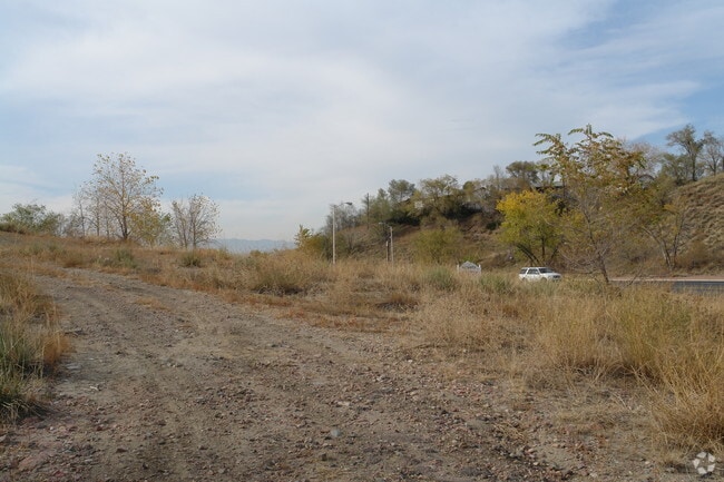
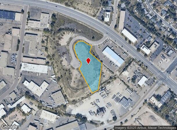
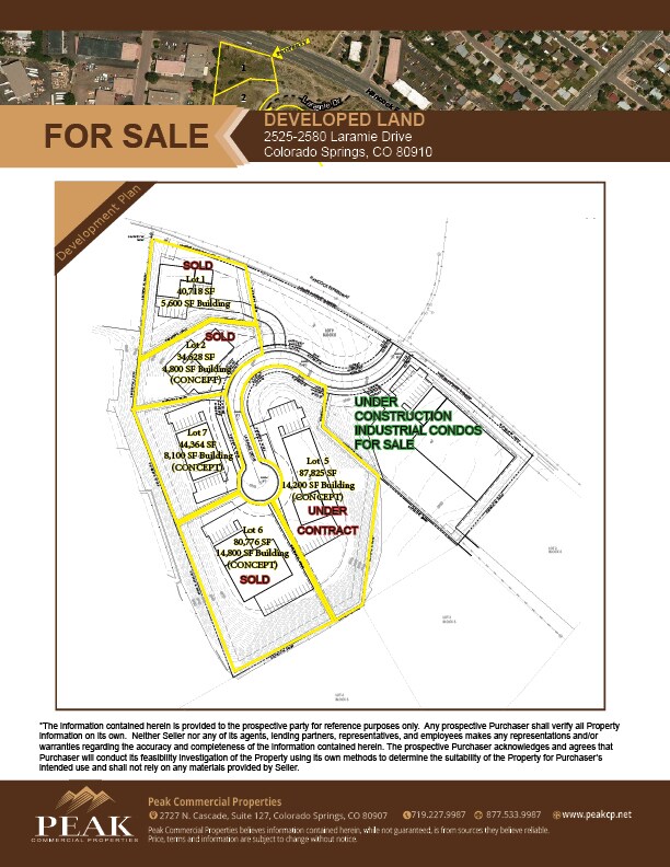

This Property Is For Sale
NEARBY LISTINGS FOR SALE OR LEASE
-
-
-
-
-
-
-
-
-
-
-
No Photo
-
View all Colorado Springs listings for sale on LoopNet.com
Property Detail
2525 Laramie Dr
Colorado Springs, CO
Sproul Rail Industrial Park Fil No 8
64342-05-024
LOT 5 BLK 1 SPROUL RAIL INDUSTRIAL PARK FIL NO 8 COLO SPGS
Industrialacreage
El Paso
X
Colorado
08041C0742G
5
2024
2 AC
2025
Southeast
005201
Colorado Springs
DEMOGRAPHICS near 2525 Laramie Dr
1 Mile
3 Mile
5 Mile
2024 Total Population
11,651
112,025
227,311
2029 Population
12,135
117,511
237,699
Pop Growth 2024-2029
+ 4.15%
+ 4.90%
+ 4.57%
Average Age
35
35
36
2024 Total Households
3,759
43,234
87,627
HH Growth 2024-2029
+ 4.39%
+ 5.26%
+ 4.92%
Median Household Inc
$53,713
$55,320
$59,587
Avg Household Size
2.60
2.50
2.40
2024 Avg HH Vehicles
2.00
2.00
2.00
Median Home Value
$240,486
$280,255
$324,858
Median Year Built
1981
1983
1978
Nearby Places
Map Layers
Map Styles
 Street
 Aerial
- Restaurants
- Banks
- Shops
- Fitness
- Groceries
PUBLIC TRANSPORTATION
AIRPORT
City of Colorado Springs Municipal
DRIVE
WALK
Distance
City of Colorado Springs Municipal
16 min
7.4 mi
Freight Ports
Tulsa Port Of Catoosa
DRIVE
WALK
Distance
Tulsa Port Of Catoosa
742 min
693.9 mi
Nearby Properties
Address
Land Use
TOTAL SIZE
Lot Size
Zoning
Address
Land Use
TOTAL SIZE
Lot Size
Zoning
309,046 SF
28.95 AC
PF SS
Address
Land Use
TOTAL SIZE
Lot Size
Zoning
215,464 SF
11.59 AC
R-5
Address
Land Use
TOTAL SIZE
Lot Size
Zoning
152,977 SF
39.50 AC
MX-M MX-M/
Address
Land Use
TOTAL SIZE
Lot Size
Zoning
229,081 SF
9.87 AC
MX-N CU SS
Address
Land Use
TOTAL SIZE
Lot Size
Zoning
200,642 SF
6.65 AC
MX-M HR AO
Address
Land Use
TOTAL SIZE
Lot Size
Zoning
233,194 SF
30 AC
R-1 6 AO S
Address
Land Use
TOTAL SIZE
Lot Size
Zoning
168,835 SF
33 AC
PF SS
Address
Land Use
TOTAL SIZE
Lot Size
Zoning
162,945 SF
20.05 AC
BP/CR CU A
Address
Land Use
TOTAL SIZE
Lot Size
Zoning
117,648 SF
3,971.89 AC
APD
Address
Land Use
TOTAL SIZE
Lot Size
Zoning
215,377 SF
11.24 AC
R-5/CR
Address
Land Use
TOTAL SIZE
Lot Size
Zoning
109,739 SF
18.61 AC
BP/CR CU
Address
Land Use
TOTAL SIZE
Lot Size
Zoning
123,644 SF
74.14 AC
GI PF SS
Address
Land Use
TOTAL SIZE
Lot Size
Zoning
113,594 SF
1.65 AC
R-5 HR
Address
Land Use
TOTAL SIZE
Lot Size
Zoning
71,438 SF
9.81 AC
R-5/CR
Address
Land Use
TOTAL SIZE
Lot Size
Zoning
704,240 SF
41.99 AC
BP/CR UV A
Address
Land Use
TOTAL SIZE
Lot Size
Zoning
65,400 SF
13.65 AC
PF CU
Address
Land Use
TOTAL SIZE
Lot Size
Zoning
98,638 SF
7.22 AC
MX-M AO
Address
Land Use
TOTAL SIZE
Lot Size
Zoning
152,517 SF
12.17 AC
MX-L
Address
Land Use
TOTAL SIZE
Lot Size
Zoning
23,535 SF
15.91 AC
BP/CR AO
Address
Land Use
TOTAL SIZE
Lot Size
Zoning
48,255 SF
17.35 AC
A-5 CAD-O
Address
Land Use
TOTAL SIZE
Lot Size
Zoning
226,448 SF
16.80 AC
MX-N/CR
Address
Land Use
TOTAL SIZE
Lot Size
Zoning
69,078 SF
0.03 AC
Address
Land Use
TOTAL SIZE
Lot Size
Zoning
107,146 SF
16.72 AC
R-1 6 CU
Address
Land Use
TOTAL SIZE
Lot Size
Zoning
124,107 SF
104.60 AC
MX-N CU
Address
Land Use
TOTAL SIZE
Lot Size
Zoning
166,182 SF
26.35 AC
BP/CR
Address
Land Use
TOTAL SIZE
Lot Size
Zoning
24,293 SF
10.61 AC
C5
Address
Land Use
TOTAL SIZE
Lot Size
Zoning
76,047 SF
5.74 AC
PF
Address
Land Use
TOTAL SIZE
Lot Size
Zoning
72,105 SF
11.32 AC
MX-T AO
Address
Land Use
TOTAL SIZE
Lot Size
Zoning
46,190 SF
4.02 AC
PDZ
Address
Land Use
TOTAL SIZE
Lot Size
Zoning
91,446 SF
12.60 AC
BP AO
The World's #1 Commercial Real Estate Marketplace
Connect with us
© 2025 CoStar Group
The information above has been obtained from sources believed reliable. While we do not doubt its accuracy we have not verified it and make no guarantee, warranty or representation about it. It is your responsibility to independently confirm its accuracy and completeness. Any projections, opinions, assumptions, or estimates used are for example only and do not represent the current or future performance of the property. The value of this transaction to you depends on tax and other factors which should be evaluated by your tax, financial, and legal advisors. You and your advisors should conduct a careful, independent investigation of the property to determine to your satisfaction the suitability of the property for your needs.